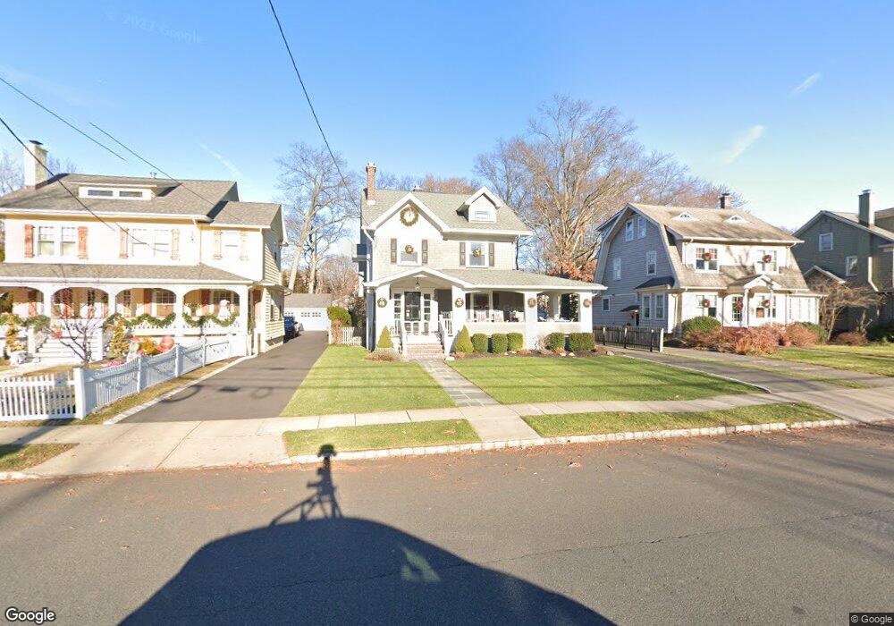
214 N Euclid Ave Westfield, NJ 07090
Estimated Value: $1,692,284 - $1,758,000
--
Bed
--
Bath
3,609
Sq Ft
$479/Sq Ft
Est. Value
About This Home
This home is located at 214 N Euclid Ave, Westfield, NJ 07090 and is currently estimated at $1,729,071, approximately $479 per square foot. 214 N Euclid Ave is a home located in Union County with nearby schools including Wilson Elementary School, Roosevelt Intermediate School, and Westfield Senior High School.
Ownership History
Date
Name
Owned For
Owner Type
Purchase Details
Closed on
Mar 17, 2008
Sold by
Shyposh Paul J and Shyposh Evelyn M
Bought by
Noack Bradley and Noack Deirdre
Current Estimated Value
Home Financials for this Owner
Home Financials are based on the most recent Mortgage that was taken out on this home.
Original Mortgage
$417,000
Interest Rate
5.17%
Mortgage Type
Purchase Money Mortgage
Purchase Details
Closed on
Jul 15, 1998
Sold by
Scott Francis X and Scott Arlene M
Bought by
Shyposh Paul J and Shyposh Evelyn M
Home Financials for this Owner
Home Financials are based on the most recent Mortgage that was taken out on this home.
Original Mortgage
$171,500
Interest Rate
6.98%
Create a Home Valuation Report for This Property
The Home Valuation Report is an in-depth analysis detailing your home's value as well as a comparison with similar homes in the area
Home Values in the Area
Average Home Value in this Area
Purchase History
| Date | Buyer | Sale Price | Title Company |
|---|---|---|---|
| Noack Bradley | $1,380,000 | None Available | |
| Shyposh Paul J | $331,500 | -- |
Source: Public Records
Mortgage History
| Date | Status | Borrower | Loan Amount |
|---|---|---|---|
| Closed | Noack Bradley | $417,000 | |
| Previous Owner | Shyposh Paul J | $171,500 |
Source: Public Records
Tax History Compared to Growth
Tax History
| Year | Tax Paid | Tax Assessment Tax Assessment Total Assessment is a certain percentage of the fair market value that is determined by local assessors to be the total taxable value of land and additions on the property. | Land | Improvement |
|---|---|---|---|---|
| 2025 | $22,635 | $1,005,100 | $519,600 | $485,500 |
| 2024 | $22,173 | $1,005,100 | $519,600 | $485,500 |
| 2023 | $22,173 | $1,005,100 | $519,600 | $485,500 |
| 2022 | $21,710 | $1,005,100 | $519,600 | $485,500 |
| 2021 | $21,740 | $1,005,100 | $519,600 | $485,500 |
| 2020 | $21,690 | $1,005,100 | $519,600 | $485,500 |
| 2019 | $21,610 | $1,005,100 | $519,600 | $485,500 |
| 2018 | $19,217 | $206,700 | $79,000 | $127,700 |
| 2017 | $19,111 | $206,700 | $79,000 | $127,700 |
| 2016 | $18,663 | $206,700 | $79,000 | $127,700 |
| 2015 | $18,291 | $206,700 | $79,000 | $127,700 |
| 2014 | $17,687 | $206,700 | $79,000 | $127,700 |
Source: Public Records
Map
Nearby Homes
- 415 Highland Ave
- 149 Harrison Ave
- 645 Kimball Ave
- 304 E Dudley Ave
- 508 N Chestnut St
- 559 Lawrence Ave
- 766 Oak Ave
- 260 Prospect St Unit C15
- 112 Linden Ave
- 303 Prospect St
- 740 Lawrence Ave
- 819 Standish Ave
- 629 Tremont Ave
- 869 Standish Ave
- 517 Clark St
- 131 Wells St
- 820 E Broad St
- 122 Stanmore Place
- 143 Stanmore Place
- 203 Ross Place
- 210 N Euclid Ave
- 220 N Euclid Ave
- 206 N Euclid Ave
- 300 N Euclid Ave
- 202 N Euclid Ave
- 304 N Euclid Ave
- 176 N Euclid Ave
- 306 N Euclid Ave
- 517 Maple St
- 301 N Euclid Ave
- 172 N Euclid Ave
- 219 Harrison Ave
- 303 N Euclid Ave
- 525 Maple St
- 209 Harrison Ave
- 215 Harrison Ave
- 205 Harrison Ave
- 201 Harrison Ave
- 227 Harrison Ave
- 314 N Euclid Ave