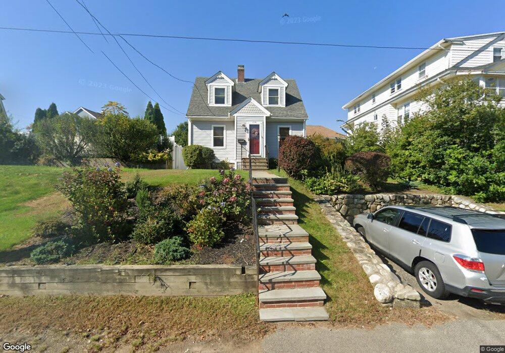
214 Osgood St North Andover, MA 01845
Estimated Value: $587,000 - $686,000
2
Beds
2
Baths
1,116
Sq Ft
$565/Sq Ft
Est. Value
About This Home
This home is located at 214 Osgood St, North Andover, MA 01845 and is currently estimated at $630,829, approximately $565 per square foot. 214 Osgood St is a home located in Essex County with nearby schools including Kittredge Elementary School, North Andover Middle School, and North Andover High School.
Ownership History
Date
Name
Owned For
Owner Type
Purchase Details
Closed on
Jun 30, 2004
Sold by
Powers Clement M and Powers Ruth Jeannette
Bought by
Benammi Amy E
Current Estimated Value
Purchase Details
Closed on
Sep 20, 2001
Sold by
Demetri Scott J
Bought by
Powers Clement M and Powers Ruth Jeannette
Purchase Details
Closed on
Dec 27, 2000
Sold by
Horan Paul T and Horan Julie A
Bought by
Demetri Scott J
Purchase Details
Closed on
Dec 13, 1999
Sold by
Mullen Dawn M and Mullen Matthew W
Bought by
Horan Julie A and Horan Paul T
Purchase Details
Closed on
Sep 30, 1997
Sold by
Tempesta Michael
Bought by
Pawelski Dawn M
Purchase Details
Closed on
Aug 31, 1989
Sold by
Caro Charles
Bought by
Tempesta Michael
Create a Home Valuation Report for This Property
The Home Valuation Report is an in-depth analysis detailing your home's value as well as a comparison with similar homes in the area
Home Values in the Area
Average Home Value in this Area
Purchase History
| Date | Buyer | Sale Price | Title Company |
|---|---|---|---|
| Benammi Amy E | $292,000 | -- | |
| Powers Clement M | $238,000 | -- | |
| Demetri Scott J | $209,500 | -- | |
| Horan Julie A | $183,300 | -- | |
| Pawelski Dawn M | $123,000 | -- | |
| Tempesta Michael | $142,000 | -- |
Source: Public Records
Mortgage History
| Date | Status | Borrower | Loan Amount |
|---|---|---|---|
| Open | Tempesta Michael | $32,000 | |
| Closed | Tempesta Michael | $18,000 |
Source: Public Records
Tax History Compared to Growth
Tax History
| Year | Tax Paid | Tax Assessment Tax Assessment Total Assessment is a certain percentage of the fair market value that is determined by local assessors to be the total taxable value of land and additions on the property. | Land | Improvement |
|---|---|---|---|---|
| 2025 | $6,119 | $543,400 | $289,000 | $254,400 |
| 2024 | $5,928 | $534,500 | $272,000 | $262,500 |
| 2023 | $5,780 | $472,200 | $249,900 | $222,300 |
| 2022 | $5,664 | $418,600 | $224,400 | $194,200 |
| 2021 | $5,642 | $398,200 | $204,000 | $194,200 |
| 2020 | $5,360 | $390,100 | $204,000 | $186,100 |
| 2019 | $5,231 | $390,100 | $204,000 | $186,100 |
| 2018 | $5,668 | $390,100 | $204,000 | $186,100 |
| 2017 | $4,504 | $315,400 | $157,800 | $157,600 |
| 2016 | $4,442 | $311,300 | $154,800 | $156,500 |
| 2015 | $4,255 | $295,700 | $149,500 | $146,200 |
Source: Public Records
Map
Nearby Homes
- 60 Park St
- 98 Mill Pond
- 112 Mill Pond
- 84 Mill Pond Unit 84
- 84 Mill Pond
- 116 Mill Pond
- 125 Phillips Brooks Rd
- 3 Fernview Ave Unit 11
- 19 Fernview Ave Unit 6
- 25 Fernview Ave Unit 8
- 35 Fernview Ave Unit 5
- 24 Faulkner Rd
- 40 Fernview Ave Unit 11
- 52 Fernview Ave Unit 7
- 64 E Water St
- 3 Great Pond Rd
- 180 Chickering Rd Unit 204C
- 180 Chickering Rd Unit 107C
- 75 Edgelawn Ave Unit 2
- 133 Autran Ave
- 232 Osgood St Unit 2
- 232 Osgood St Unit 2FL
- 232 Osgood St Unit 1
- 230 Osgood St Unit 232
- 230 Osgood St Unit 2
- 230 Osgood St
- 230 Osgood St Unit 1
- 220 Osgood St
- 10 Beacon Hill Blvd Unit 12
- 10 Beacon Hill Blvd Unit 10 Beacon Hill Blvd.
- 10 Beacon Hill Blvd
- 11 Bay State Rd
- 227 Osgood St
- 201 Osgood St
- 5 Beacon Hill Blvd
- 233 Osgood St
- 9 Beacon Hill Blvd
- 210 Osgood St
- 22 Beacon Hill Blvd
- 15 Beacon Hill Blvd