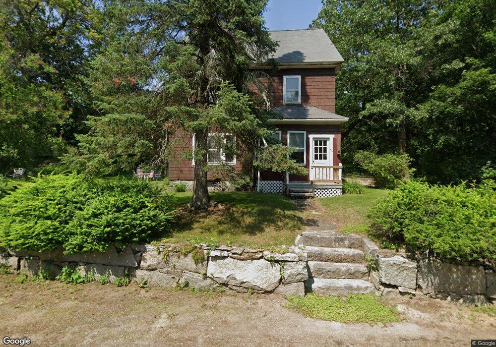
214 Sherburne Ave Tyngsboro, MA 01879
Estimated Value: $693,891 - $769,000
4
Beds
3
Baths
2,480
Sq Ft
$294/Sq Ft
Est. Value
About This Home
This home is located at 214 Sherburne Ave, Tyngsboro, MA 01879 and is currently estimated at $727,973, approximately $293 per square foot. 214 Sherburne Ave is a home located in Middlesex County with nearby schools including Tyngsborough Elementary School, Tyngsborough Middle School, and Tyngsborough High School.
Ownership History
Date
Name
Owned For
Owner Type
Purchase Details
Closed on
Jul 15, 2024
Sold by
Lescard Donald A and Lescard Anne M
Bought by
Lescard Int and Lescard L
Current Estimated Value
Purchase Details
Closed on
Oct 26, 1972
Bought by
Lescard Donald A and Lescard Anne M
Create a Home Valuation Report for This Property
The Home Valuation Report is an in-depth analysis detailing your home's value as well as a comparison with similar homes in the area
Home Values in the Area
Average Home Value in this Area
Purchase History
| Date | Buyer | Sale Price | Title Company |
|---|---|---|---|
| Lescard Int | -- | None Available | |
| Lescard Int | -- | None Available | |
| Lescard Donald A | $36,000 | -- |
Source: Public Records
Mortgage History
| Date | Status | Borrower | Loan Amount |
|---|---|---|---|
| Previous Owner | Lescard Donald A | $50,000 |
Source: Public Records
Tax History Compared to Growth
Tax History
| Year | Tax Paid | Tax Assessment Tax Assessment Total Assessment is a certain percentage of the fair market value that is determined by local assessors to be the total taxable value of land and additions on the property. | Land | Improvement |
|---|---|---|---|---|
| 2025 | $72 | $582,000 | $323,300 | $258,700 |
| 2024 | $6,850 | $538,500 | $305,400 | $233,100 |
| 2023 | $6,626 | $468,600 | $266,200 | $202,400 |
| 2022 | $6,642 | $444,600 | $242,200 | $202,400 |
| 2021 | $6,669 | $415,000 | $227,000 | $188,000 |
| 2020 | $6,489 | $399,300 | $218,200 | $181,100 |
| 2019 | $5,670 | $365,100 | $211,700 | $153,400 |
| 2018 | $6,295 | $367,900 | $211,700 | $156,200 |
| 2017 | $6,136 | $357,600 | $211,700 | $145,900 |
| 2016 | $5,995 | $341,400 | $211,700 | $129,700 |
| 2015 | $5,790 | $341,400 | $211,700 | $129,700 |
Source: Public Records
Map
Nearby Homes
- 15 Dowling Dr
- 1461 Pawtucket Blvd Unit 12
- 12 Trotting Park Rd
- 14 Trotting Park Rd
- 1401 Pawtucket Blvd Unit 10
- 1370 Varnum Ave
- 730 Wellman Ave
- 271 Wellman Ave
- 251 Wellman Ave Unit 251
- 739 Wellman Ave
- 330 Wellman Ave
- 436 Wellman Ave
- 863 Wellman Ave Unit 863
- 123 Sherburne Ave
- 1 Hope St
- 10 Butterfield St
- 5 Mission Rd Unit 107
- 20 Sandy Ln
- 10 Worden Rd
- 20 Merrimac Way Unit 20E
- 218 Sherburne Ave
- 222 Sherburne Ave
- 208 Sherburne Ave
- 226 Sherburne Ave
- 200 Sherburne Ave
- 198 Sherburne Ave
- 236 Sherburne Ave
- 237 Sherburne Ave
- 242 Sherburne Ave
- 238 Sherburne Ave
- 90 Constance Dr
- 84 Constance Dr
- 84 Constance Dr
- 64 Constance Dr
- 246 Sherburne Ave
- 91 Constance Dr
- 85 Constance Dr
- 241 Sherburne Ave
- 48 Constance Dr
- 77 Constance Dr