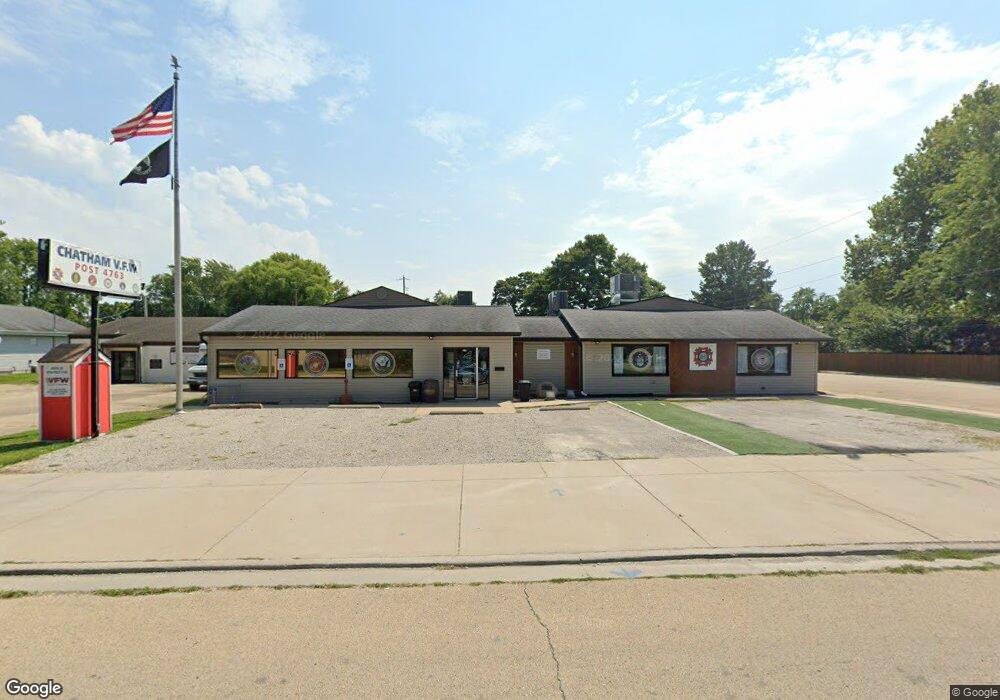
214 W Chestnut St Chatham, IL 62629
Estimated Value: $143,000 - $290,000
--
Bed
--
Bath
5,350
Sq Ft
$40/Sq Ft
Est. Value
About This Home
This home is located at 214 W Chestnut St, Chatham, IL 62629 and is currently estimated at $216,500, approximately $40 per square foot. 214 W Chestnut St is a home located in Sangamon County with nearby schools including Chatham Elementary School, Glenwood Middle School, and Glenwood Intermediate School.
Ownership History
Date
Name
Owned For
Owner Type
Purchase Details
Closed on
Aug 12, 2021
Sold by
Inb National Association
Bought by
Chatham Post 4763 Veterans Of Foreign Wars Of
Current Estimated Value
Home Financials for this Owner
Home Financials are based on the most recent Mortgage that was taken out on this home.
Original Mortgage
$150,000
Interest Rate
2.9%
Mortgage Type
Construction
Purchase Details
Closed on
Aug 25, 2020
Sold by
Sheriff Of Sangamon County
Bought by
Inb National Association
Purchase Details
Closed on
May 3, 2005
Purchase Details
Closed on
Sep 16, 2003
Purchase Details
Closed on
Apr 15, 2003
Purchase Details
Closed on
Mar 8, 2002
Purchase Details
Closed on
Feb 26, 2002
Purchase Details
Closed on
Mar 22, 1995
Create a Home Valuation Report for This Property
The Home Valuation Report is an in-depth analysis detailing your home's value as well as a comparison with similar homes in the area
Home Values in the Area
Average Home Value in this Area
Purchase History
| Date | Buyer | Sale Price | Title Company |
|---|---|---|---|
| Chatham Post 4763 Veterans Of Foreign Wars Of | $80,000 | Prairie Land Title | |
| Inb National Association | -- | Sheehan Ashton N | |
| -- | $252,500 | -- | |
| -- | -- | -- | |
| -- | -- | -- | |
| -- | -- | -- | |
| -- | -- | -- | |
| -- | -- | -- |
Source: Public Records
Mortgage History
| Date | Status | Borrower | Loan Amount |
|---|---|---|---|
| Closed | Chatham Post 4763 Veterans Of Foreign Wars Of | $150,000 |
Source: Public Records
Tax History Compared to Growth
Tax History
| Year | Tax Paid | Tax Assessment Tax Assessment Total Assessment is a certain percentage of the fair market value that is determined by local assessors to be the total taxable value of land and additions on the property. | Land | Improvement |
|---|---|---|---|---|
| 2024 | $252 | $3,510 | $3,510 | $0 |
| 2023 | $243 | $3,230 | $3,230 | $0 |
| 2022 | $239 | $3,111 | $3,111 | $0 |
| 2021 | $237 | $3,059 | $3,059 | $0 |
| 2020 | $231 | $2,984 | $2,984 | $0 |
| 2019 | $227 | $2,980 | $2,980 | $0 |
| 2018 | $221 | $2,945 | $2,945 | $0 |
| 2017 | $219 | $2,913 | $2,913 | $0 |
| 2016 | $215 | $2,853 | $2,853 | $0 |
| 2015 | $217 | $2,825 | $2,825 | $0 |
| 2014 | $216 | $2,793 | $2,793 | $0 |
| 2013 | $212 | $2,750 | $2,750 | $0 |
Source: Public Records
Map
Nearby Homes
- 26 Circle
- 530 S Grand Ave
- 309 Dewberry Trail
- 0 State Route 4
- 510 E Chestnut St Unit 1
- 68 Moonlight Ct
- 802 E Locust St
- 719 E Walnut St Unit 1
- 448 Wintergreen Dr
- 852 Oxford Dr Unit 1
- 856 Oxford Dr Unit 1
- 34 Buckingham Rd Unit 1
- 911 Mesa Dr
- 300 Hodges Ct
- 337 Keystone Dr
- 108 Kodiak Dr
- 305 Hodges Ct
- 1005 Campanella Dr
- 315 Aspen Dr
- 327 Aspen Dr
- 210 W Chestnut St
- 101 S Church St Unit 1
- 213 W Chestnut St Unit 1
- 115 S Church St Unit 1
- 213 W Locust St Unit 1
- 211 W Locust St Unit 1
- 209 W Chestnut St
- 207 W Chestnut St
- 113 N Church St Unit 1
- 301 W Locust St Unit 1
- 205 W Locust St Unit 1
- 305 W Locust St Unit 1
- 304 W Chestnut St Unit 1
- 305 W Chestnut St Unit 1
- 309 W Locust St
- 105 N Market St
- 300 W Locust St Unit 1
- 204 W Locust St Unit 1
- 200 S Church St Unit 1
- 309 W Chestnut St Unit 1