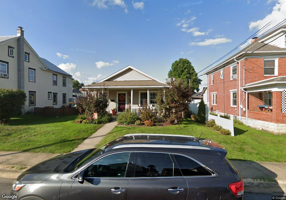
214 W Chestnut St Selinsgrove, PA 17870
Estimated Value: $206,000 - $247,067
--
Bed
--
Bath
--
Sq Ft
8,276
Sq Ft Lot
About This Home
This home is located at 214 W Chestnut St, Selinsgrove, PA 17870 and is currently estimated at $229,267. 214 W Chestnut St is a home located in Snyder County with nearby schools including Selinsgrove Area Elementary School, Selinsgrove Intermediate School, and Selinsgrove Area Middle School.
Ownership History
Date
Name
Owned For
Owner Type
Purchase Details
Closed on
Aug 8, 2018
Sold by
Cottrill John L and Cottrill Samantha P
Bought by
Thayer Asa J and Thayer Danyelle L
Current Estimated Value
Home Financials for this Owner
Home Financials are based on the most recent Mortgage that was taken out on this home.
Original Mortgage
$156,000
Outstanding Balance
$135,480
Interest Rate
4.5%
Mortgage Type
New Conventional
Estimated Equity
$93,787
Purchase Details
Closed on
Feb 22, 2016
Sold by
Lewis Jeffrey Paul and Lewis Phyllis Lynn
Bought by
Cottrill John L and Cottrill Samantha P
Home Financials for this Owner
Home Financials are based on the most recent Mortgage that was taken out on this home.
Original Mortgage
$127,300
Interest Rate
3.92%
Mortgage Type
New Conventional
Create a Home Valuation Report for This Property
The Home Valuation Report is an in-depth analysis detailing your home's value as well as a comparison with similar homes in the area
Home Values in the Area
Average Home Value in this Area
Purchase History
| Date | Buyer | Sale Price | Title Company |
|---|---|---|---|
| Thayer Asa J | -- | None Available | |
| Cottrill John L | $134,000 | Attorney |
Source: Public Records
Mortgage History
| Date | Status | Borrower | Loan Amount |
|---|---|---|---|
| Open | Thayer Asa J | $156,000 | |
| Previous Owner | Cottrill John L | $127,300 |
Source: Public Records
Tax History Compared to Growth
Tax History
| Year | Tax Paid | Tax Assessment Tax Assessment Total Assessment is a certain percentage of the fair market value that is determined by local assessors to be the total taxable value of land and additions on the property. | Land | Improvement |
|---|---|---|---|---|
| 2025 | $2,321 | $19,400 | $2,200 | $17,200 |
| 2024 | $2,179 | $19,400 | $2,200 | $17,200 |
| 2023 | $869 | $19,400 | $2,200 | $17,200 |
| 2022 | $2,091 | $19,400 | $2,200 | $17,200 |
| 2021 | $2,072 | $19,400 | $2,200 | $17,200 |
| 2020 | $2,062 | $19,400 | $2,200 | $17,200 |
| 2019 | $2,053 | $19,400 | $2,200 | $17,200 |
| 2018 | $2,033 | $19,400 | $2,200 | $17,200 |
| 2017 | $2,014 | $19,400 | $2,200 | $17,200 |
| 2016 | $1,083 | $19,400 | $2,200 | $17,200 |
| 2015 | $71,416 | $19,400 | $2,200 | $17,200 |
| 2014 | $71,416 | $19,400 | $2,200 | $17,200 |
Source: Public Records
Map
Nearby Homes
- 207 Orange St Unit 209
- 211 W Pine St
- 500 N Orange St
- 511 N 10th St
- 00 S Market St
- 223 E Pine St
- 722 N 8th St
- Lot 1 522 Route S
- 321 Pleasant Dr
- 20 Quarry Rd
- 12 Minton Dr
- 0 Wedgewood Dr
- 456 State School Rd
- 9130 State Route 147
- 1262 N Old Trail
- 85 Old Colony Rd
- 732 Salem Rd
- 34 Oakmont Ct
- 0 Mill Rd
- 594 Augusta Dr
- 216 W Chestnut St Unit 218
- 210 W Chestnut St
- 220 W Chestnut St
- 208 W Chestnut St
- 113 Independence St
- 111 Independence St
- 117 Independence St
- 222 W Chestnut St
- 107 Independence St
- 215 W Chestnut St
- 217 W Chestnut St
- 219 W Chestnut St
- 202 W Chestnut St
- 119 Independence St Unit 121
- 105 Independence St
- 123 Independence St
- 125 Independence St
- 110 Orange St
- 203 W Chestnut St
- 57 N Broad St