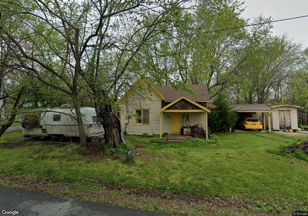
214 W Thurman St Prairie Grove, AR 72753
Estimated Value: $129,815 - $231,000
2
Beds
1
Bath
840
Sq Ft
$196/Sq Ft
Est. Value
About This Home
This home is located at 214 W Thurman St, Prairie Grove, AR 72753 and is currently estimated at $164,704, approximately $196 per square foot. 214 W Thurman St is a home located in Washington County with nearby schools including Prairie Grove Elementary School, Prairie Grove Middle School, and Prairie Grove Junior High School.
Ownership History
Date
Name
Owned For
Owner Type
Purchase Details
Closed on
Aug 2, 1996
Bought by
Dennis Robert E and Dennis Mary L
Current Estimated Value
Purchase Details
Closed on
Jun 23, 1995
Bought by
Moore Charles Dean and Moore Temple C
Purchase Details
Closed on
Aug 6, 1993
Bought by
Moore Don and Moore Betty
Purchase Details
Closed on
Dec 1, 1986
Bought by
Dersam Steven R and Dersam Bonnie S
Purchase Details
Closed on
Nov 17, 1986
Bought by
Farmers & Merchants Bank Of and Prairie Grove, Ar
Purchase Details
Closed on
Jan 18, 1986
Bought by
Snapp John Benjamin and Snapp Marcy
Purchase Details
Closed on
Oct 7, 1980
Bought by
Snapp John B
Create a Home Valuation Report for This Property
The Home Valuation Report is an in-depth analysis detailing your home's value as well as a comparison with similar homes in the area
Home Values in the Area
Average Home Value in this Area
Purchase History
| Date | Buyer | Sale Price | Title Company |
|---|---|---|---|
| Dennis Robert E | $28,000 | -- | |
| Moore Charles Dean | $18,000 | -- | |
| Moore Don | $17,000 | -- | |
| Dersam Steven R | $17,000 | -- | |
| Farmers & Merchants Bank Of | -- | -- | |
| Snapp John Benjamin | -- | -- | |
| Snapp John B | -- | -- |
Source: Public Records
Tax History Compared to Growth
Tax History
| Year | Tax Paid | Tax Assessment Tax Assessment Total Assessment is a certain percentage of the fair market value that is determined by local assessors to be the total taxable value of land and additions on the property. | Land | Improvement |
|---|---|---|---|---|
| 2025 | -- | $21,810 | $9,100 | $12,710 |
| 2024 | -- | $21,810 | $9,100 | $12,710 |
| 2023 | $0 | $21,810 | $9,100 | $12,710 |
| 2022 | $0 | $12,830 | $2,800 | $10,030 |
| 2021 | $8 | $12,830 | $2,800 | $10,030 |
| 2020 | $8 | $12,830 | $2,800 | $10,030 |
| 2019 | $8 | $8,550 | $3,000 | $5,550 |
| 2018 | $0 | $8,550 | $3,000 | $5,550 |
| 2017 | $0 | $8,550 | $3,000 | $5,550 |
| 2016 | -- | $8,550 | $3,000 | $5,550 |
| 2015 | -- | $8,550 | $3,000 | $5,550 |
| 2014 | -- | $5,470 | $1,800 | $3,670 |
Source: Public Records
Map
Nearby Homes
- 4.66 +/- AC Tract 5 Hwy 62 & S Mock St
- 601 Westwood Ave
- 211 Boston St
- 110 Cypress St
- 703 Grant Ave
- 311 S Mock St
- Lot 2 Holmes St
- TBD Kate Smith St
- 661 Summer Ln
- 601 Pennington Ave
- 208 N Neal St
- 106 S Ozark St
- 806 Grant Ave
- 600 Kendra St
- 621 Kendra St
- 740 Kendra St
- 807 Sedgwick Dr
- 107 S Ozark St
- 304 S Summit St
- 308 S Summit St
- 206 Hickory St
- 300 W Thurman St
- 210 W Thurman St
- 215 W Thurman St
- 213 W Thurman St
- 219 W Thurman St
- 207 Walnut St
- 217 W Cleveland St
- 205 Hickory St
- 303 W Thurman St
- 208 W Thurman St
- 218 W Butler St
- 306 W Thurman St
- 207 W Cleveland St
- 206 Walnut St
- 303 W Cleveland St
- 305 W Cleveland St
- 203 W Thurman St
- 308 W Thurman St
- 210 Walnut St