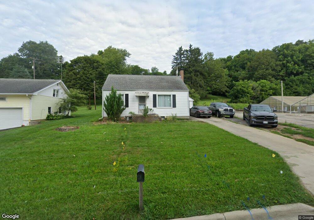
214 Zanesfield Rd West Liberty, OH 43357
Estimated Value: $149,000 - $213,000
3
Beds
1
Bath
1,094
Sq Ft
$155/Sq Ft
Est. Value
About This Home
This home is located at 214 Zanesfield Rd, West Liberty, OH 43357 and is currently estimated at $169,395, approximately $154 per square foot. 214 Zanesfield Rd is a home located in Logan County with nearby schools including West Liberty-Salem Elementary School, West Liberty-Salem Middle School, and West Liberty-Salem Middle/High School.
Ownership History
Date
Name
Owned For
Owner Type
Purchase Details
Closed on
Sep 8, 2016
Sold by
Cooper Jacob G
Bought by
Smith Michael K and Smith Debra A
Current Estimated Value
Purchase Details
Closed on
Aug 21, 2015
Sold by
Hook Mary L
Bought by
Cooper Jacob G
Home Financials for this Owner
Home Financials are based on the most recent Mortgage that was taken out on this home.
Original Mortgage
$64,693
Outstanding Balance
$50,881
Interest Rate
4.03%
Mortgage Type
New Conventional
Estimated Equity
$118,514
Create a Home Valuation Report for This Property
The Home Valuation Report is an in-depth analysis detailing your home's value as well as a comparison with similar homes in the area
Home Values in the Area
Average Home Value in this Area
Purchase History
| Date | Buyer | Sale Price | Title Company |
|---|---|---|---|
| Smith Michael K | $85,100 | Scout Title | |
| Cooper Jacob G | $59,000 | None Available |
Source: Public Records
Mortgage History
| Date | Status | Borrower | Loan Amount |
|---|---|---|---|
| Open | Cooper Jacob G | $64,693 |
Source: Public Records
Tax History Compared to Growth
Tax History
| Year | Tax Paid | Tax Assessment Tax Assessment Total Assessment is a certain percentage of the fair market value that is determined by local assessors to be the total taxable value of land and additions on the property. | Land | Improvement |
|---|---|---|---|---|
| 2024 | $1,517 | $37,840 | $13,300 | $24,540 |
| 2023 | $1,517 | $37,840 | $13,300 | $24,540 |
| 2022 | $1,519 | $31,530 | $11,080 | $20,450 |
| 2021 | $1,519 | $31,530 | $11,080 | $20,450 |
| 2020 | $1,357 | $29,010 | $10,240 | $18,770 |
| 2019 | $1,358 | $29,010 | $10,240 | $18,770 |
| 2018 | $1,240 | $29,010 | $10,240 | $18,770 |
| 2016 | $1,007 | $27,330 | $10,270 | $17,060 |
| 2014 | $787 | $27,330 | $10,270 | $17,060 |
| 2013 | $779 | $27,330 | $10,270 | $17,060 |
| 2012 | $721 | $28,190 | $10,270 | $17,920 |
Source: Public Records
Map
Nearby Homes
- 414 N Detroit St
- 116 E Newell St
- 215 N Detroit St
- 308 Reynolds St
- 512 W Columbus St
- 0 County Road 189
- 619 W Baird St
- . Co Rd 189
- 5714 Hickory Dr
- Lot 1 County Road 1
- 129 Tanglewood Dr
- 5197 County Road 1
- 4164 County Road 1
- 7885 N Ludlow Rd
- 6404 Township Road 55
- Lot 3 County Road 1
- Lot 2 County Road 1
- Lot 1 County Road 1
- 4124 State Route 245 W
- 501 Gunntown Rd Unit Lot 66
- 210 Zanesfield Rd
- 300 Zanesfield Rd
- 215 Zanesfield Rd
- 206 Zanesfield Rd
- 211 Zanesfield Rd
- 302 Us Route 68
- 209 Zanesfield Rd
- 301 Zanesfield Rd
- 200 Zanesfield Rd
- 200 Zanesfield Rd Unit 310905
- 109 Linden St
- 417 N Detroit St
- 309 Zanesfield Rd
- 112 Pickrelltown Rd
- 516 Center St
- 112 Linden St
- 306 Zanesfield Rd
- 120 Pickrelltown Rd
- 102 Zanesfield Rd
- 116 Linden St