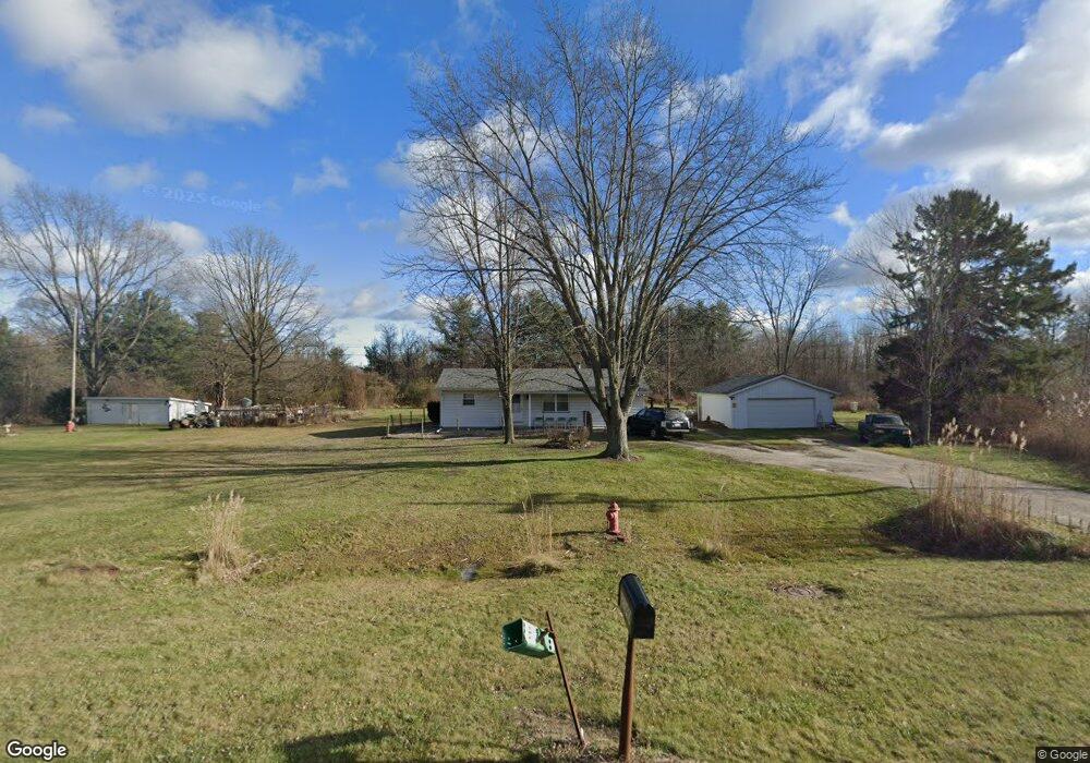
2140 Range Rd Port Huron, MI 48060
Estimated Value: $172,000 - $209,000
3
Beds
1
Bath
1,150
Sq Ft
$163/Sq Ft
Est. Value
About This Home
This home is located at 2140 Range Rd, Port Huron, MI 48060 and is currently estimated at $187,890, approximately $163 per square foot. 2140 Range Rd is a home located in St. Clair County with nearby schools including Kimball Elementary School, Central Middle School, and Port Huron High School.
Ownership History
Date
Name
Owned For
Owner Type
Purchase Details
Closed on
Oct 27, 2023
Sold by
Futurvest Llc
Bought by
Parr Jeffrey
Current Estimated Value
Home Financials for this Owner
Home Financials are based on the most recent Mortgage that was taken out on this home.
Original Mortgage
$170,000
Outstanding Balance
$166,848
Interest Rate
7.18%
Mortgage Type
VA
Estimated Equity
$21,042
Purchase Details
Closed on
Oct 11, 2023
Sold by
Futurvest Llc
Bought by
Parr Jeffrey
Home Financials for this Owner
Home Financials are based on the most recent Mortgage that was taken out on this home.
Original Mortgage
$170,000
Outstanding Balance
$166,848
Interest Rate
7.18%
Mortgage Type
VA
Estimated Equity
$21,042
Purchase Details
Closed on
Feb 27, 2009
Sold by
Logan Ronald
Bought by
Futurvest Llc
Purchase Details
Closed on
Sep 13, 2007
Sold by
Fisher Angela
Bought by
Us Bank National Association
Create a Home Valuation Report for This Property
The Home Valuation Report is an in-depth analysis detailing your home's value as well as a comparison with similar homes in the area
Home Values in the Area
Average Home Value in this Area
Purchase History
| Date | Buyer | Sale Price | Title Company |
|---|---|---|---|
| Parr Jeffrey | $170,000 | Liberty Title | |
| Parr Jeffrey | $170,000 | Liberty Title | |
| Futurvest Llc | -- | None Available | |
| Us Bank National Association | $99,000 | None Available |
Source: Public Records
Mortgage History
| Date | Status | Borrower | Loan Amount |
|---|---|---|---|
| Open | Parr Jeffrey | $170,000 | |
| Closed | Parr Jeffrey | $170,000 |
Source: Public Records
Tax History
| Year | Tax Paid | Tax Assessment Tax Assessment Total Assessment is a certain percentage of the fair market value that is determined by local assessors to be the total taxable value of land and additions on the property. | Land | Improvement |
|---|---|---|---|---|
| 2025 | $2,844 | $76,400 | $0 | $0 |
| 2024 | $1,453 | $78,400 | $0 | $0 |
| 2023 | $1,561 | $71,800 | $0 | $0 |
| 2022 | $2,271 | $59,400 | $0 | $0 |
| 2020 | $2,123 | $49,100 | $49,100 | $0 |
| 2019 | $2,089 | $44,200 | $0 | $0 |
| 2018 | $2,046 | $44,200 | $0 | $0 |
| 2017 | $2,007 | $42,600 | $0 | $0 |
| 2016 | $1,301 | $42,600 | $0 | $0 |
| 2015 | -- | $38,600 | $38,600 | $0 |
| 2014 | -- | $36,200 | $36,200 | $0 |
| 2013 | -- | $35,300 | $0 | $0 |
Source: Public Records
Map
Nearby Homes
- 0000 Range Rd
- 0 Wall Rd Unit 50185999
- 00 Howard Rd
- 4380 Lapeer Rd
- 1405 Range Rd
- 0 Lapeer Rd Unit 50137357
- 1786 Omar Rd
- 0 Allen Rd Unit 20250008597
- 0 Allen Rd Unit 20250008612
- 00 Range Rd
- V/L Allen
- 4911 Castlewood Dr
- 1604 Allen Rd
- 3101 Range Rd
- 265 Westbrook Ct
- 3255 Harrington Rd
- 0000 W Water St
- 4459 Cambridge Dr
- 3115 Spruce Dr
- 174 Meadow Ln
Your Personal Tour Guide
Ask me questions while you tour the home.