
Seller's Agent in 2025
Janae Smith
Hybrid Real Estate
(541) 221-3452
5 in this area
51 Total Sales
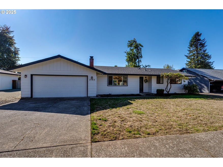
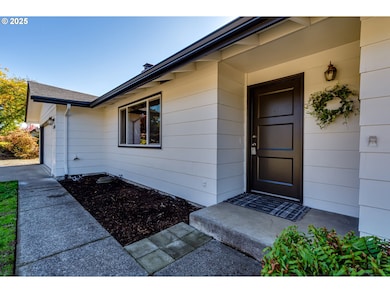
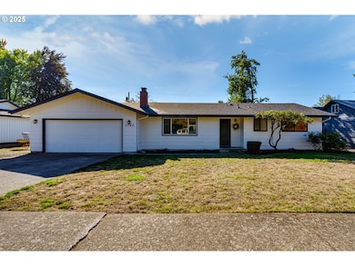
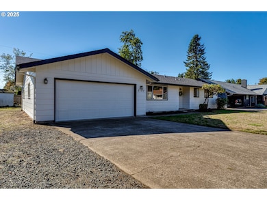
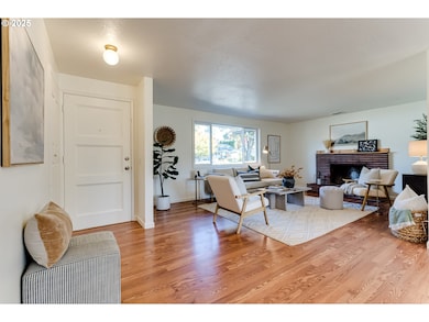
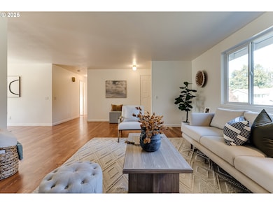
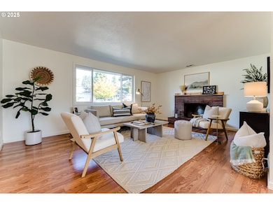
Inviting single-level home in the sought-after Ferry Street Bridge area. Recent updates include a brand-new roof and fresh interior and exterior paint. Inside, a wood-burning fireplace creates a cozy focal point, while the well-designed layout offers both a living room and a family room—ideal for comfortable everyday living. Set on a generous lot with a spacious backyard and room for RV parking. Situated on a quiet dead-end street backing up to Sheldon High School, this home combines convenience, functionality, and plenty of potential to make it your own.
Last Agent to Sell the Property
Hybrid Real Estate License #201222450 Listed on: 10/17/2025
| Date | Type | Sale Price | Title Company |
|---|---|---|---|
| Warranty Deed | $452,000 | Cascade Title | |
| Interfamily Deed Transfer | -- | Cascade Title Co | |
| Interfamily Deed Transfer | -- | Cascade Title Co | |
| Interfamily Deed Transfer | -- | Cascade Title Co |
| Date | Status | Loan Amount | Loan Type |
|---|---|---|---|
| Open | $361,600 | New Conventional |
| Date | Event | Price | List to Sale | Price per Sq Ft |
|---|---|---|---|---|
| 11/19/2025 11/19/25 | Sold | $452,000 | +0.4% | $312 / Sq Ft |
| 10/20/2025 10/20/25 | Pending | -- | -- | -- |
| 10/17/2025 10/17/25 | For Sale | $450,000 | -- | $310 / Sq Ft |
| Year | Tax Paid | Tax Assessment Tax Assessment Total Assessment is a certain percentage of the fair market value that is determined by local assessors to be the total taxable value of land and additions on the property. | Land | Improvement |
|---|---|---|---|---|
| 2025 | $4,862 | $249,539 | -- | -- |
| 2024 | $4,801 | $242,271 | -- | -- |
| 2023 | $4,801 | $235,215 | $0 | $0 |
| 2022 | $4,498 | $228,365 | $0 | $0 |
| 2021 | $4,225 | $221,714 | $0 | $0 |
| 2020 | $4,240 | $215,257 | $0 | $0 |
| 2019 | $4,095 | $208,988 | $0 | $0 |
| 2018 | $3,854 | $196,991 | $0 | $0 |
| 2017 | $3,618 | $196,991 | $0 | $0 |
| 2016 | $3,438 | $191,253 | $0 | $0 |
| 2015 | $3,315 | $185,683 | $0 | $0 |
| 2014 | $3,263 | $180,275 | $0 | $0 |
Seller's Agent in 2025
Janae Smith
Hybrid Real Estate
(541) 221-3452
5 in this area
51 Total Sales
Source: Regional Multiple Listing Service (RMLS)
MLS Number: 167684327
APN: 0171742
Disclaimer: Certain information contained herein is derived from information provided by parties other than Homes.com. All information provided is deemed reliable, but is not guaranteed to be accurate and should be independently verified.
![]() The content relating to real estate for sale on this web site comes in part from the IDX program of the RMLS™ of Portland, Oregon. Real estate listings held by brokerage firms other than Ten-X are marked with the RMLS™ logo, and detailed information about these properties includes the names of the listing brokers. Listing content is copyright © 2026 RMLS™, Portland, Oregon. Some properties which appear for sale on this web site may subsequently have sold or may no longer be available. All information provided is deemed reliable but is not guaranteed and should be independently verified.
The content relating to real estate for sale on this web site comes in part from the IDX program of the RMLS™ of Portland, Oregon. Real estate listings held by brokerage firms other than Ten-X are marked with the RMLS™ logo, and detailed information about these properties includes the names of the listing brokers. Listing content is copyright © 2026 RMLS™, Portland, Oregon. Some properties which appear for sale on this web site may subsequently have sold or may no longer be available. All information provided is deemed reliable but is not guaranteed and should be independently verified.
Ask me questions while you tour the home.