
Seller's Agent in 2025
Tyson Bolster
Georgetown Realty Inc.
(503) 260-3289
3 in this area
152 Total Sales
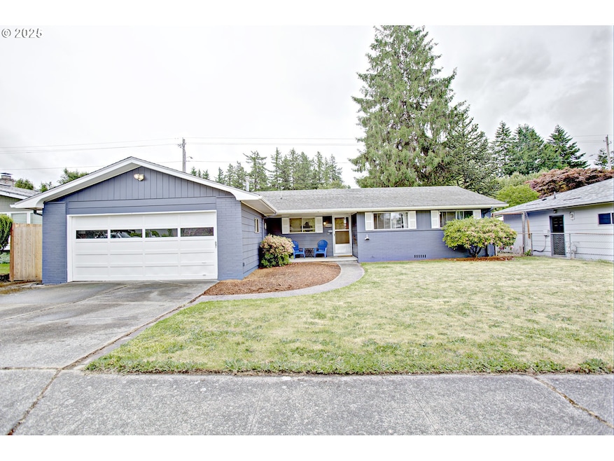
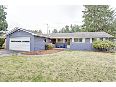

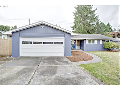

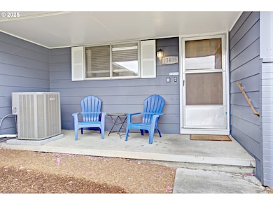
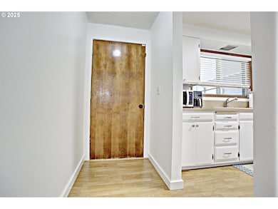
Solid 3 bed 2 bath Gresham ranch, ready for its next chapter. Move in and enjoy the versatile floorplan and quiet setting (Burnside is close, but hardly imposing). The light & bright kitchen welcomes you, then flows into formal living with the ambiance of a wood burning fireplace. To the right you have 3 bedrooms, with the primary bedroom featuring an en-suite with a stand up shower. To the left you find formal dining, leading to the large family room with a house warming free standing wood stove, and then onto the large fully fenced blank slate backyard. Fresh exterior paint, fresh carpet in the bedrooms and laminate floors throughout main living. 2019 brought a new electrical panel, furnace and air conditioning. All major appliances included!
Last Agent to Sell the Property
Georgetown Realty Inc. Brokerage Email: accounting@gtrealty.com License #200309028 Listed on: 06/06/2025
| Date | Type | Sale Price | Title Company |
|---|---|---|---|
| Warranty Deed | $401,000 | First American Title | |
| Bargain Sale Deed | -- | Wfg Title | |
| Personal Reps Deed | $227,500 | First American |
| Date | Status | Loan Amount | Loan Type |
|---|---|---|---|
| Open | $286,000 | New Conventional | |
| Previous Owner | $295,075 | FHA | |
| Previous Owner | $182,000 | New Conventional |
| Date | Event | Price | List to Sale | Price per Sq Ft |
|---|---|---|---|---|
| 10/17/2025 10/17/25 | Sold | $401,000 | +0.3% | $278 / Sq Ft |
| 09/20/2025 09/20/25 | Pending | -- | -- | -- |
| 09/18/2025 09/18/25 | For Sale | $399,900 | 0.0% | $278 / Sq Ft |
| 09/03/2025 09/03/25 | Pending | -- | -- | -- |
| 08/29/2025 08/29/25 | Price Changed | $399,900 | 0.0% | $278 / Sq Ft |
| 08/29/2025 08/29/25 | For Sale | $399,900 | -4.8% | $278 / Sq Ft |
| 08/14/2025 08/14/25 | Pending | -- | -- | -- |
| 07/29/2025 07/29/25 | For Sale | $419,900 | +4.7% | $291 / Sq Ft |
| 06/30/2025 06/30/25 | Off Market | $401,000 | -- | -- |
| 06/17/2025 06/17/25 | Price Changed | $419,900 | -3.4% | $291 / Sq Ft |
| 06/06/2025 06/06/25 | For Sale | $434,900 | -- | $302 / Sq Ft |
| Year | Tax Paid | Tax Assessment Tax Assessment Total Assessment is a certain percentage of the fair market value that is determined by local assessors to be the total taxable value of land and additions on the property. | Land | Improvement |
|---|---|---|---|---|
| 2025 | $4,614 | $226,740 | -- | -- |
| 2024 | $4,417 | $220,140 | -- | -- |
| 2023 | $4,417 | $213,730 | -- | -- |
| 2022 | $3,912 | $207,510 | $0 | $0 |
| 2021 | $3,813 | $201,470 | $0 | $0 |
| 2020 | $3,588 | $195,610 | $0 | $0 |
| 2019 | $3,494 | $189,920 | $0 | $0 |
| 2018 | $3,332 | $184,390 | $0 | $0 |
| 2017 | $3,196 | $179,020 | $0 | $0 |
| 2016 | $2,818 | $173,810 | $0 | $0 |
| 2015 | $2,757 | $168,750 | $0 | $0 |
| 2014 | $2,690 | $163,840 | $0 | $0 |
Seller's Agent in 2025
Tyson Bolster
Georgetown Realty Inc.
(503) 260-3289
3 in this area
152 Total Sales
J
Buyer's Agent in 2025
Jackie Wren
Better Homes & Gardens Realty
(503) 266-7333
1 in this area
7 Total Sales
Source: Regional Multiple Listing Service (RMLS)
MLS Number: 118425413
APN: R281723
Disclaimer: Certain information contained herein is derived from information provided by parties other than Homes.com. All information provided is deemed reliable, but is not guaranteed to be accurate and should be independently verified.
![]() The content relating to real estate for sale on this web site comes in part from the IDX program of the RMLS™ of Portland, Oregon. Real estate listings held by brokerage firms other than Ten-X are marked with the RMLS™ logo, and detailed information about these properties includes the names of the listing brokers. Listing content is copyright © 2026 RMLS™, Portland, Oregon. Some properties which appear for sale on this web site may subsequently have sold or may no longer be available. All information provided is deemed reliable but is not guaranteed and should be independently verified.
The content relating to real estate for sale on this web site comes in part from the IDX program of the RMLS™ of Portland, Oregon. Real estate listings held by brokerage firms other than Ten-X are marked with the RMLS™ logo, and detailed information about these properties includes the names of the listing brokers. Listing content is copyright © 2026 RMLS™, Portland, Oregon. Some properties which appear for sale on this web site may subsequently have sold or may no longer be available. All information provided is deemed reliable but is not guaranteed and should be independently verified.
Ask me questions while you tour the home.