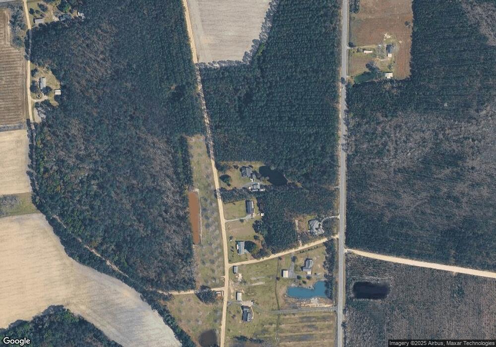
2141 2141 John Herndon Rd Surrency, GA 31563
Estimated Value: $308,464 - $456,000
4
Beds
3
Baths
2,818
Sq Ft
$132/Sq Ft
Est. Value
About This Home
This home is located at 2141 2141 John Herndon Rd, Surrency, GA 31563 and is currently estimated at $371,366, approximately $131 per square foot. 2141 2141 John Herndon Rd is a home located in Appling County.
Ownership History
Date
Name
Owned For
Owner Type
Purchase Details
Closed on
Oct 10, 2017
Sold by
Ruhnau Glenda D
Bought by
Hanner Darryl D and Kiaosouvath Bouphasavanh Deang
Current Estimated Value
Home Financials for this Owner
Home Financials are based on the most recent Mortgage that was taken out on this home.
Original Mortgage
$232,750
Outstanding Balance
$194,203
Interest Rate
3.78%
Mortgage Type
New Conventional
Estimated Equity
$177,163
Purchase Details
Closed on
Sep 10, 2014
Sold by
Ruhnau Glenda
Bought by
Spell Voncile M and Spell Charles A
Purchase Details
Closed on
Nov 3, 1997
Bought by
Ruhnau Glenda
Create a Home Valuation Report for This Property
The Home Valuation Report is an in-depth analysis detailing your home's value as well as a comparison with similar homes in the area
Home Values in the Area
Average Home Value in this Area
Purchase History
| Date | Buyer | Sale Price | Title Company |
|---|---|---|---|
| Hanner Darryl D | $245,000 | -- | |
| Spell Voncile M | -- | -- | |
| Ruhnau Glenda | -- | -- |
Source: Public Records
Mortgage History
| Date | Status | Borrower | Loan Amount |
|---|---|---|---|
| Open | Hanner Darryl D | $232,750 |
Source: Public Records
Tax History Compared to Growth
Tax History
| Year | Tax Paid | Tax Assessment Tax Assessment Total Assessment is a certain percentage of the fair market value that is determined by local assessors to be the total taxable value of land and additions on the property. | Land | Improvement |
|---|---|---|---|---|
| 2024 | $2,317 | $94,360 | $3,920 | $90,440 |
| 2023 | $2,317 | $94,383 | $3,943 | $90,440 |
| 2022 | $2,514 | $97,381 | $3,943 | $93,438 |
| 2021 | $2,515 | $97,381 | $3,943 | $93,438 |
| 2020 | $2,611 | $97,381 | $3,943 | $93,438 |
| 2019 | $2,663 | $97,381 | $3,943 | $93,438 |
| 2018 | $2,711 | $97,381 | $3,943 | $93,438 |
| 2017 | $2,134 | $75,374 | $3,943 | $71,431 |
| 2016 | $1,817 | $75,374 | $3,943 | $71,431 |
| 2015 | $1,817 | $75,374 | $3,943 | $71,431 |
| 2014 | $2,147 | $76,816 | $5,385 | $71,431 |
| 2013 | -- | $74,452 | $3,021 | $71,431 |
Source: Public Records
Map
Nearby Homes
- 1564 Eagles Point
- 0 Eagles Point Unit LOT 8
- 0 Eagles Point Unit LOT 12
- 0 Eagles Point Unit LOT 11
- 0 Eagles Point (Lot 12) Unit 23776
- 0 Eagles Point (Lot 11) Unit 23775
- 0 Eagles Point (Lot 8) Unit 23774
- 1347 Eagles Point
- 290 ACRES Georgia 121
- 7946 Old Surrency Rd
- 0 Brentwood Rd
- Lot 4 Brentwood Rd
- Lot 2 Brentwood Rd
- Lot 3 Brentwood Rd
- Lot 1 Brentwood Rd
- Tract 1 Unit Bennett Mill Pond
- Tract 2 Unit Bennett Mill Pond
- Tract 3 Unit Bennett Mill Pond
- Tract 4 Unit Bennett Mill Pond
- 3293 Bennett Mill Pond Rd
- 1693 Wilson Landing Rd
- 0 Mildred Bush Rd Unit 23202193
- 00 Blackshear Hwy
- 000 Blackshear Hwy
- 230 E Hart St
- 0 U S 341
- 215 E Hart St
- 9019 Old Surrency Rd
- 240 E Dukes St
- 183 E Hart St
- 144 E Hart St SE
- 172 E Dukes St
- 201 Roberson St
- 160 Ga Highway 121 NE
- 172 Roberson St
- 367 E Martin St
- 75 E Hart St
- 124 E Dukes St
- 55 Highway Hwy
- 121 Ga Hwy
