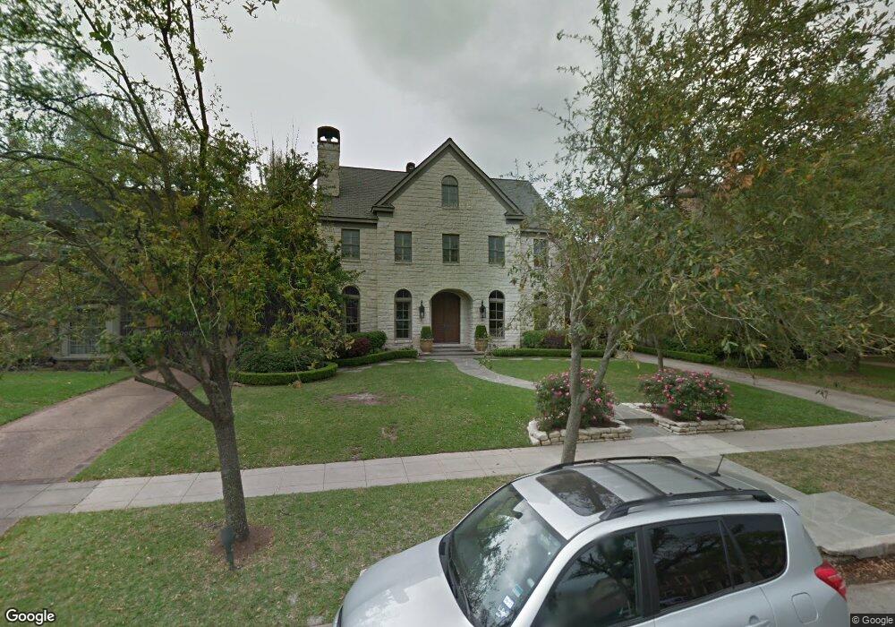
2141 Del Monte Dr Houston, TX 77019
River Oaks NeighborhoodEstimated Value: $2,907,772 - $4,128,000
5
Beds
6
Baths
4,606
Sq Ft
$732/Sq Ft
Est. Value
About This Home
This home is located at 2141 Del Monte Dr, Houston, TX 77019 and is currently estimated at $3,373,193, approximately $732 per square foot. 2141 Del Monte Dr is a home located in Harris County with nearby schools including River Oaks Elementary School, Lanier Middle School, and Lamar High School.
Ownership History
Date
Name
Owned For
Owner Type
Purchase Details
Closed on
Oct 25, 2011
Sold by
Weichert Relocation Resources Inc
Bought by
Marquez Mauricio and Marquez Lesley S
Current Estimated Value
Home Financials for this Owner
Home Financials are based on the most recent Mortgage that was taken out on this home.
Original Mortgage
$1,000,000
Outstanding Balance
$678,410
Interest Rate
3.99%
Mortgage Type
New Conventional
Estimated Equity
$2,694,783
Purchase Details
Closed on
Oct 11, 2011
Sold by
Thomas Robert F and Thomas Tammy L
Bought by
Weichert Relocation Resources Inc
Home Financials for this Owner
Home Financials are based on the most recent Mortgage that was taken out on this home.
Original Mortgage
$1,000,000
Outstanding Balance
$678,410
Interest Rate
3.99%
Mortgage Type
New Conventional
Estimated Equity
$2,694,783
Purchase Details
Closed on
May 16, 2005
Sold by
Surrat Timothy A and Holloman Michael C
Bought by
Thomas Robert F
Home Financials for this Owner
Home Financials are based on the most recent Mortgage that was taken out on this home.
Original Mortgage
$1,250,000
Interest Rate
5.75%
Mortgage Type
Fannie Mae Freddie Mac
Purchase Details
Closed on
May 13, 2005
Sold by
Thomas Tammy
Bought by
Thomas Robert F
Home Financials for this Owner
Home Financials are based on the most recent Mortgage that was taken out on this home.
Original Mortgage
$1,250,000
Interest Rate
5.75%
Mortgage Type
Fannie Mae Freddie Mac
Purchase Details
Closed on
Sep 16, 1999
Sold by
Keiser James M and Keiser Vicki G
Bought by
Surratt Timothy A and Holloman Michael C
Home Financials for this Owner
Home Financials are based on the most recent Mortgage that was taken out on this home.
Original Mortgage
$434,550
Interest Rate
7.37%
Create a Home Valuation Report for This Property
The Home Valuation Report is an in-depth analysis detailing your home's value as well as a comparison with similar homes in the area
Home Values in the Area
Average Home Value in this Area
Purchase History
| Date | Buyer | Sale Price | Title Company |
|---|---|---|---|
| Marquez Mauricio | -- | Chicago Title Insurance Co | |
| Weichert Relocation Resources Inc | -- | Chicago Title Insurance Co | |
| Thomas Robert F | -- | Stewart Title Company | |
| Thomas Robert F | -- | Stewart Title Company | |
| Surratt Timothy A | -- | Stewart Title Company |
Source: Public Records
Mortgage History
| Date | Status | Borrower | Loan Amount |
|---|---|---|---|
| Open | Marquez Mauricio | $1,000,000 | |
| Previous Owner | Thomas Robert F | $1,250,000 | |
| Previous Owner | Surratt Timothy A | $434,550 | |
| Closed | Surratt Timothy A | $81,480 |
Source: Public Records
Tax History Compared to Growth
Tax History
| Year | Tax Paid | Tax Assessment Tax Assessment Total Assessment is a certain percentage of the fair market value that is determined by local assessors to be the total taxable value of land and additions on the property. | Land | Improvement |
|---|---|---|---|---|
| 2025 | $44,309 | $3,326,993 | $1,905,750 | $1,421,243 |
| 2024 | $44,309 | $2,694,321 | $1,790,250 | $904,071 |
| 2023 | $44,309 | $2,815,419 | $1,732,500 | $1,082,919 |
| 2022 | $62,159 | $2,822,993 | $1,674,750 | $1,148,243 |
| 2021 | $61,763 | $2,650,000 | $1,559,250 | $1,090,750 |
| 2020 | $64,656 | $2,670,000 | $1,559,250 | $1,110,750 |
| 2019 | $68,249 | $2,697,098 | $1,559,250 | $1,137,848 |
| 2018 | $53,640 | $2,651,500 | $1,501,500 | $1,150,000 |
| 2017 | $64,656 | $2,688,526 | $1,501,500 | $1,187,026 |
| 2016 | $58,778 | $2,400,000 | $1,368,500 | $1,031,500 |
| 2015 | $39,534 | $2,521,735 | $1,319,625 | $1,202,110 |
| 2014 | $39,534 | $2,387,361 | $1,124,125 | $1,263,236 |
Source: Public Records
Map
Nearby Homes
- 2105 Del Monte Dr
- 2217 Pelham Dr
- 2204 Inwood Dr
- 2233 Pelham Dr
- 2131 Brentwood Dr
- 2249 Pelham Dr
- 1601 S Shepherd Dr Unit 20
- 1601 S Shepherd Dr Unit 29
- 1601 S Shepherd Dr Unit 138
- 1711 Huldy St Unit A
- 1915 Spann St
- 2100 Welch St Unit C113
- 2100 Welch St Unit C101
- 2413 Brentwood Dr
- 1910 Huldy St Unit A
- 1712 Mcduffie St
- 2221 Welch St Unit 201
- 2221 Welch St Unit 401
- 2247 Chilton Rd
- 1509 Mcduffie St
- 2135 Del Monte Dr
- 2147 Del Monte Dr
- 2144 Pelham Dr
- 2136 Pelham Dr
- 2146 Pelham Dr
- 2153 Del Monte Dr
- 2129 Del Monte Dr
- 2140 Del Monte Dr
- 2152 Pelham Dr
- 2126 Pelham Dr
- 2146 Del Monte Dr
- 2134 Del Monte Dr
- 2159 Del Monte Dr
- 2123 Del Monte Dr
- 2719 Katy Area
- 0 2431 Unit 7704243-11487753
- 0 2431 Unit 7704243-11487752
- 0 2431 Unit 7704243-11487755
- 0 2431 Unit 7704243-11487754
- 0 6161 Unit 7705419-11489132