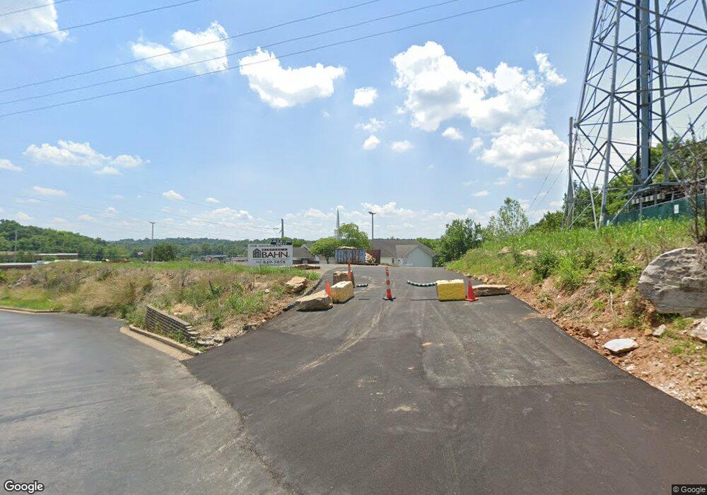
2141 Sams Dr Saint Louis, MO 63131
Estimated Value: $2,774,706
--
Bed
--
Bath
8,310
Sq Ft
$334/Sq Ft
Est. Value
About This Home
This home is located at 2141 Sams Dr, Saint Louis, MO 63131 and is currently estimated at $2,774,706, approximately $333 per square foot. 2141 Sams Dr is a home located in St. Louis County with nearby schools including Mason Ridge Elementary School, Parkway West Middle School, and Parkway West High School.
Ownership History
Date
Name
Owned For
Owner Type
Purchase Details
Closed on
Mar 9, 2023
Sold by
Molly & Me Llc
Bought by
Jack Oates Inc
Current Estimated Value
Purchase Details
Closed on
May 8, 2008
Sold by
Jampac Llc
Bought by
Molly & Me Llc
Purchase Details
Closed on
Apr 29, 2008
Sold by
The Rock Church Inc
Bought by
Molly & Me Llc
Purchase Details
Closed on
Sep 7, 2007
Sold by
Wal Mart Stores Inc
Bought by
The Rock Church Inc and Christian Family Worship Center Inc
Create a Home Valuation Report for This Property
The Home Valuation Report is an in-depth analysis detailing your home's value as well as a comparison with similar homes in the area
Home Values in the Area
Average Home Value in this Area
Purchase History
| Date | Buyer | Sale Price | Title Company |
|---|---|---|---|
| Jack Oates Inc | -- | -- | |
| Molly & Me Llc | -- | Fa | |
| Molly & Me Llc | -- | Fa | |
| Molly & Me Llc | $1,500,000 | Fa | |
| Molly & Me Llc | -- | Fa | |
| The Rock Church Inc | -- | None Available |
Source: Public Records
Tax History Compared to Growth
Tax History
| Year | Tax Paid | Tax Assessment Tax Assessment Total Assessment is a certain percentage of the fair market value that is determined by local assessors to be the total taxable value of land and additions on the property. | Land | Improvement |
|---|---|---|---|---|
| 2025 | $28,089 | $367,260 | $178,430 | $188,830 |
| 2024 | $28,089 | $304,000 | $149,980 | $154,020 |
| 2023 | $27,833 | $304,000 | $149,980 | $154,020 |
| 2022 | $26,873 | $296,730 | $155,260 | $141,470 |
| 2021 | $10,586 | $176,190 | $92,190 | $84,000 |
| 2020 | $8,513 | $135,480 | $50,070 | $85,410 |
| 2019 | $8,393 | $135,480 | $50,070 | $85,410 |
| 2018 | $10,746 | $160,350 | $46,270 | $114,080 |
| 2017 | $10,600 | $160,350 | $46,270 | $114,080 |
| 2016 | $10,285 | $147,900 | $33,820 | $114,080 |
| 2015 | $10,841 | $147,900 | $33,820 | $114,080 |
| 2014 | $8,384 | $124,250 | $84,630 | $39,620 |
Source: Public Records
Map
Nearby Homes
- 2211 Viewroyal Dr
- 2527 Barrett Place Dr
- 2522 Barrett Place Dr
- 13354 Thornhill Dr
- 2323 Hollyhead Dr
- 2405 Fairoyal Dr
- 831 Minarca Dr
- 1826 S Mason Rd
- 1824 Topping Rd
- 12841 Thornhill Ct
- 1848 Ridgeview Circle Dr
- 1652 Mason Knoll Rd
- 614 Carman Forest Ln
- 35 Ridgeview Circle Ct
- 13124 Huntercreek Ridge Rd
- 1515 Topping Rd
- 1311 Prospect Village Ln Unit B
- 1536 S Mason Rd
- 1307 Prospect Village Ln Unit C
- 194 Braeshire Dr
- 2100 Barrett Station Rd
- 13762 Stonemont Ct
- 2131 Barrett Station Rd
- 2115 Barrett Station 2155 Rd Unit 2115, 2131, 2133, 21
- 2052 Barrett Station Rd
- 2173 Barrett Station Rd
- 13200 Laurel Lake Ct
- 13208 Laurel Lake Ct
- 2038 Barrett Station Rd
- 2040 Grecian Way Ct
- 2110 Patrician Way Ct
- 13230 Laurel Lake Ct
- 13610 Mason Meadows Ct
- 2118 Patrician Way Ct
- 13606 Mason Meadows Ct
- 13605 Mason Oaks Ln Unit F5
- 13609 Mason Oaks Ln Unit F4
- 13613 Mason Oaks Ln Unit F3
- 13621 Mason Oaks Ln Unit F1
- 2039 Grecian Way Ct
