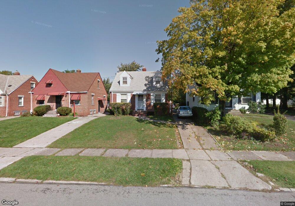
21419 Clare Ave Maple Heights, OH 44137
Estimated Value: $116,000 - $132,000
3
Beds
1
Bath
1,175
Sq Ft
$104/Sq Ft
Est. Value
About This Home
This home is located at 21419 Clare Ave, Maple Heights, OH 44137 and is currently estimated at $121,681, approximately $103 per square foot. 21419 Clare Ave is a home located in Cuyahoga County with nearby schools including Abraham Lincoln Elementary School, Rockside/ J.F. Kennedy School, and Barack Obama School.
Ownership History
Date
Name
Owned For
Owner Type
Purchase Details
Closed on
Oct 2, 2016
Sold by
Smith Caroline Jean and Smith Ronald James
Bought by
Smith Caroline Jean
Current Estimated Value
Purchase Details
Closed on
Nov 24, 1993
Sold by
Ransom Terrance
Bought by
Smith Ronald J
Purchase Details
Closed on
Mar 3, 1989
Sold by
Graham Gregory S
Bought by
Ransom Terrance
Purchase Details
Closed on
Apr 4, 1986
Sold by
Anita L Fascione
Bought by
Zeleznikar Anita
Purchase Details
Closed on
Jul 29, 1976
Sold by
Fascione Mary Paradise
Bought by
Anita L Fascione
Purchase Details
Closed on
Sep 18, 1975
Sold by
Harsany Theresa
Bought by
Fascione Mary Paradise
Purchase Details
Closed on
Jan 1, 1975
Bought by
Harsany Theresa
Create a Home Valuation Report for This Property
The Home Valuation Report is an in-depth analysis detailing your home's value as well as a comparison with similar homes in the area
Home Values in the Area
Average Home Value in this Area
Purchase History
| Date | Buyer | Sale Price | Title Company |
|---|---|---|---|
| Smith Caroline Jean | -- | None Available | |
| Smith Ronald J | $59,900 | -- | |
| Ransom Terrance | $42,100 | -- | |
| Zeleznikar Anita | -- | -- | |
| Graham Gregory S | $39,900 | -- | |
| Anita L Fascione | $15,000 | -- | |
| Fascione Mary Paradise | $25,000 | -- | |
| Harsany Theresa | -- | -- |
Source: Public Records
Tax History
| Year | Tax Paid | Tax Assessment Tax Assessment Total Assessment is a certain percentage of the fair market value that is determined by local assessors to be the total taxable value of land and additions on the property. | Land | Improvement |
|---|---|---|---|---|
| 2025 | $2,791 | $34,195 | $6,720 | $27,475 |
| 2024 | $3,100 | $34,195 | $6,720 | $27,475 |
| 2023 | $2,250 | $20,860 | $4,060 | $16,800 |
| 2022 | $2,242 | $20,860 | $4,060 | $16,800 |
| 2021 | $2,388 | $20,860 | $4,060 | $16,800 |
| 2020 | $2,046 | $15,820 | $3,080 | $12,740 |
| 2019 | $2,034 | $45,200 | $8,800 | $36,400 |
| 2018 | $2,023 | $15,820 | $3,080 | $12,740 |
| 2017 | $1,940 | $14,700 | $2,870 | $11,830 |
| 2016 | $1,877 | $14,700 | $2,870 | $11,830 |
| 2015 | $1,875 | $14,700 | $2,870 | $11,830 |
| 2014 | $1,875 | $16,170 | $3,150 | $13,020 |
Source: Public Records
Map
Nearby Homes
- 21202 Hillgrove Ave
- 21207 Franklin Rd
- 21601 Gardenview Dr
- 21860 Louis Rd
- 21607 Libby Rd
- 21202 Gardenview Dr
- 20905 Clare Ave
- 20814 Clare Ave
- 20715 Watson Rd
- 20705 Hansen Rd
- 20600 Watson Rd
- 5147 Warrensville Center Rd
- 5285 Mardale Ave
- 5301 Mardale Ave
- 0 Miles Rd Unit 5188561
- 19910 Mountville Dr
- 19931 Raymond St
- 5424 Fairtree Rd
- 19520 Maple Heights Blvd
- 20648 Donny Brook Rd
- 21501 Clare Ave
- 21415 Clare Ave
- 21407 Clare Ave
- 21418 Hillgrove Ave
- 21511 Clare Ave
- 21414 Hillgrove Ave
- 21502 Hillgrove Ave
- 21410 Hillgrove Ave
- 21506 Hillgrove Ave
- 21403 Clare Ave
- 21515 Clare Ave
- 21406 Hillgrove Ave
- 21510 Hillgrove Ave
- 21418 Clare Ave
- 21414 Clare Ave
- 21502 Clare Ave
- 21410 Clare Ave
- 21506 Clare Ave
- 21319 Clare Ave
- 21402 Hillgrove Ave
Your Personal Tour Guide
Ask me questions while you tour the home.