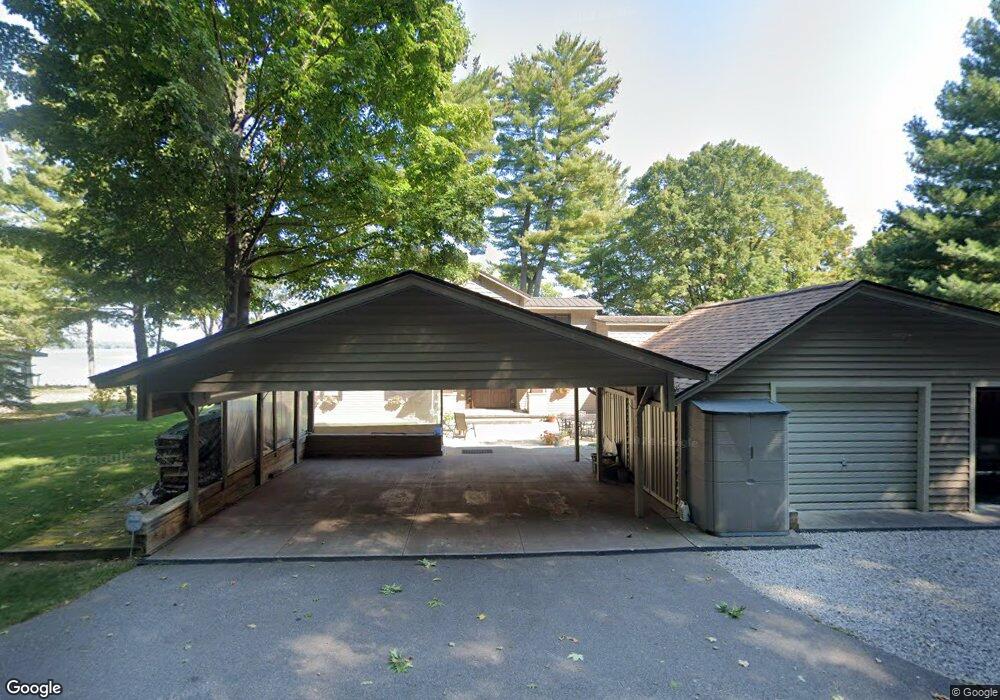
2142 Elmhurst Rd Brutus, MI 49716
Estimated Value: $1,412,548 - $2,295,000
Studio
--
Bath
--
Sq Ft
38,768
Sq Ft Lot
About This Home
This home is located at 2142 Elmhurst Rd, Brutus, MI 49716 and is currently estimated at $1,818,183. 2142 Elmhurst Rd is a home located in Cheboygan County with nearby schools including Pellston Elementary School and Pellston Middle/High School.
Ownership History
Date
Name
Owned For
Owner Type
Purchase Details
Closed on
Feb 20, 2024
Sold by
Cheney Cheryl
Bought by
Cheney Stuart F and Cheney Cheryl L
Current Estimated Value
Purchase Details
Closed on
Apr 14, 2020
Sold by
Cheney Stuart F
Bought by
Cheney Stuart F and Cheney Cheryl L
Purchase Details
Closed on
Nov 17, 2012
Sold by
Cheney Cherly L
Bought by
Cheney Stuart F
Purchase Details
Closed on
Sep 6, 2010
Sold by
Frederick G Frederick G
Bought by
Cheney Stuart F
Purchase Details
Closed on
Sep 5, 2010
Sold by
Cheney Stuart F
Bought by
Cheney Stuart F and Cheney Cheryl
Purchase Details
Closed on
Sep 5, 1996
Sold by
Cheney Helen G
Bought by
Cheney Stuart and Helen Cheney
Purchase Details
Closed on
May 11, 1993
Sold by
Cheney Mary Ann
Bought by
Cheney Stuart F
Purchase Details
Closed on
Sep 4, 1992
Sold by
Cheney Grant W
Bought by
Cheney Helen G
Purchase Details
Closed on
Mar 5, 1990
Sold by
Cheney Grant
Bought by
Cheney Grant and Cheney Helen
Purchase Details
Closed on
Feb 14, 1989
Sold by
Cheney Grant W
Bought by
Cheney Grant and Cheney Helen
Create a Home Valuation Report for This Property
The Home Valuation Report is an in-depth analysis detailing your home's value as well as a comparison with similar homes in the area
Purchase History
| Date | Buyer | Sale Price | Title Company |
|---|---|---|---|
| Cheney Stuart F | -- | -- | |
| Cheney Stuart F | -- | -- | |
| Cheney Stuart F | -- | -- | |
| Cheney Stuart F | -- | -- | |
| Cheney Stuart F | -- | -- | |
| Cheney Stuart | -- | -- | |
| Cheney Stuart F | -- | -- | |
| Cheney Helen G | -- | -- | |
| Cheney Grant | -- | -- | |
| Cheney Grant | -- | -- |
Source: Public Records
Tax History
| Year | Tax Paid | Tax Assessment Tax Assessment Total Assessment is a certain percentage of the fair market value that is determined by local assessors to be the total taxable value of land and additions on the property. | Land | Improvement |
|---|---|---|---|---|
| 2025 | $6,705 | $701,100 | $0 | $0 |
| 2024 | $3,723 | $621,700 | $0 | $0 |
| 2023 | $3,569 | $574,500 | $0 | $0 |
| 2022 | $3,514 | $484,300 | $0 | $0 |
| 2021 | $6,298 | $437,900 | $437,900 | $0 |
| 2020 | $6,404 | $406,600 | $406,600 | $0 |
| 2019 | $5,677 | $417,600 | $417,600 | $0 |
| 2018 | $5,599 | $386,700 | $0 | $0 |
| 2017 | $5,184 | $369,500 | $0 | $0 |
| 2016 | $5,115 | $343,300 | $0 | $0 |
| 2015 | -- | $219,100 | $0 | $0 |
| 2014 | -- | $240,300 | $0 | $0 |
| 2012 | -- | $251,400 | $0 | $0 |
Source: Public Records
Map
Nearby Homes
- 1830 Indian Point Rd
- 10826 Chickagami Trail
- 1442 Indian Point Rd
- 939 Stratford Ln
- 78 Plymouth Beach Dr
- 7028 Barney Rd
- 6888 Sequoia Dr
- 0 Vl Louella St Unit 50200311
- 6893 Sequoia Dr
- 865 Wintree Dr
- 10 Lots Arthur St
- 4333 U S 31
- TBD Miller Rd Unit LOTS : 10;11;15;17;1
- 8688 Miller Rd
- 8959 Robinson Rd
- 1400 Topinabee Shore Dr
- 8118 Miller Rd Unit Lot 19
- 8139 Bluebird Ln Unit Lot 17
- 8842 Chickadee Ln Unit Lot 12
- 8195 Bluebird Ln Unit Lot 15
- 2214 Elmhurst Rd
- 2158 Elmhurst Rd
- 2124 Elmhurst Rd
- 2114 Elmhurst Rd
- 2100 Elmhurst Rd
- 2180 Elmhurst Rd
- 2182 Elmhurst Rd
- 2094 Elmhurst Rd
- 2084 Elmhurst Rd
- 9926 Woodland Dr
- 2076 Elmhurst Rd
- 9906 Woodland Dr
- 2068 Elmhurst Rd
- 9946 Woodland Dr
- 9886 Woodland Dr
- 2342 Burt Springs Cir
- 2342 Burt Springs Cir Unit 6
- 2322 Burt Springs Circle (Unit 4) Dr
- 2064 Elmhurst Rd
- 2046 Elmhurst Rd
Your Personal Tour Guide
Ask me questions while you tour the home.