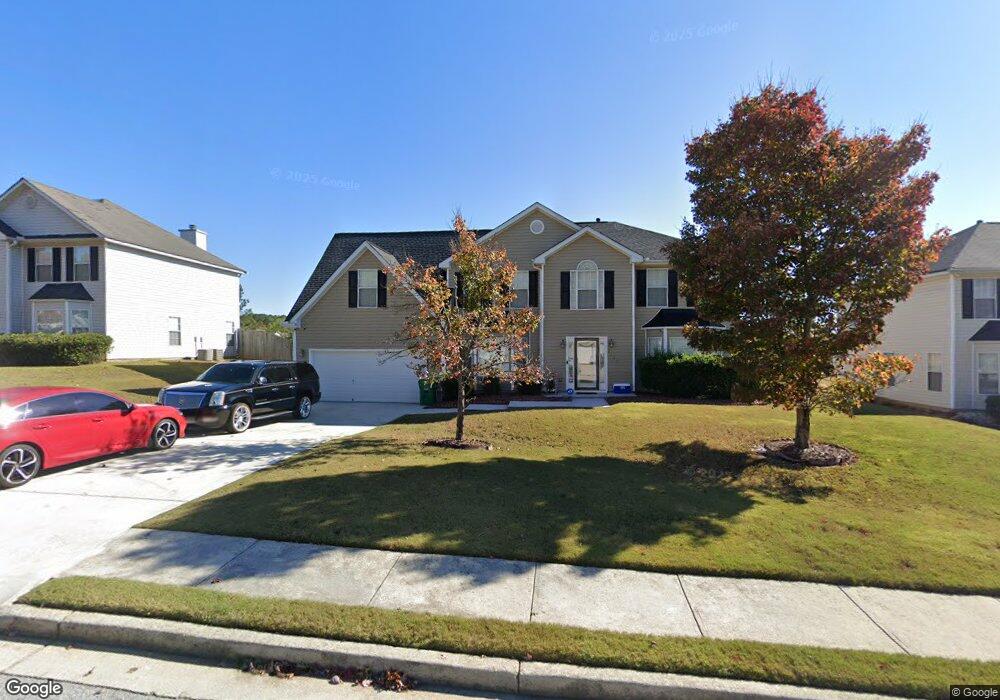
2142 Strang Blvd Unit B Lithonia, GA 30058
Estimated Value: $342,258 - $372,000
5
Beds
3
Baths
3,235
Sq Ft
$111/Sq Ft
Est. Value
About This Home
This home is located at 2142 Strang Blvd Unit B, Lithonia, GA 30058 and is currently estimated at $360,065, approximately $111 per square foot. 2142 Strang Blvd Unit B is a home located in DeKalb County with nearby schools including Rock Chapel Elementary School, Lithonia Middle School, and Lithonia High School.
Ownership History
Date
Name
Owned For
Owner Type
Purchase Details
Closed on
Aug 31, 2001
Sold by
W Thomas Construction
Bought by
Jackson Kimberly D
Current Estimated Value
Home Financials for this Owner
Home Financials are based on the most recent Mortgage that was taken out on this home.
Original Mortgage
$158,317
Outstanding Balance
$77,390
Interest Rate
10.75%
Mortgage Type
New Conventional
Estimated Equity
$282,675
Create a Home Valuation Report for This Property
The Home Valuation Report is an in-depth analysis detailing your home's value as well as a comparison with similar homes in the area
Home Values in the Area
Average Home Value in this Area
Purchase History
| Date | Buyer | Sale Price | Title Company |
|---|---|---|---|
| Jackson Kimberly D | $166,700 | -- |
Source: Public Records
Mortgage History
| Date | Status | Borrower | Loan Amount |
|---|---|---|---|
| Open | Jackson Kimberly D | $158,317 |
Source: Public Records
Tax History
| Year | Tax Paid | Tax Assessment Tax Assessment Total Assessment is a certain percentage of the fair market value that is determined by local assessors to be the total taxable value of land and additions on the property. | Land | Improvement |
|---|---|---|---|---|
| 2025 | $3,936 | $133,760 | $20,000 | $113,760 |
| 2024 | $4,127 | $136,680 | $20,000 | $116,680 |
| 2023 | $4,127 | $115,480 | $20,000 | $95,480 |
Source: Public Records
Map
Nearby Homes
- 1857 Demilio Dr
- 7808 Providence Point Way
- 7888 Providence Point Way
- 7862 Providence Point Way
- 7887 Providence Point Way Unit 1
- 7492 Ferrara Dr
- 7701 Stone Meadow Trail
- 7977 Union Grove Rd
- 2391 Harmony Ridge Ct
- 7690 Union Grove Rd
- 7569 Lowilla Ln
- 2469 Osceola Rd
- 7962 Harmony Ridge Ln
- 1745 Indian Woods Rd
- 8347 Union Grove Rd
- 7537 Union Grove Rd
- 2289 Overlook Ave
- 7982 Harmony Lakes Dr
- 2330 Haliard Way
- 2325 Haliard Way
- 2148 Strang Blvd
- 7709 Providence Point Way
- 2009 Locksley Terrace
- 2015 Locksley Terrace
- 2154 Strang Blvd
- 2003 Locksley Terrace
- 2141 Strang Blvd Unit 2B
- 2147 Strang Blvd
- 2135 Strang Blvd
- 2021 Locksley Terrace Unit 2B
- 2160 Strang Blvd
- 2124 Strang Blvd
- 2153 Strang Blvd
- 2129 Strang Blvd
- 2027 Locksley Terrace
- 7720 Providence Point Way Unit IIB
- 2123 Strang Blvd
- 2159 Strang Blvd
- 2010 Locksley Terrace Unit 2B
- 2166 Strang Blvd Unit 2B
Your Personal Tour Guide
Ask me questions while you tour the home.