Estimated Value: $192,000 - $209,904
4
Beds
1
Bath
1,268
Sq Ft
$160/Sq Ft
Est. Value
About This Home
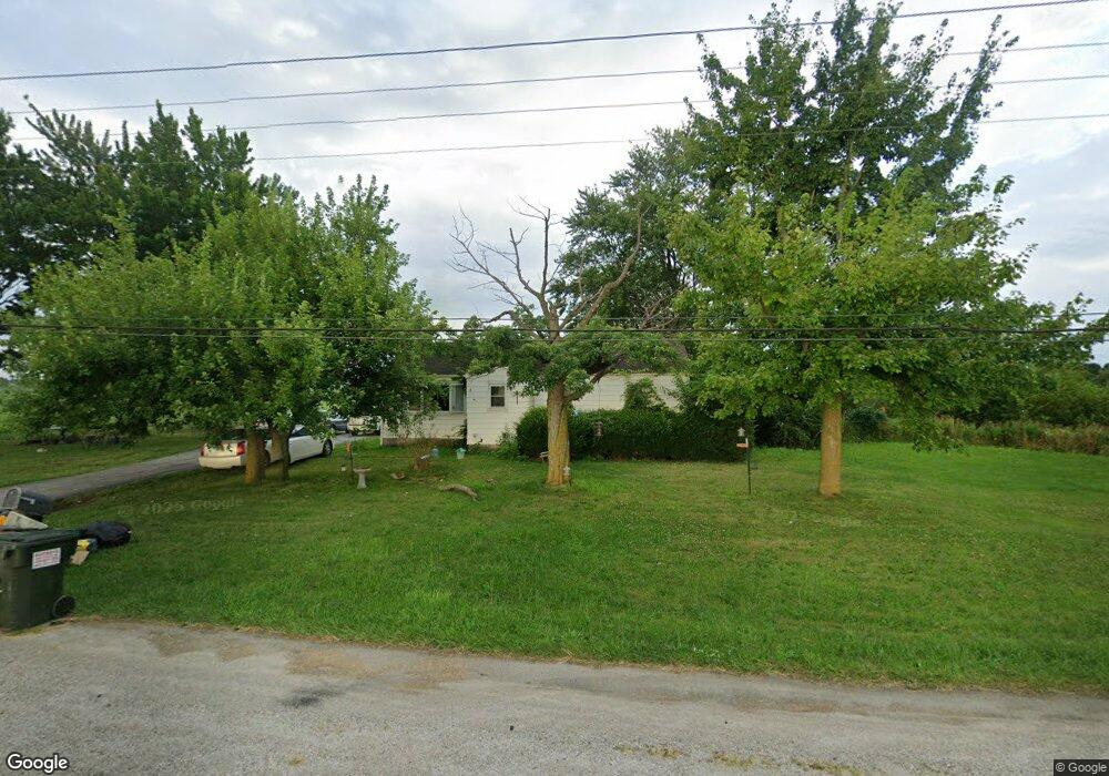
This home is located at 21420 State Route 51 W, Genoa, OH 43430 and is currently estimated at $202,726, approximately $159 per square foot. 21420 State Route 51 W is a home located in Ottawa County with nearby schools including Genoa Elementary School and Community Christian Academy.
Ownership History
Date
Name
Owned For
Owner Type
Purchase Details
Closed on
Feb 5, 2021
Sold by
Skaff Mollie and Skaff Molly
Bought by
Skaff Elizabeth and Skaff Spencer
Current Estimated Value
Purchase Details
Closed on
Dec 22, 2020
Sold by
Berfield Polly
Bought by
Skaff Molly
Purchase Details
Closed on
Jul 15, 2014
Sold by
Estate Of Molly P Nagy
Bought by
Nacy Michael and Berfiled Pully
Create a Home Valuation Report for This Property
The Home Valuation Report is an in-depth analysis detailing your home's value as well as a comparison with similar homes in the area
Home Values in the Area
Average Home Value in this Area
Purchase History
| Date | Buyer | Sale Price | Title Company |
|---|---|---|---|
| Skaff Elizabeth | -- | None Available | |
| Skaff Molly | $10,000 | None Available | |
| Skaff Molly | $10,000 | None Available | |
| Skaff Molly | $10,000 | None Available | |
| Nacy Michael | -- | None Available |
Source: Public Records
Tax History Compared to Growth
Tax History
| Year | Tax Paid | Tax Assessment Tax Assessment Total Assessment is a certain percentage of the fair market value that is determined by local assessors to be the total taxable value of land and additions on the property. | Land | Improvement |
|---|---|---|---|---|
| 2024 | $2,645 | $54,930 | $16,951 | $37,979 |
| 2023 | $2,551 | $46,610 | $14,126 | $32,484 |
| 2022 | $2,565 | $46,610 | $14,126 | $32,484 |
| 2021 | $2,285 | $46,610 | $14,130 | $32,480 |
| 2020 | $2,002 | $38,340 | $10,090 | $28,250 |
| 2019 | $1,987 | $38,340 | $10,090 | $28,250 |
| 2018 | $1,973 | $38,340 | $10,090 | $28,250 |
| 2017 | $1,326 | $34,580 | $10,090 | $24,490 |
| 2016 | $1,330 | $34,580 | $10,090 | $24,490 |
| 2015 | $1,338 | $34,580 | $10,090 | $24,490 |
| 2014 | $14,185 | $32,350 | $10,090 | $22,260 |
| 2013 | $12,493 | $32,350 | $10,090 | $22,260 |
Source: Public Records
Map
Nearby Homes
- 207 E 11th St
- 1350 N Genoa Clay Center Rd
- 904 Main St
- 1301 West St
- 514 West St
- 510 Wilson St
- 416 Castle Cove
- 1615 N Thyre Dr
- 22771 W Holt Harrigan Rd
- 1861 N Opfer-Lentz Rd
- 23225 Ohio 51
- 23430 State Route 51 W
- 19383 Courtland Ave
- 0 Recker Rd
- 20240 W Portage River South Rd
- 0 W Portage River Rd S Unit 6130453
- 24764 Bradner Rd
- 1251 S Railroad St
- 0 W Walbridge Rd
- Track 1 W Walbridge Rd
- 21440 State Route 51 W
- 21495 State Route 51 W
- 21495 Ohio 51
- 21521 State Route 51 W
- 651 Nottingham Dr
- 23255 Ohio 51
- 21000 Ohio 51
- 22435 Ohio 51
- 673 Nottingham Dr
- 673 Nottingham Dr
- 695 Nottingham Dr
- 21581 Ohio 51
- 21581 State Route 51 W
- 21581 W St Rt 51
- 739 Nottingham Dr
- 21593 State Route 51 W
- 761 Nottingham Dr
- 783 Nottingham Dr
- 783 Nottingham Dr
- LOT 20 Nottingham Dr