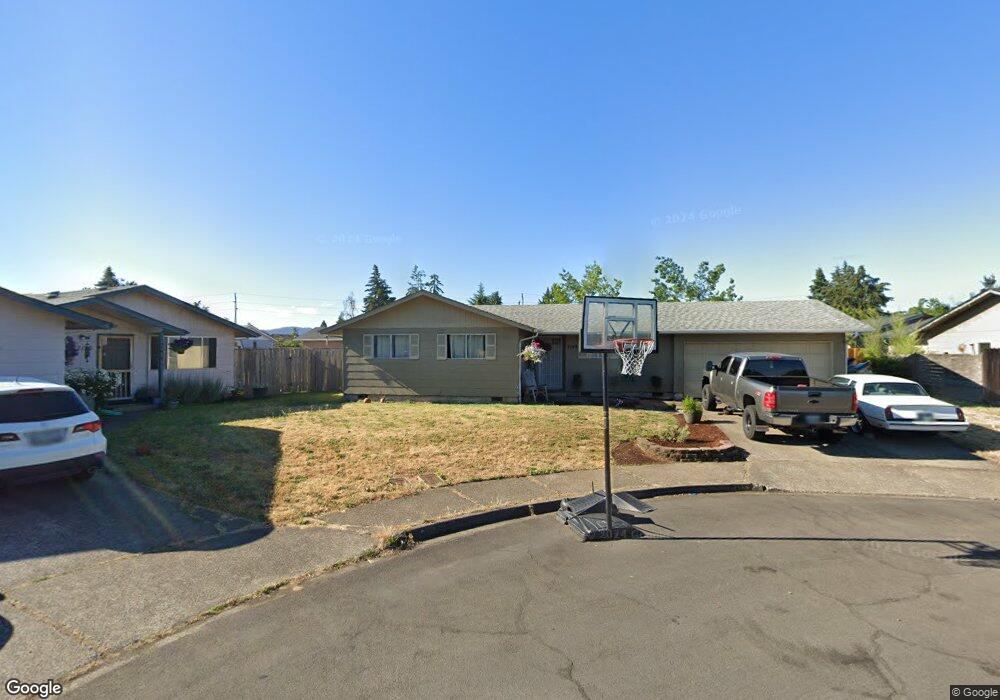
2143 6th St Springfield, OR 97477
North Springfield NeighborhoodEstimated Value: $366,000 - $384,000
2
Beds
2
Baths
1,078
Sq Ft
$347/Sq Ft
Est. Value
About This Home
This home is located at 2143 6th St, Springfield, OR 97477 and is currently estimated at $374,347, approximately $347 per square foot. 2143 6th St is a home located in Lane County with nearby schools including Elizabeth Page Elementary School, Briggs Middle School, and Springfield High School.
Ownership History
Date
Name
Owned For
Owner Type
Purchase Details
Closed on
Jul 25, 2022
Sold by
Temple Susan R
Bought by
Temple Joint Trust
Current Estimated Value
Purchase Details
Closed on
Mar 24, 2021
Sold by
Hinman Ardith H and Temple Susan
Bought by
Temple Susan
Purchase Details
Closed on
Feb 3, 2021
Sold by
Hinman Ardith M and Temple Susan
Bought by
Hinman Ardith M and Temple Susan
Purchase Details
Closed on
Jul 31, 2003
Sold by
Zimmerman J Wayne and Zimmerman Judy M
Bought by
Hinman Harold H and Hinman Ardith M
Create a Home Valuation Report for This Property
The Home Valuation Report is an in-depth analysis detailing your home's value as well as a comparison with similar homes in the area
Home Values in the Area
Average Home Value in this Area
Purchase History
| Date | Buyer | Sale Price | Title Company |
|---|---|---|---|
| Temple Joint Trust | -- | None Listed On Document | |
| Temple Susan | -- | None Available | |
| Hinman Ardith M | -- | None Available | |
| Hinman Harold H | $120,000 | Western Pioneer Title Co |
Source: Public Records
Tax History
| Year | Tax Paid | Tax Assessment Tax Assessment Total Assessment is a certain percentage of the fair market value that is determined by local assessors to be the total taxable value of land and additions on the property. | Land | Improvement |
|---|---|---|---|---|
| 2025 | $3,466 | $188,988 | -- | -- |
| 2024 | $3,409 | $183,484 | -- | -- |
| 2023 | $3,409 | $178,140 | $0 | $0 |
| 2022 | $3,158 | $172,952 | $0 | $0 |
| 2021 | $3,101 | $167,915 | $0 | $0 |
| 2020 | $3,011 | $163,025 | $0 | $0 |
| 2019 | $2,920 | $158,277 | $0 | $0 |
| 2018 | $2,753 | $149,191 | $0 | $0 |
| 2017 | $2,647 | $149,191 | $0 | $0 |
| 2016 | $2,591 | $144,846 | $0 | $0 |
| 2015 | $2,517 | $140,627 | $0 | $0 |
| 2014 | $2,479 | $136,531 | $0 | $0 |
Source: Public Records
Map
Nearby Homes
- 2155 6th St
- 638 Northridge Ave
- 634 Northridge Ave
- 652 Northridge Ave
- 2131 6th St
- 616 Northridge Ave
- 2160 8th St
- 2167 6th St
- 2173 6th St
- 686 Northridge Ave
- 2183 6th St
- 2148 8th St
- 2241 6th St
- 641 Northridge Ave
- 748 Northridge Ave
- 655 Northridge Ave
- 637 Northridge Ave
- 2130 6th St
- 2225 6th St
- 2126 6th St
Your Personal Tour Guide
Ask me questions while you tour the home.