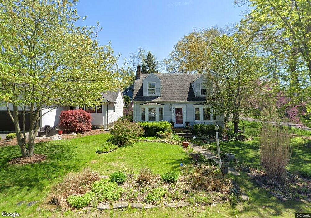
2143 Garland St Sylvan Lake, MI 48320
Estimated Value: $347,000 - $426,000
3
Beds
2
Baths
1,244
Sq Ft
$306/Sq Ft
Est. Value
About This Home
This home is located at 2143 Garland St, Sylvan Lake, MI 48320 and is currently estimated at $380,301, approximately $305 per square foot. 2143 Garland St is a home located in Oakland County with nearby schools including Walt Whitman Elementary School, Pontiac Middle School, and Pontiac High School.
Ownership History
Date
Name
Owned For
Owner Type
Purchase Details
Closed on
Aug 19, 2002
Sold by
Sherman Aram D
Bought by
Daelemans Kathleen M
Current Estimated Value
Purchase Details
Closed on
Jul 28, 1997
Sold by
Walsh John M
Bought by
Sherman Aram D
Home Financials for this Owner
Home Financials are based on the most recent Mortgage that was taken out on this home.
Original Mortgage
$129,600
Interest Rate
7.71%
Create a Home Valuation Report for This Property
The Home Valuation Report is an in-depth analysis detailing your home's value as well as a comparison with similar homes in the area
Home Values in the Area
Average Home Value in this Area
Purchase History
| Date | Buyer | Sale Price | Title Company |
|---|---|---|---|
| Daelemans Kathleen M | $236,000 | -- | |
| Sherman Aram D | $162,000 | -- |
Source: Public Records
Mortgage History
| Date | Status | Borrower | Loan Amount |
|---|---|---|---|
| Previous Owner | Sherman Aram D | $129,600 |
Source: Public Records
Tax History Compared to Growth
Tax History
| Year | Tax Paid | Tax Assessment Tax Assessment Total Assessment is a certain percentage of the fair market value that is determined by local assessors to be the total taxable value of land and additions on the property. | Land | Improvement |
|---|---|---|---|---|
| 2024 | $4,121 | $158,230 | $0 | $0 |
| 2023 | $3,946 | $153,110 | $0 | $0 |
| 2022 | $4,088 | $135,960 | $0 | $0 |
| 2021 | $3,939 | $109,950 | $0 | $0 |
| 2020 | $3,783 | $101,230 | $0 | $0 |
| 2019 | $3,999 | $96,890 | $0 | $0 |
| 2018 | $3,902 | $98,170 | $0 | $0 |
| 2017 | $3,863 | $94,860 | $0 | $0 |
| 2016 | $3,884 | $86,780 | $0 | $0 |
| 2015 | -- | $86,690 | $0 | $0 |
| 2014 | -- | $76,980 | $0 | $0 |
| 2011 | -- | $57,610 | $0 | $0 |
Source: Public Records
Map
Nearby Homes
- 49 Canal Dr Unit 300-049
- 21 Canal Dr Unit 300-021
- 27 Riverbank Dr Unit 300-127
- 25 Riverbank Dr Unit 300-125
- 14 Riverbank Dr Unit 300-114
- 26 Edna Ave
- 1160 Dorchester Ave
- 1796 Briarcliff St
- 1061 Dorchester Ave
- 1785 Ward Rd
- 1075 Canterbury Dr
- 1775 Woodland Ave
- 990 Voorheis Rd
- 1205 Leinbach Ave
- 8 Myra Ave
- 147 Draper Ave
- 1030 Menominee Rd
- 0000 Ward Road Ward Rd
- 1660 Beechmont St
- 10 Wenonah Dr
- 2139 Garland St
- 1411 Rosedale Ave
- 1402 Rosedale Ave
- 2135 Garland St
- 1413 Rosedale Ave
- 2125 Garland St
- 2165 Garland St
- 1417 Rosedale Ave
- 1410 Rosedale Ave
- 1420 Glenwood Dr
- 2140 Garland St
- 2115 Garland St
- 1426 Glenwood Dr
- 1421 Rosedale Ave
- 1420 Rosedale Ave
- 2136 Garland St
- 1414 Glenwood Dr
- 2156 Garland St
- 2105 Garland St
- 2181 Garland St