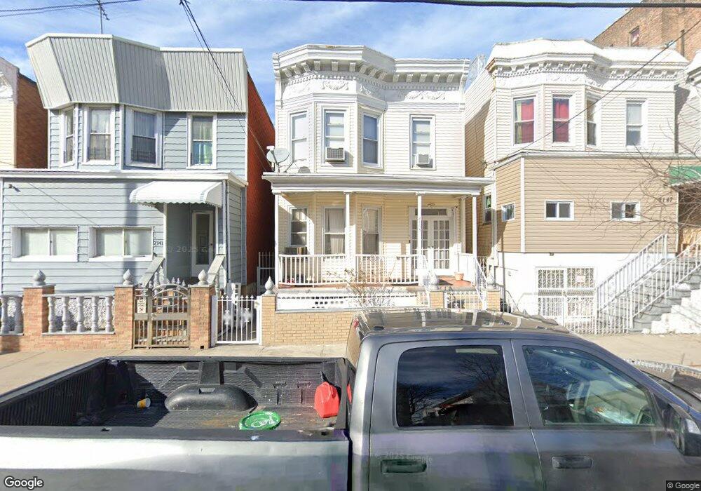
2143 Gleason Ave Bronx, NY 10462
Unionport NeighborhoodEstimated Value: $742,056 - $919,000
Studio
--
Bath
2,252
Sq Ft
$382/Sq Ft
Est. Value
About This Home
This home is located at 2143 Gleason Ave, Bronx, NY 10462 and is currently estimated at $861,264, approximately $382 per square foot. 2143 Gleason Ave is a home located in Bronx County with nearby schools including P.S. 36 Unionport, Herbert H Lehman High School, and St Helena School.
Ownership History
Date
Name
Owned For
Owner Type
Purchase Details
Closed on
Aug 12, 2004
Sold by
Jean Phillips Denise and St Jean Katia
Bought by
St Jean Katia
Current Estimated Value
Purchase Details
Closed on
Sep 17, 2001
Sold by
Rem Realty Holding Corp
Bought by
St Jean Katia and Phillips Denise Jean
Home Financials for this Owner
Home Financials are based on the most recent Mortgage that was taken out on this home.
Original Mortgage
$277,750
Interest Rate
7.04%
Mortgage Type
Purchase Money Mortgage
Purchase Details
Closed on
Feb 8, 2001
Sold by
Boodoo Harold
Bought by
Zsa Zsa Holding Llc
Create a Home Valuation Report for This Property
The Home Valuation Report is an in-depth analysis detailing your home's value as well as a comparison with similar homes in the area
Home Values in the Area
Average Home Value in this Area
Purchase History
| Date | Buyer | Sale Price | Title Company |
|---|---|---|---|
| St Jean Katia | -- | -- | |
| St Jean Katia | -- | -- | |
| St Jean Katia | -- | -- | |
| Rem Realty Holding Corp | -- | -- | |
| Rem Realty Holding Corp | -- | -- | |
| Zsa Zsa Holding Llc | $160,000 | -- | |
| Zsa Zsa Holding Llc | $160,000 | -- |
Source: Public Records
Mortgage History
| Date | Status | Borrower | Loan Amount |
|---|---|---|---|
| Previous Owner | Rem Realty Holding Corp | $277,750 | |
| Previous Owner | Rem Realty Holding Corp | $0 |
Source: Public Records
Tax History Compared to Growth
Tax History
| Year | Tax Paid | Tax Assessment Tax Assessment Total Assessment is a certain percentage of the fair market value that is determined by local assessors to be the total taxable value of land and additions on the property. | Land | Improvement |
|---|---|---|---|---|
| 2025 | $5,440 | $28,663 | $4,854 | $23,809 |
| 2024 | $5,440 | $27,086 | $5,117 | $21,969 |
| 2023 | $5,501 | $27,086 | $5,155 | $21,931 |
| 2022 | $5,357 | $44,400 | $9,420 | $34,980 |
| 2021 | $5,328 | $37,560 | $9,420 | $28,140 |
| 2020 | $5,056 | $37,740 | $9,420 | $28,320 |
| 2019 | $4,722 | $35,820 | $9,420 | $26,400 |
| 2018 | $4,601 | $22,572 | $6,750 | $15,822 |
| 2017 | $4,559 | $22,363 | $6,053 | $16,310 |
| 2016 | $4,218 | $21,099 | $6,665 | $14,434 |
| 2015 | $2,325 | $19,905 | $7,980 | $11,925 |
| 2014 | $2,325 | $18,810 | $7,507 | $11,303 |
Source: Public Records
Map
Nearby Homes
- 2131 Newbold Ave
- 2164 Cross Bronx Expy
- 1163 Havemeyer Ave
- 1170 Havemeyer Ave
- 2313 Ellis Ave
- 1107 Havemeyer Ave
- 2181 Starling Ave Unit 5D
- 2016 Haviland Ave
- 1039 Olmstead Ave
- 2120 Chatterton Ave
- 2012 Benedict Ave
- 2215 Bruckner Blvd
- 2131 Bruckner Blvd
- 2053 Mcgraw Ave Unit 4E
- 2304 Glebe Ave
- 1521 Unionport Rd Unit 11G
- 1521 Unionport Rd Unit 11A
- 1439 Zerega Ave
- 1966 Newbold Ave Unit 108
- 1966 Newbold Ave Unit 1510
- 2141 Gleason Ave
- 2147 Gleason Ave
- 2139 Gleason Ave
- 2149 Gleason Ave
- 2137 Gleason Ave
- 2135 Gleason Ave
- 2142 Ellis Ave
- 2140 Ellis Ave
- 2155 Gleason Ave
- 2138 Ellis Ave
- 2144 Ellis Ave
- 2144 Ellis Ave Unit 2
- 2150 Ellis Ave
- 2133 Gleason Ave
- 2136 Ellis Ave
- 2134 Ellis Ave
- 2152 Ellis Ave
- 2131 Gleason Ave
- 2142 Gleason Ave
- 2140 Gleason Ave