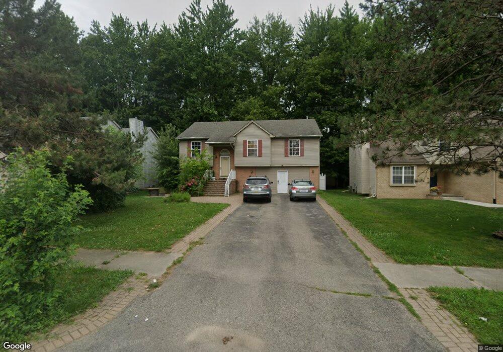
2144 Martin St Unit 7 Westland, MI 48186
Estimated Value: $301,000 - $467,000
4
Beds
2
Baths
2,032
Sq Ft
$183/Sq Ft
Est. Value
About This Home
This home is located at 2144 Martin St Unit 7, Westland, MI 48186 and is currently estimated at $371,908, approximately $183 per square foot. 2144 Martin St Unit 7 is a home located in Wayne County with nearby schools including Adams Middle School, Benjamin Franklin Middle School, and Adlai Stevenson Middle School.
Ownership History
Date
Name
Owned For
Owner Type
Purchase Details
Closed on
Sep 6, 2011
Sold by
Deutsche Bank National Trust Company
Bought by
Elzaynab Issam
Current Estimated Value
Purchase Details
Closed on
Jun 2, 2011
Sold by
Moon Patrice and Powell Ernest L
Bought by
Deutsche Bank National Trust Company
Purchase Details
Closed on
Mar 31, 2004
Sold by
Moon Patrice
Bought by
Powell Ernest L
Purchase Details
Closed on
Jun 27, 1997
Sold by
Gerald Roux Homes Inc
Bought by
Moon Patrice
Create a Home Valuation Report for This Property
The Home Valuation Report is an in-depth analysis detailing your home's value as well as a comparison with similar homes in the area
Home Values in the Area
Average Home Value in this Area
Purchase History
| Date | Buyer | Sale Price | Title Company |
|---|---|---|---|
| Elzaynab Issam | $79,211 | Etitle Agency Inc | |
| Deutsche Bank National Trust Company | $78,750 | None Available | |
| Powell Ernest L | -- | Title Resource | |
| Moon Patrice | $139,200 | -- |
Source: Public Records
Tax History Compared to Growth
Tax History
| Year | Tax Paid | Tax Assessment Tax Assessment Total Assessment is a certain percentage of the fair market value that is determined by local assessors to be the total taxable value of land and additions on the property. | Land | Improvement |
|---|---|---|---|---|
| 2025 | $3,614 | $138,500 | $0 | $0 |
| 2024 | $3,614 | $125,500 | $0 | $0 |
| 2023 | $3,124 | $114,500 | $0 | $0 |
| 2022 | $3,607 | $105,700 | $0 | $0 |
| 2021 | $3,306 | $99,700 | $0 | $0 |
| 2020 | $3,272 | $97,400 | $0 | $0 |
| 2019 | $2,315 | $89,900 | $0 | $0 |
| 2018 | $2,018 | $57,700 | $0 | $0 |
| 2017 | $746 | $54,300 | $0 | $0 |
| 2016 | $2,144 | $48,600 | $0 | $0 |
| 2015 | $4,254 | $42,540 | $0 | $0 |
| 2013 | $5,232 | $54,830 | $0 | $0 |
| 2012 | $2,514 | $52,240 | $0 | $0 |
Source: Public Records
Map
Nearby Homes
- 2011 S Brandon St
- 38692 Watson Cir
- 3329 S Newburgh Rd
- 1519 S Dowling St
- 38290 Avondale St
- 36255 Manila Ave
- 38775 Laurenwood St
- 1825 Liddicot Ave
- 36675 Thinbark St
- 1786 Daisy Ln
- 00000 Avondale St
- 39260 Phlox Ln Unit 12
- 3020 Rivers Edge Dr
- 36012 Manila Ave
- 3018 Rivers Edge Dr N
- 35833 Farragut Ave
- 36323 Monroe Ave
- 39250 Northampton St
- 1853 S Linville Ave
- 35801 Glenwood Rd
- 2120 Martin St
- 2168 Martin St Unit 8
- 2192 Martin St
- 2096 Martin St
- 2131 E Butler Cir
- 2151 E Butler Cir Unit 200
- 2216 Martin St
- 2111 E Butler Cir
- 2072 Martin St
- 2091 E Butler Cir
- 2163 Martin St
- 2071 E Butler Cir
- 2048 Martin St
- 37613 S Butler Cir
- 2135 Martin St
- 2181 Martin St
- 2199 Martin St
- 2107 Martin St
- 2051 E Butler Cir
- 37600 Winfield Ct