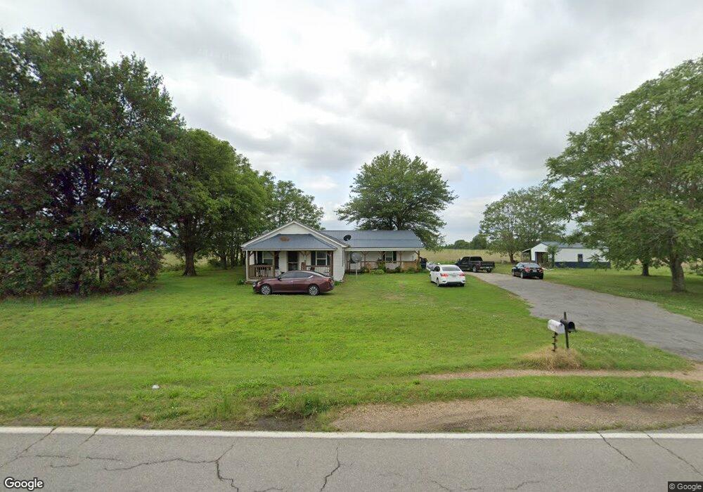
2145 W State Highway 164 Steele, MO 63877
Estimated Value: $112,777 - $154,000
3
Beds
--
Bath
2,228
Sq Ft
$62/Sq Ft
Est. Value
About This Home
This home is located at 2145 W State Highway 164, Steele, MO 63877 and is currently estimated at $137,444, approximately $61 per square foot. 2145 W State Highway 164 is a home with nearby schools including Central Elementary School and South Pemiscot High School.
Ownership History
Date
Name
Owned For
Owner Type
Purchase Details
Closed on
Sep 24, 2021
Sold by
Smith James and Smith Tracy M
Bought by
Smith Matthew and Smith Hannah
Current Estimated Value
Home Financials for this Owner
Home Financials are based on the most recent Mortgage that was taken out on this home.
Original Mortgage
$115,000
Outstanding Balance
$104,869
Interest Rate
2.8%
Mortgage Type
VA
Estimated Equity
$32,575
Purchase Details
Closed on
Feb 28, 2018
Sold by
Kennedy Blaine L and Kennedy Kami J
Bought by
Smith Matthew and Smith Hannah
Home Financials for this Owner
Home Financials are based on the most recent Mortgage that was taken out on this home.
Original Mortgage
$89,100
Interest Rate
4.04%
Mortgage Type
Commercial
Create a Home Valuation Report for This Property
The Home Valuation Report is an in-depth analysis detailing your home's value as well as a comparison with similar homes in the area
Home Values in the Area
Average Home Value in this Area
Purchase History
| Date | Buyer | Sale Price | Title Company |
|---|---|---|---|
| Smith Matthew | -- | Terry Abstract Company | |
| Covington David | -- | Terry Abstract Company | |
| Smith Matthew | -- | None Available |
Source: Public Records
Mortgage History
| Date | Status | Borrower | Loan Amount |
|---|---|---|---|
| Open | Covington David | $115,000 | |
| Previous Owner | Smith Matthew | $89,100 |
Source: Public Records
Tax History Compared to Growth
Tax History
| Year | Tax Paid | Tax Assessment Tax Assessment Total Assessment is a certain percentage of the fair market value that is determined by local assessors to be the total taxable value of land and additions on the property. | Land | Improvement |
|---|---|---|---|---|
| 2024 | $780 | $13,450 | $0 | $0 |
| 2023 | $776 | $13,450 | $0 | $0 |
| 2022 | $741 | $12,880 | $0 | $0 |
| 2021 | $757 | $12,880 | $0 | $0 |
| 2020 | $757 | $12,880 | $0 | $0 |
| 2019 | $707 | $12,880 | $0 | $0 |
| 2018 | $701 | $12,880 | $0 | $0 |
| 2017 | $705 | $12,880 | $0 | $0 |
| 2016 | -- | $12,880 | $0 | $0 |
| 2015 | -- | $12,880 | $0 | $0 |
| 2013 | -- | $12,920 | $0 | $0 |
Source: Public Records
Map
Nearby Homes
- 0 County Road 488
- 317 Main St
- 312 Missouri St
- 8835 County Road 719
- 453 State 164 Hwy E
- 0 County Road 709
- O Brock St
- 3337 E County Road 70
- 0 County Road 421
- 132 S Gosnell St
- 804 Golf Links Dr
- 657 Moody St
- 322 Perry St
- 323 Perry St
- 555 Clement Ln
- 463 Crestmont Cir
- 102 Gayle Rd
- 10 acres Bevill St
- 10 Bevill St
- 0 E County Road 2 Unit MAR24043003
- 2043 W State Highway 164
- 2450 County Highway 454
- 5381 State Highway C
- 263 County Highway 466
- 5363 State Highway C
- 119 State Highway F
- 195 State Highway F
- 1730 County Highway 472
- 1704 County Highway 472
- 406 County Road 466
- 5274 State Highway C
- 1484 W State Highway 164
- 318 State Highway F
- 1733 W State Highway 164
- 132 County Highway 466
- 1707 W State Highway 164
- 1474 County Highway 461
- 1688 W State Highway 164
- 1502 County Highway 461
- 1498 County Highway 461