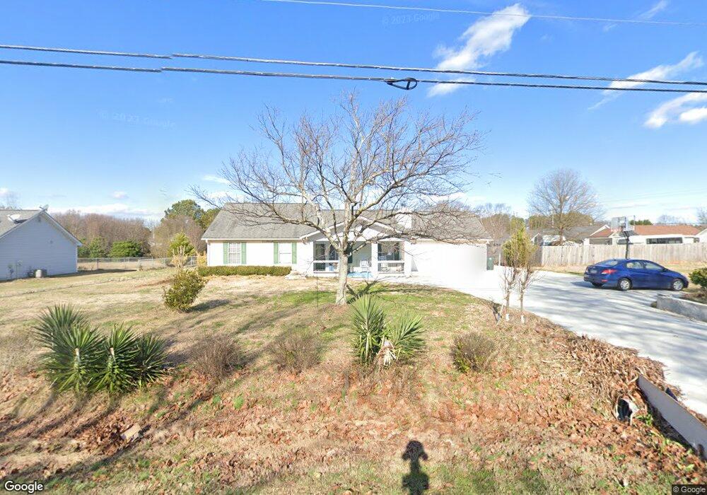
2146 Broad St Unit 1 Statham, GA 30666
Estimated Value: $268,000 - $284,000
--
Bed
2
Baths
1,242
Sq Ft
$224/Sq Ft
Est. Value
About This Home
This home is located at 2146 Broad St Unit 1, Statham, GA 30666 and is currently estimated at $278,258, approximately $224 per square foot. 2146 Broad St Unit 1 is a home located in Barrow County with nearby schools including Statham Elementary School, Bear Creek Middle School, and Winder-Barrow High School.
Ownership History
Date
Name
Owned For
Owner Type
Purchase Details
Closed on
Jul 5, 2007
Sold by
Turk Robin C
Bought by
Cleveland Dalerie
Current Estimated Value
Home Financials for this Owner
Home Financials are based on the most recent Mortgage that was taken out on this home.
Original Mortgage
$109,200
Outstanding Balance
$67,717
Interest Rate
6.35%
Mortgage Type
New Conventional
Estimated Equity
$210,541
Create a Home Valuation Report for This Property
The Home Valuation Report is an in-depth analysis detailing your home's value as well as a comparison with similar homes in the area
Home Values in the Area
Average Home Value in this Area
Purchase History
| Date | Buyer | Sale Price | Title Company |
|---|---|---|---|
| Cleveland Dalerie | $110,000 | -- |
Source: Public Records
Mortgage History
| Date | Status | Borrower | Loan Amount |
|---|---|---|---|
| Open | Cleveland Dalerie | $109,200 |
Source: Public Records
Tax History Compared to Growth
Tax History
| Year | Tax Paid | Tax Assessment Tax Assessment Total Assessment is a certain percentage of the fair market value that is determined by local assessors to be the total taxable value of land and additions on the property. | Land | Improvement |
|---|---|---|---|---|
| 2024 | $1,838 | $65,047 | $12,000 | $53,047 |
| 2023 | $1,141 | $65,047 | $12,000 | $53,047 |
| 2022 | $1,444 | $52,434 | $12,000 | $40,434 |
| 2021 | $1,541 | $52,434 | $12,000 | $40,434 |
| 2020 | $1,546 | $52,434 | $12,000 | $40,434 |
| 2019 | $1,308 | $44,360 | $10,000 | $34,360 |
| 2018 | $1,200 | $41,237 | $10,000 | $31,237 |
| 2017 | $1,283 | $36,758 | $10,000 | $26,758 |
| 2016 | $1,047 | $37,098 | $10,000 | $27,098 |
| 2015 | $1,069 | $37,756 | $10,000 | $27,756 |
| 2014 | $834 | $31,859 | $4,900 | $26,959 |
| 2013 | -- | $30,622 | $4,900 | $25,722 |
Source: Public Records
Map
Nearby Homes
- 67 Defilippe Dr
- 97 Defilippe Dr
- 129 Purackal Ln
- 341 Graham Campbell Ln
- 619 Graham Campbell Ln
- 1880 Oakley Trail
- 2641 Oakley Trail
- 2661 Oakley Trail
- 2540 Oakley Trail
- 2671 Oakley Trail
- 2665 Oakley Trail
- 564 Peters St
- 227 Dove Field Dr Unit 84
- 2054 Jana Ln
- 247 Dove Field Dr Unit 83
- 267 Dove Field Dr Unit 82
- 287 Dove Field Dr
- 287 Dove Field Dr Unit 81
- 305 Dove Field Dr Unit 80
- 139 Goldshore Way
- 2138 Broad St Unit 1
- 515 Hammond Rd
- 507 Hammond Rd
- 2136 Broad St Unit 1
- 499 Hammond Rd
- 2132 Broad St
- 2155 Broad St
- 491 Hammond Rd
- 514 Hammond Rd Unit 1
- 485 Hammond Rd Unit 1
- 2128 Broad St Unit 1
- 508 Hammond Rd Unit 1
- 2125 Broad St
- 2181 Jackson Dr Unit 1
- 2006 Rachael Dr Unit 2
- 2008 Rachael Dr
- 481 Hammond Rd
- 481 Hammond Rd Unit 1
- 494 Hammond Rd
- 2124 Broad St