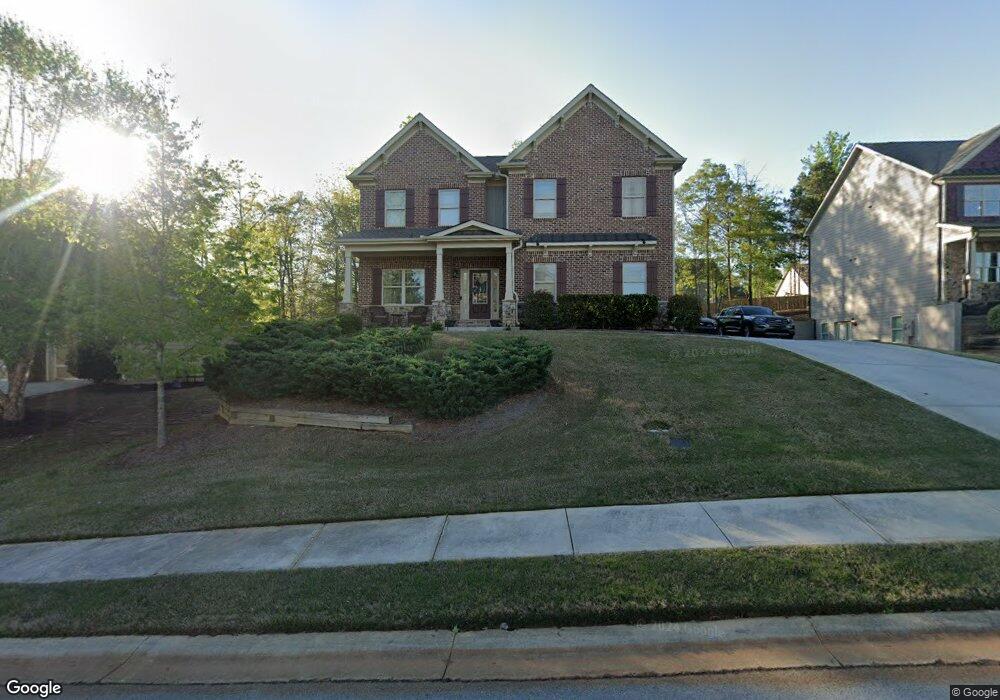
2147 Independence Ln Buford, GA 30519
Estimated Value: $559,000 - $663,000
4
Beds
4
Baths
2,402
Sq Ft
$248/Sq Ft
Est. Value
About This Home
This home is located at 2147 Independence Ln, Buford, GA 30519 and is currently estimated at $596,235, approximately $248 per square foot. 2147 Independence Ln is a home with nearby schools including Friendship Elementary School, Cherokee Bluff Middle School, and Cherokee Bluff High School.
Ownership History
Date
Name
Owned For
Owner Type
Purchase Details
Closed on
Sep 19, 2014
Sold by
Premier Homebuilders Inc
Bought by
Morton Richard Dale and Morton Shawn Mccanless
Current Estimated Value
Home Financials for this Owner
Home Financials are based on the most recent Mortgage that was taken out on this home.
Original Mortgage
$263,264
Outstanding Balance
$201,620
Interest Rate
4.15%
Mortgage Type
New Conventional
Estimated Equity
$394,615
Purchase Details
Closed on
Mar 12, 2013
Sold by
Gwinnett Community Bank
Bought by
Premier Homebuilders Inc
Home Financials for this Owner
Home Financials are based on the most recent Mortgage that was taken out on this home.
Original Mortgage
$259,000
Interest Rate
3.57%
Mortgage Type
New Conventional
Purchase Details
Closed on
Nov 3, 2009
Sold by
Greenwood Builder Group Inc
Bought by
Gwinnett Cmnty Bk
Purchase Details
Closed on
Feb 6, 2006
Sold by
Chateau Corners Development Corp
Bought by
Embry Custom Homes Llc
Create a Home Valuation Report for This Property
The Home Valuation Report is an in-depth analysis detailing your home's value as well as a comparison with similar homes in the area
Home Values in the Area
Average Home Value in this Area
Purchase History
| Date | Buyer | Sale Price | Title Company |
|---|---|---|---|
| Morton Richard Dale | $306,900 | -- | |
| Premier Homebuilders Inc | $296,000 | -- | |
| Gwinnett Cmnty Bk | $156,551 | -- | |
| Embry Custom Homes Llc | $2,085,000 | -- |
Source: Public Records
Mortgage History
| Date | Status | Borrower | Loan Amount |
|---|---|---|---|
| Open | Morton Richard Dale | $263,264 | |
| Previous Owner | Premier Homebuilders Inc | $259,000 |
Source: Public Records
Tax History Compared to Growth
Tax History
| Year | Tax Paid | Tax Assessment Tax Assessment Total Assessment is a certain percentage of the fair market value that is determined by local assessors to be the total taxable value of land and additions on the property. | Land | Improvement |
|---|---|---|---|---|
| 2024 | $5,518 | $221,800 | $39,400 | $182,400 |
| 2023 | $4,338 | $191,400 | $29,200 | $162,200 |
| 2022 | $4,481 | $173,320 | $27,600 | $145,720 |
| 2021 | $3,859 | $146,840 | $17,000 | $129,840 |
| 2020 | $3,888 | $143,800 | $17,000 | $126,800 |
| 2019 | $3,671 | $134,720 | $16,000 | $118,720 |
| 2018 | $3,768 | $133,880 | $16,000 | $117,880 |
| 2017 | $3,587 | $124,520 | $12,000 | $112,520 |
| 2016 | $3,052 | $108,720 | $12,000 | $96,720 |
| 2015 | $346 | $108,720 | $12,000 | $96,720 |
| 2014 | $346 | $12,000 | $12,000 | $0 |
Source: Public Records
Map
Nearby Homes
- 2228 Mayors Way
- 7235 Coral Lake Dr
- 7272 Coral Lake Dr
- 2638 Democracy Dr Unit 1
- 7464 Williams Rd
- 7343 Peacebrook Dr
- 7207 Spout Springs Rd
- Sierra Plan at Sherwood Square
- Sawnee Plan at Sherwood Square
- 7289 Mulberry Trace Ln Unit LOT 178
- 7296 Mulberry Trace Ln Unit LOT 180
- 7296 Mulberry Trace Ln
- 7300 Mulberry Trace Ln
- 7300 Mulberry Trace Ln Unit LOT 181
- 7304 Mulberry Trace Ln Unit LOT 182
- 7304 Mulberry Trace Ln
- 7308 Mulberry Trace Ln Unit LOT 183
- 7308 Mulberry Trace Ln
- 7312 Mulberry Trace Ln Unit LOT 184
- 7312 Mulberry Trace Ln
- 2143 Independence Ln Unit 189
- 2143 Independence Ln
- 2205 Independence Ln
- 2139 Independence Ln
- 2152 Independence Ln
- 2209 Independence Ln
- 2065 Democracy Dr
- 2061 Democracy Dr Unit 175
- 2061 Democracy Dr
- 2069 Democracy Dr
- 2148 Independence Ln
- 2204 Independence Ln
- 2208 Mayors Way
- 2057 Democracy Dr Unit 150
- 2057 Democracy Dr
- 2135 Independence Ln
- 2073 Democracy Dr
- 2148 Lot #215 Independence
- 2214 Independence Ln
- 2144 Independence Ln