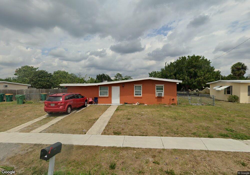
21472 Mallory Ave Port Charlotte, FL 33952
Estimated Value: $163,069 - $190,000
2
Beds
1
Bath
882
Sq Ft
$194/Sq Ft
Est. Value
About This Home
This home is located at 21472 Mallory Ave, Port Charlotte, FL 33952 and is currently estimated at $171,267, approximately $194 per square foot. 21472 Mallory Ave is a home located in Charlotte County with nearby schools including Peace River Elementary School, Port Charlotte Middle School, and Charlotte High School.
Ownership History
Date
Name
Owned For
Owner Type
Purchase Details
Closed on
Jul 7, 2017
Sold by
Bournival Charles E and Bournival Pamela J
Bought by
Olson Heather and Gratitude Trust
Current Estimated Value
Purchase Details
Closed on
Jun 1, 2017
Bought by
Olson Heather Trustee
Purchase Details
Closed on
May 12, 2008
Sold by
Shantel Holdings Inc
Bought by
Bournival Charles E and Bournival Pamela J
Purchase Details
Closed on
Jan 31, 2006
Sold by
Heyder Laverne A and Fitzpatrick Robert M
Bought by
Shantel Holdings Inc and 21472 Mallory Ave Land Trust
Home Financials for this Owner
Home Financials are based on the most recent Mortgage that was taken out on this home.
Original Mortgage
$80,000
Interest Rate
10%
Mortgage Type
Purchase Money Mortgage
Purchase Details
Closed on
Nov 10, 2004
Sold by
Fitzpatrick Robert M
Bought by
Fitzpatrick Robert M and Heyder Laverne A
Create a Home Valuation Report for This Property
The Home Valuation Report is an in-depth analysis detailing your home's value as well as a comparison with similar homes in the area
Home Values in the Area
Average Home Value in this Area
Purchase History
| Date | Buyer | Sale Price | Title Company |
|---|---|---|---|
| Olson Heather | -- | Attorney | |
| Olson Heather Trustee | $100 | -- | |
| Bournival Charles E | $80,000 | None Available | |
| Shantel Holdings Inc | $75,000 | Executive Title Ins Svcs Inc | |
| Fitzpatrick Robert M | -- | -- |
Source: Public Records
Mortgage History
| Date | Status | Borrower | Loan Amount |
|---|---|---|---|
| Previous Owner | Shantel Holdings Inc | $80,000 |
Source: Public Records
Tax History Compared to Growth
Tax History
| Year | Tax Paid | Tax Assessment Tax Assessment Total Assessment is a certain percentage of the fair market value that is determined by local assessors to be the total taxable value of land and additions on the property. | Land | Improvement |
|---|---|---|---|---|
| 2023 | $2,316 | $67,702 | $0 | $0 |
| 2022 | $1,847 | $95,276 | $13,600 | $81,676 |
| 2021 | $1,554 | $54,497 | $5,950 | $48,547 |
| 2020 | $1,441 | $48,550 | $4,505 | $44,045 |
| 2019 | $1,367 | $47,331 | $5,015 | $42,316 |
| 2018 | $1,237 | $44,663 | $4,505 | $40,158 |
| 2017 | $1,107 | $37,658 | $3,953 | $33,705 |
| 2016 | $1,045 | $32,327 | $0 | $0 |
| 2015 | $1,005 | $29,318 | $0 | $0 |
| 2014 | $940 | $26,653 | $0 | $0 |
Source: Public Records
Map
Nearby Homes
- 21455 Mallory Ave
- 21456 Holdern Ave
- 21448 Kenyon Ave
- 21422 Mallory Ave
- 3124 Crestwood Dr
- 21536 Holdern Ave
- 3132 Crestwood Dr
- 3157 Crestwood Dr
- 3107 Easy St
- 3155 Key Ln
- 21405 Olean Blvd Unit 327
- 21405 Olean Blvd Unit 224
- 21405 Olean Blvd Unit 508
- 21405 Olean Blvd Unit 605
- 21405 Olean Blvd Unit 404
- 3100 Harbor Blvd Unit 106
- 3100 Harbor Blvd Unit 114
- 3100 Harbor Blvd Unit 315
- 3100 Harbor Blvd Unit 207
- 3100 Harbor Blvd Unit 113
- 21480 Mallory Ave
- 21464 Mallory Ave
- 21471 Kenyon Ave
- 21463 Kenyon Ave
- 21479 Kenyon Ave
- 21488 Mallory Ave
- 21456 Mallory Ave
- 21471 Mallory Ave
- 21479 Mallory Ave
- 21463 Mallory Ave
- 21455 Kenyon Ave
- 21487 Kenyon Ave
- 21496 Mallory Ave
- 21448 Mallory Ave
- 21447 Kenyon Ave
- 21495 Kenyon Ave
- 21472 Holdern Ave
- 21472 Kenyon Ave
- 21495 Mallory Ave
- 21480 Holdern Ave