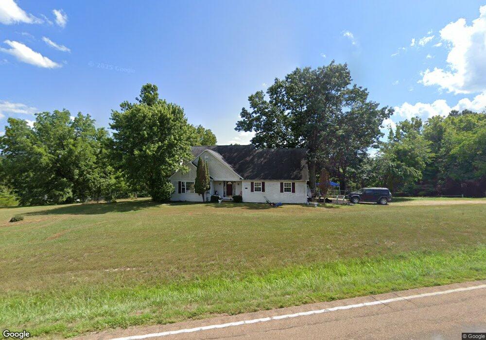
21475 Highway 17 Waynesville, MO 65583
Estimated Value: $271,000 - $304,000
3
Beds
3
Baths
2,448
Sq Ft
$120/Sq Ft
Est. Value
About This Home
This home is located at 21475 Highway 17, Waynesville, MO 65583 and is currently estimated at $293,430, approximately $119 per square foot. 21475 Highway 17 is a home located in Pulaski County with nearby schools including Waynesville East Elementary School, Freedom Elementary School, and Waynesville Sixth Grade Center.
Ownership History
Date
Name
Owned For
Owner Type
Purchase Details
Closed on
Mar 31, 2019
Sold by
Moniot Darren R and Moniot Moon
Bought by
Knight William B
Current Estimated Value
Home Financials for this Owner
Home Financials are based on the most recent Mortgage that was taken out on this home.
Original Mortgage
$157,990
Outstanding Balance
$120,343
Interest Rate
4.4%
Mortgage Type
VA
Estimated Equity
$173,087
Purchase Details
Closed on
Aug 25, 2005
Sold by
Lusk Robert L and Lusk Shannon M
Bought by
Miniot Darren R
Home Financials for this Owner
Home Financials are based on the most recent Mortgage that was taken out on this home.
Original Mortgage
$140,000
Interest Rate
5.81%
Mortgage Type
New Conventional
Create a Home Valuation Report for This Property
The Home Valuation Report is an in-depth analysis detailing your home's value as well as a comparison with similar homes in the area
Home Values in the Area
Average Home Value in this Area
Purchase History
| Date | Buyer | Sale Price | Title Company |
|---|---|---|---|
| Knight William B | -- | -- | |
| Miniot Darren R | -- | -- |
Source: Public Records
Mortgage History
| Date | Status | Borrower | Loan Amount |
|---|---|---|---|
| Open | Knight William B | $157,990 | |
| Previous Owner | Miniot Darren R | $140,000 |
Source: Public Records
Tax History Compared to Growth
Tax History
| Year | Tax Paid | Tax Assessment Tax Assessment Total Assessment is a certain percentage of the fair market value that is determined by local assessors to be the total taxable value of land and additions on the property. | Land | Improvement |
|---|---|---|---|---|
| 2024 | $1,217 | $27,979 | $3,800 | $24,179 |
| 2023 | $1,189 | $27,979 | $3,800 | $24,179 |
| 2022 | $1,097 | $27,979 | $3,800 | $24,179 |
| 2021 | $1,084 | $27,979 | $3,800 | $24,179 |
| 2020 | $1,064 | $27,569 | $0 | $0 |
| 2019 | $1,063 | $26,828 | $0 | $0 |
| 2018 | $1,063 | $26,828 | $0 | $0 |
| 2017 | $1,062 | $31,719 | $0 | $0 |
| 2016 | $1,008 | $26,830 | $0 | $0 |
| 2015 | $1,007 | $26,830 | $0 | $0 |
| 2014 | $1,007 | $26,830 | $0 | $0 |
Source: Public Records
Map
Nearby Homes
- 508 Shoshone Dr
- 48 LOT Breckenridge Dr
- 208 Teton Pass
- 176 Teton Pass
- 143 La Vista Dr
- 109 Paradise St
- 21805 Revere Ln
- 109 Summit Pass
- 105 Paradise St
- 141 La Vista Dr
- 125 La Vista Dr
- 000 Laduff Rd
- 21042 Larson Rd
- 1 Park View
- 22130 Rhyme Ln
- 205 Majestic
- 22197 Reliable Rd
- 19580 Lyle Ln
- 21438 Lancaster Ln
- 19958 Ladera Rd
- 21475 Missouri 17
- 21513 Highway 17
- 21451 Highway 17
- 21511 Highway 17
- 21513 Missouri 17
- 21347 Highway 17
- 21340 Highway 17
- 21525 Highway 17
- 21345 Highway 17
- 0 Pippin Road 128 Acres Unit 20012366
- 0 Pippin Road 128 Acres Unit 19046941
- 21200 Highway 17
- 21195 Highway 17
- 21361 Laduff Rd
- 21180 Highway 17
- 21355 Reporter Rd
- 408 Breckenridge Dr
- 20890 Lexington Rd
- 21170 Highway 17
- 29 Wind River Range