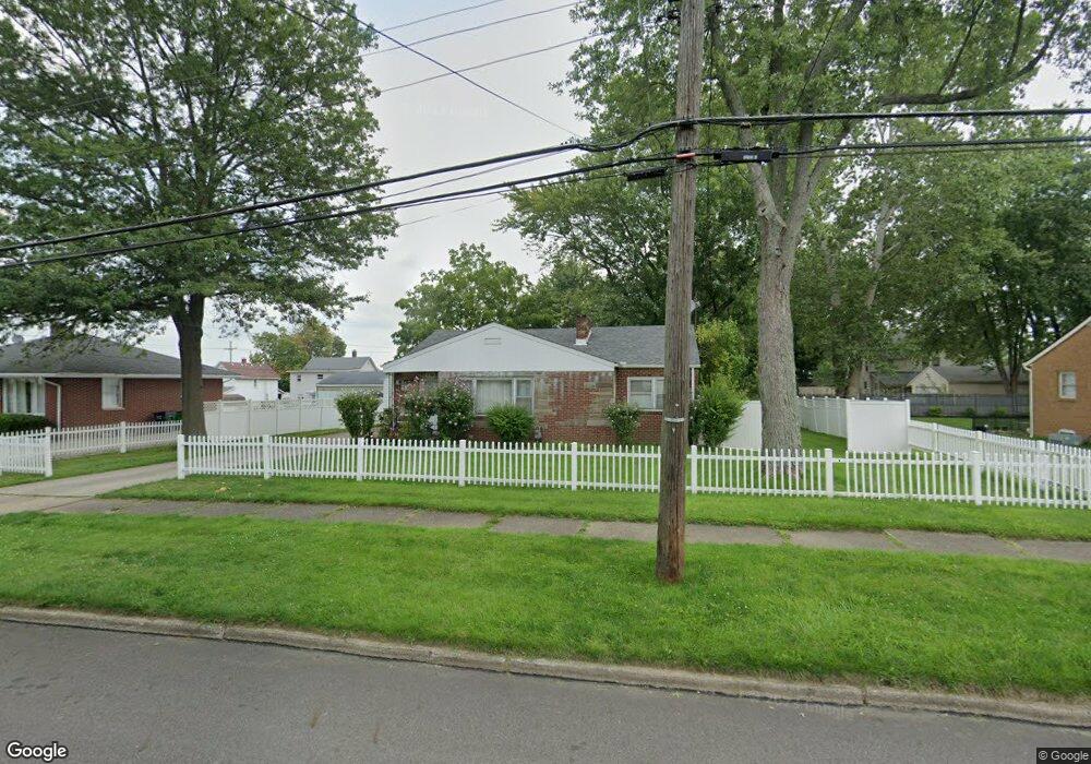
2148 Clark Ave Alliance, OH 44601
Estimated Value: $130,000 - $170,000
3
Beds
2
Baths
1,029
Sq Ft
$143/Sq Ft
Est. Value
About This Home
This home is located at 2148 Clark Ave, Alliance, OH 44601 and is currently estimated at $147,570, approximately $143 per square foot. 2148 Clark Ave is a home located in Stark County with nearby schools including Alliance Elementary School at Rockhill, Alliance Intermediate School at Northside, and Alliance Middle School.
Ownership History
Date
Name
Owned For
Owner Type
Purchase Details
Closed on
Jul 25, 2008
Sold by
Vasu Gheorghe and Vasu Eugenia
Bought by
Ace & G Rentals Ltd
Current Estimated Value
Purchase Details
Closed on
Mar 10, 2008
Sold by
The Huntington National Bank
Bought by
Vasu Gheorghe
Home Financials for this Owner
Home Financials are based on the most recent Mortgage that was taken out on this home.
Original Mortgage
$56,000
Interest Rate
5.51%
Mortgage Type
Purchase Money Mortgage
Create a Home Valuation Report for This Property
The Home Valuation Report is an in-depth analysis detailing your home's value as well as a comparison with similar homes in the area
Home Values in the Area
Average Home Value in this Area
Purchase History
| Date | Buyer | Sale Price | Title Company |
|---|---|---|---|
| Ace & G Rentals Ltd | -- | Attorney | |
| Vasu Gheorghe | $70,000 | Heritage Union Title Co Ltd |
Source: Public Records
Mortgage History
| Date | Status | Borrower | Loan Amount |
|---|---|---|---|
| Previous Owner | Vasu Gheorghe | $56,000 |
Source: Public Records
Tax History Compared to Growth
Tax History
| Year | Tax Paid | Tax Assessment Tax Assessment Total Assessment is a certain percentage of the fair market value that is determined by local assessors to be the total taxable value of land and additions on the property. | Land | Improvement |
|---|---|---|---|---|
| 2025 | -- | $31,890 | $10,990 | $20,900 |
| 2024 | -- | $31,890 | $10,990 | $20,900 |
| 2023 | $1,359 | $33,010 | $12,880 | $20,130 |
| 2022 | $684 | $33,010 | $12,880 | $20,130 |
| 2021 | $1,371 | $33,010 | $12,880 | $20,130 |
| 2020 | $1,276 | $28,700 | $11,200 | $17,500 |
| 2019 | $1,401 | $31,920 | $12,110 | $19,810 |
| 2018 | $1,407 | $31,920 | $12,110 | $19,810 |
| 2017 | $1,267 | $28,220 | $10,120 | $18,100 |
| 2016 | $1,288 | $28,470 | $10,120 | $18,350 |
| 2015 | $1,300 | $28,470 | $10,120 | $18,350 |
| 2014 | $1,115 | $23,250 | $8,260 | $14,990 |
| 2013 | $556 | $23,250 | $8,260 | $14,990 |
Source: Public Records
Map
Nearby Homes
- 112 E College St
- 317 E State St
- 236 E Milton St
- 2460 S Arch Ave
- 2408 S Linden Ave
- 884 W College Rd
- 2839 S Rockhill Ave
- 2218 S Freedom Ave
- 1515 S Rockhill Ave
- 390 E College St
- 1475 Chatauqua Ct
- 1846 S Freedom Ave
- 2376 S Seneca Ave
- 555 E Milton St
- 1437 S Linden Ave
- 3101 Ridgehill Ave
- 1059 Oakwood Dr
- 1321 Parkway Blvd
- 853 Fairway Dr
- 1136 Parkway Blvd
- 2136 Clark Ave
- 2208 Clark Ave
- 2145 Miller Ave
- 2122 Clark Ave
- 2131 Miller Ave
- 2205 Miller Ave
- 2220 Clark Ave
- 2189 Clark Ave
- 2117 Miller Ave
- 2155 Clark Ave
- 2104 Clark Ave
- 2221 Miller Ave
- 2205 Clark Ave
- 2105 Miller Ave
- 2230 Clark Ave
- 2101 Clark Ave
- 2233 Miller Ave
- 2144 Miller Ave
- 2219 Clark Ave
- 2229 Clark Ave