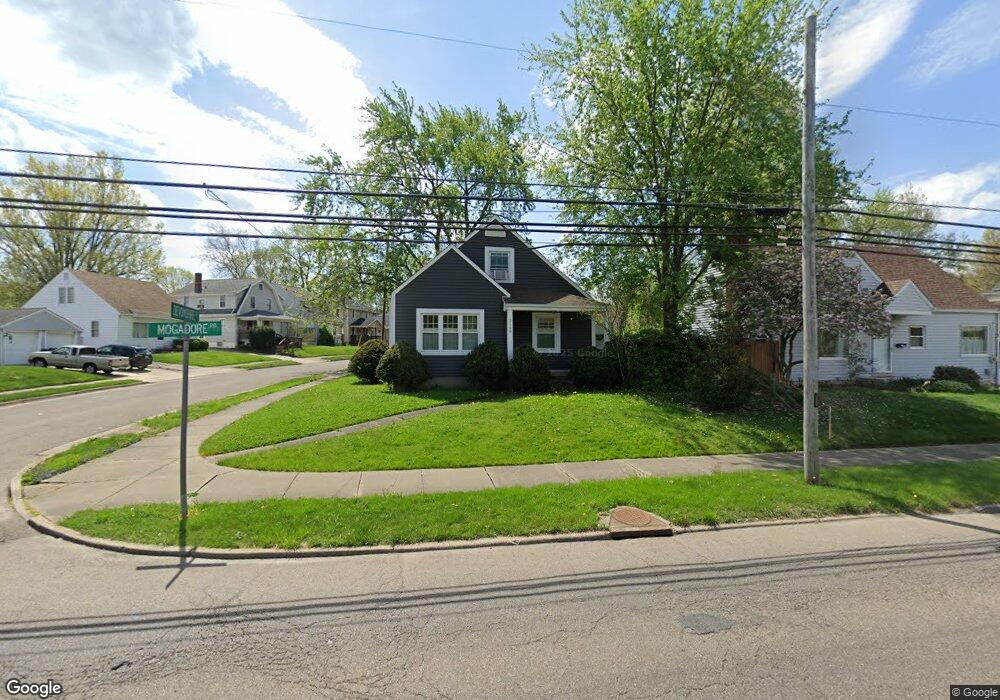
2148 Mogadore Rd Akron, OH 44312
Ellet NeighborhoodEstimated Value: $132,362 - $160,000
3
Beds
1
Bath
888
Sq Ft
$164/Sq Ft
Est. Value
About This Home
This home is located at 2148 Mogadore Rd, Akron, OH 44312 and is currently estimated at $145,841, approximately $164 per square foot. 2148 Mogadore Rd is a home located in Summit County with nearby schools including Ellet High School, Summit Academy Akron Elementary School, and Akron Preparatory school.
Ownership History
Date
Name
Owned For
Owner Type
Purchase Details
Closed on
Jun 21, 1999
Sold by
Alleshouse Darlene R and Andreetti Darlene R
Bought by
Gelsinger Pamela A
Current Estimated Value
Home Financials for this Owner
Home Financials are based on the most recent Mortgage that was taken out on this home.
Original Mortgage
$76,866
Outstanding Balance
$20,439
Interest Rate
7.15%
Mortgage Type
FHA
Estimated Equity
$125,402
Create a Home Valuation Report for This Property
The Home Valuation Report is an in-depth analysis detailing your home's value as well as a comparison with similar homes in the area
Home Values in the Area
Average Home Value in this Area
Purchase History
| Date | Buyer | Sale Price | Title Company |
|---|---|---|---|
| Gelsinger Pamela A | $77,500 | Endress/Lawyers Title |
Source: Public Records
Mortgage History
| Date | Status | Borrower | Loan Amount |
|---|---|---|---|
| Open | Gelsinger Pamela A | $76,866 |
Source: Public Records
Tax History Compared to Growth
Tax History
| Year | Tax Paid | Tax Assessment Tax Assessment Total Assessment is a certain percentage of the fair market value that is determined by local assessors to be the total taxable value of land and additions on the property. | Land | Improvement |
|---|---|---|---|---|
| 2025 | $1,956 | $33,786 | $7,319 | $26,467 |
| 2024 | $1,956 | $33,786 | $7,319 | $26,467 |
| 2023 | $1,956 | $33,786 | $7,319 | $26,467 |
| 2022 | $1,820 | $24,483 | $5,303 | $19,180 |
| 2021 | $1,822 | $24,483 | $5,303 | $19,180 |
| 2020 | $1,848 | $24,480 | $5,300 | $19,180 |
| 2019 | $1,999 | $24,380 | $5,050 | $19,330 |
| 2018 | $1,975 | $24,380 | $5,050 | $19,330 |
| 2017 | $1,673 | $24,380 | $5,050 | $19,330 |
| 2016 | $1,726 | $20,440 | $5,050 | $15,390 |
| 2015 | $1,673 | $20,440 | $5,050 | $15,390 |
| 2014 | $1,661 | $20,440 | $5,050 | $15,390 |
| 2013 | $1,762 | $22,370 | $5,050 | $17,320 |
Source: Public Records
Map
Nearby Homes
- 57 Carlton Dr
- 2258 Mogadore Rd
- 1955 Preston Ave Unit 1957
- 1947 Preston Ave Unit 1949
- 172 Emmons Ave
- 195 Prairie Dr
- 2382 Mogadore Rd
- 181 Hilbish Ave
- 159 Dellenberger Ave
- 1892 Malasia Rd
- 198 Hilbish Ave
- 333 Cluster Ave
- 2076 Congo St
- 249 Malacca St
- 404 Newell Ave
- 248 Malacca St
- 287 E Park Blvd
- 428 Seaman Ave
- 360 Cluster Ave
- 1874 Adelaide Blvd
- 2142 Mogadore Rd
- 2158 Mogadore Rd
- 22 Devonshire Dr
- 2162 Mogadore Rd
- 15 Devonshire Dr
- 2134 Mogadore Rd
- 19 Devonshire Dr
- 23 Devonshire Dr
- 2130 Mogadore Rd
- 13 Carlton Dr
- 32 Devonshire Dr
- 27 Devonshire Dr
- 2168 Mogadore Rd
- 17 Carlton Dr
- 36 Devonshire Dr
- 31 Devonshire Dr
- 21 Carlton Dr
- 33 Devonshire Dr
- 40 Devonshire Dr
- 10 Carlton Dr Unit 12