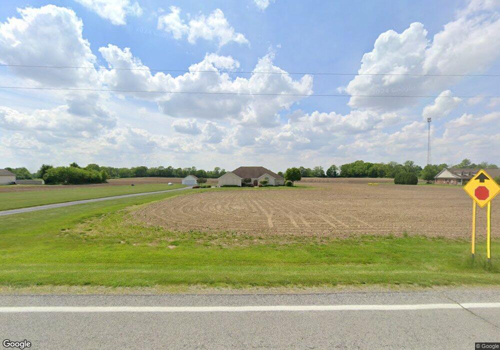
2148 N State Route 201 Casstown, OH 45312
Estimated Value: $476,000 - $643,000
3
Beds
3
Baths
2,364
Sq Ft
$237/Sq Ft
Est. Value
About This Home
This home is located at 2148 N State Route 201, Casstown, OH 45312 and is currently estimated at $561,397, approximately $237 per square foot. 2148 N State Route 201 is a home located in Miami County with nearby schools including Miami East Elementary School, Miami East Junior High School, and Miami East High School.
Ownership History
Date
Name
Owned For
Owner Type
Purchase Details
Closed on
Mar 1, 2005
Sold by
Schaefer Kenneth L and Schaefer Sandra E
Bought by
Bell Jesse L and Bell Ruby L
Current Estimated Value
Create a Home Valuation Report for This Property
The Home Valuation Report is an in-depth analysis detailing your home's value as well as a comparison with similar homes in the area
Home Values in the Area
Average Home Value in this Area
Purchase History
| Date | Buyer | Sale Price | Title Company |
|---|---|---|---|
| Bell Jesse L | $72,000 | -- |
Source: Public Records
Tax History Compared to Growth
Tax History
| Year | Tax Paid | Tax Assessment Tax Assessment Total Assessment is a certain percentage of the fair market value that is determined by local assessors to be the total taxable value of land and additions on the property. | Land | Improvement |
|---|---|---|---|---|
| 2024 | $3,515 | $113,590 | $15,030 | $98,560 |
| 2023 | $3,515 | $113,590 | $15,030 | $98,560 |
| 2022 | $3,646 | $113,590 | $15,030 | $98,560 |
| 2021 | $3,194 | $95,130 | $12,980 | $82,150 |
| 2020 | $3,210 | $95,130 | $12,980 | $82,150 |
| 2019 | $3,261 | $95,130 | $12,980 | $82,150 |
| 2018 | $3,048 | $86,630 | $15,650 | $70,980 |
| 2017 | $3,019 | $86,630 | $15,650 | $70,980 |
| 2016 | $2,836 | $86,630 | $15,650 | $70,980 |
| 2015 | $2,841 | $82,320 | $14,070 | $68,250 |
| 2014 | $2,841 | $82,320 | $14,070 | $68,250 |
| 2013 | $2,856 | $82,320 | $14,070 | $68,250 |
Source: Public Records
Map
Nearby Homes
- 211 N Grant St
- 5782 N Addison New Carlisle Rd
- 4845 E Troy Urbana Rd
- 107 N Main St
- 12 N Main St
- 910 S Alcony Conover Rd
- 910 S Alcony-Conover Rd
- 72 N Childrens Home Rd
- 10916 Ayres Pike
- 2386 Lefevre Rd
- 6380 State Route 589
- 1947 Woodcliffe Dr
- 6570 S Tipp Cowl Rd
- 7210 N Bollinger Rd
- 1760 Hunters Ridge Dr
- 7925 E South St
- 1500 Paradise Trail
- 1400 Troy Urbana Rd
- 1002 Stonyridge Ave
- 1329 Lee Rd
- 2232 N State Route 201
- 2088 S State Route 201
- 1990 N State Route 201
- 1950 N State Route 201
- 6738 E State Route 55
- 1800 N State Route 201
- 2435 Sodom Rd
- 7435 E State Route 55
- 5246 E St Rt 41
- 0 St Rt 589 Unit 581835
- 0 St Rt 589 Unit 565243
- 0 St Rt 589 Unit 351410
- 0 St Rt 589 Unit 369722
- 0 N Rugged Hill Unit 288970
- 0 N Rugged Hill Unit 344216
- 0 N Lstck Shelby Unit 413253
- 7503 E State Route 55
- 1450 N State Route 201
- 7539 E State Route 55
- 1445 N State Route 201