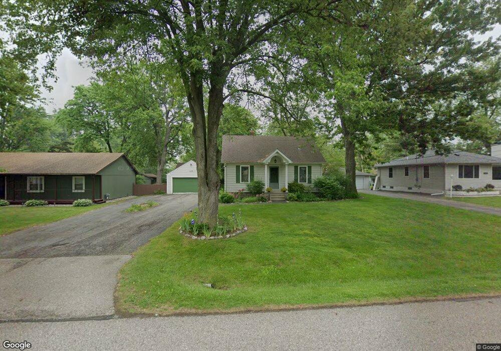
2148 Snellbrook Rd Auburn Hills, MI 48326
Estimated Value: $239,444 - $290,000
4
Beds
2
Baths
1,304
Sq Ft
$207/Sq Ft
Est. Value
About This Home
This home is located at 2148 Snellbrook Rd, Auburn Hills, MI 48326 and is currently estimated at $270,111, approximately $207 per square foot. 2148 Snellbrook Rd is a home located in Oakland County with nearby schools including Rogers Elementary, Pontiac Middle School, and Pontiac High School.
Ownership History
Date
Name
Owned For
Owner Type
Purchase Details
Closed on
Jan 16, 2018
Sold by
Knox Kerro
Bought by
Knox Kerro
Current Estimated Value
Purchase Details
Closed on
Jul 21, 2004
Sold by
Arnold Richard T
Bought by
Knox Kerro
Home Financials for this Owner
Home Financials are based on the most recent Mortgage that was taken out on this home.
Original Mortgage
$17,100
Interest Rate
6.34%
Mortgage Type
Unknown
Purchase Details
Closed on
Aug 29, 1995
Sold by
Pachuta Joseph A
Bought by
Pachuta Michael A
Create a Home Valuation Report for This Property
The Home Valuation Report is an in-depth analysis detailing your home's value as well as a comparison with similar homes in the area
Home Values in the Area
Average Home Value in this Area
Purchase History
| Date | Buyer | Sale Price | Title Company |
|---|---|---|---|
| Knox Kerro | -- | None Available | |
| Knox Kerro | $172,000 | Title One Inc | |
| Pachuta Michael A | -- | -- |
Source: Public Records
Mortgage History
| Date | Status | Borrower | Loan Amount |
|---|---|---|---|
| Closed | Knox Kerro | $17,100 | |
| Previous Owner | Knox Kerro | $137,600 |
Source: Public Records
Tax History Compared to Growth
Tax History
| Year | Tax Paid | Tax Assessment Tax Assessment Total Assessment is a certain percentage of the fair market value that is determined by local assessors to be the total taxable value of land and additions on the property. | Land | Improvement |
|---|---|---|---|---|
| 2024 | $1,087 | $91,210 | $0 | $0 |
| 2023 | $1,037 | $85,020 | $0 | $0 |
| 2022 | $1,830 | $75,450 | $0 | $0 |
| 2021 | $1,800 | $71,770 | $0 | $0 |
| 2020 | $976 | $68,030 | $0 | $0 |
| 2019 | $1,653 | $66,450 | $0 | $0 |
| 2018 | $1,617 | $64,120 | $0 | $0 |
| 2017 | $1,586 | $62,830 | $0 | $0 |
| 2016 | $1,575 | $59,220 | $0 | $0 |
| 2015 | -- | $53,210 | $0 | $0 |
| 2014 | -- | $48,710 | $0 | $0 |
| 2011 | -- | $47,540 | $0 | $0 |
Source: Public Records
Map
Nearby Homes
- 2375 Snellbrook Rd
- 2300 Richwood Rd
- 2400 Walnut Rd
- 2325 Walnut Rd
- 2526 Patrick Henry Rd
- 2274 Allerton Rd
- 3164 Bookham Cir
- 2085 Allerton Rd
- 3160 Bookham Cir
- 2464 Allerton Rd
- 2638 Patrick Henry Rd
- 2530 Patrick Henry St
- 3101 Elstead St
- 2641 Konrad Ct Unit 6
- 4444 Walton Blvd
- 3111 Ramzi Ln
- 2551 James Rd
- 3024 Carly Ct Unit 57
- 151 Cedar Isle Dr
- 3057 Bridgewater Rd
- 2136 Snellbrook Rd
- 2154 Snellbrook Rd
- 2160 Snellbrook Rd
- 2180 Snellbrook Rd
- 2189 Snellbrook Rd
- 2125 Snellbrook Rd
- 2155 Snellbrook Rd
- 2212 Snellbrook Rd
- 23751 Snellbrook Rd
- Lot 88 Snellbrook Rd
- 2201 Snellbrook Rd
- 2115 Snellbrook Rd
- 2213 Snellbrook Rd
- 2239 Snellbrook Rd
- 2244 Snellbrook Rd
- 2235 Joswick Rd
- 2265 Snellbrook Rd
- 2110 Dexter Rd
- 2180 Dexter Rd
- 2148 Dexter Rd