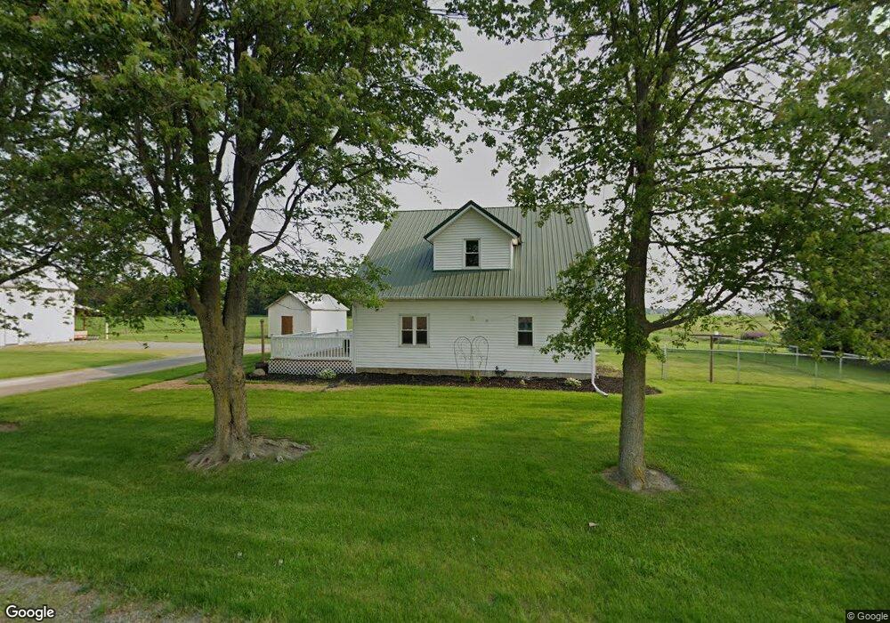
21483 Church Rd Delphos, OH 45833
Estimated Value: $162,243 - $198,000
--
Bed
2
Baths
1,092
Sq Ft
$163/Sq Ft
Est. Value
About This Home
This home is located at 21483 Church Rd, Delphos, OH 45833 and is currently estimated at $177,811, approximately $162 per square foot. 21483 Church Rd is a home located in Van Wert County with nearby schools including Lincolnview Elementary School and Lincolnview Junior/Senior High School.
Ownership History
Date
Name
Owned For
Owner Type
Purchase Details
Closed on
Nov 20, 2020
Sold by
Beair Thomas
Bought by
Beair Devin M
Current Estimated Value
Home Financials for this Owner
Home Financials are based on the most recent Mortgage that was taken out on this home.
Original Mortgage
$112,000
Outstanding Balance
$99,664
Interest Rate
2.8%
Mortgage Type
New Conventional
Estimated Equity
$78,147
Create a Home Valuation Report for This Property
The Home Valuation Report is an in-depth analysis detailing your home's value as well as a comparison with similar homes in the area
Home Values in the Area
Average Home Value in this Area
Purchase History
| Date | Buyer | Sale Price | Title Company |
|---|---|---|---|
| Beair Devin M | $122,000 | None Available |
Source: Public Records
Mortgage History
| Date | Status | Borrower | Loan Amount |
|---|---|---|---|
| Open | Beair Devin M | $112,000 |
Source: Public Records
Tax History Compared to Growth
Tax History
| Year | Tax Paid | Tax Assessment Tax Assessment Total Assessment is a certain percentage of the fair market value that is determined by local assessors to be the total taxable value of land and additions on the property. | Land | Improvement |
|---|---|---|---|---|
| 2024 | $1,116 | $35,370 | $7,280 | $28,090 |
| 2023 | $1,116 | $35,370 | $7,280 | $28,090 |
| 2022 | $1,152 | $26,820 | $5,600 | $21,220 |
| 2021 | $1,138 | $26,820 | $5,600 | $21,220 |
| 2020 | $773 | $23,400 | $5,600 | $17,800 |
| 2019 | $494 | $21,000 | $4,650 | $16,350 |
| 2018 | $486 | $21,000 | $4,650 | $16,350 |
| 2017 | $455 | $21,000 | $4,650 | $16,350 |
| 2016 | $413 | $20,950 | $4,410 | $16,540 |
| 2015 | $407 | $20,950 | $4,410 | $16,540 |
| 2014 | $422 | $20,950 | $4,410 | $16,540 |
| 2013 | $507 | $20,950 | $4,410 | $16,540 |
Source: Public Records
Map
Nearby Homes
- 8951 Brickner Rd
- 7510 State Route 66
- 0 Road 24-Q
- 320 Auglaize St
- 104 W Railroad St
- 112 W Railroad St
- 104 W South St
- TBD Dog Creek Rd
- 0 Heritage Cir Unit 6112034
- 0 Heritage Cir Unit 303239
- 604 W 6th St
- 616 W 5th St
- 503 W 6th St
- 409 N Bredeick St
- 11630 Clearview Dr
- 810 N Franklin St
- 610 N Washington St
- 704 N Franklin St
- 1303 Carolyn Dr
- 628 N Pierce St
- - Church
- 21452 Sterling Rd
- 6813 Converse Roselm Rd
- 21619 Sterling Rd
- 18981 Road 28
- 18887 Road 28
- 7264 Bockey Rd
- 6615 Converse Roselm Rd
- 21530 Rousch Rd
- 21224 Rousch Rd
- 21109 Sterling Rd
- 21892 Sterling Rd
- 7443 Converse Roselm Rd
- 7386 Converse Roselm Rd
- 0 Bockey Rd
- 6408 Converse Roselm Rd
- 4730 Rd
- 18499 Road 28
- 20716 Church Rd
- 7537 Bockey Rd