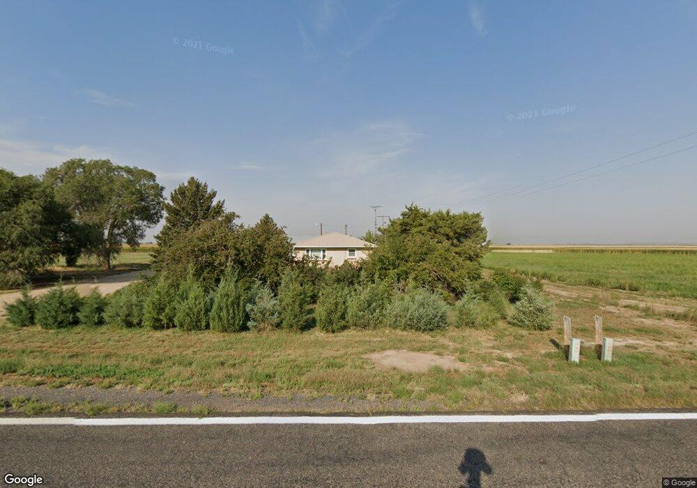
21485 Highway 39 Wiggins, CO 80654
Estimated Value: $473,000 - $553,000
3
Beds
2
Baths
2,752
Sq Ft
$183/Sq Ft
Est. Value
About This Home
This home is located at 21485 Highway 39, Wiggins, CO 80654 and is currently estimated at $503,645, approximately $183 per square foot. 21485 Highway 39 is a home located in Morgan County with nearby schools including Wiggins Elementary School, Wiggins Middle School, and Wiggins High School.
Ownership History
Date
Name
Owned For
Owner Type
Purchase Details
Closed on
Mar 25, 2022
Sold by
Jorisch Watson Deborah Gail
Bought by
Watson Family Trust
Current Estimated Value
Purchase Details
Closed on
Sep 19, 2007
Sold by
Shackleford Jessica and The Estate Of Kaye Musgrave
Bought by
Jorisch Deborah G
Home Financials for this Owner
Home Financials are based on the most recent Mortgage that was taken out on this home.
Original Mortgage
$205,000
Interest Rate
6.63%
Mortgage Type
Credit Line Revolving
Create a Home Valuation Report for This Property
The Home Valuation Report is an in-depth analysis detailing your home's value as well as a comparison with similar homes in the area
Home Values in the Area
Average Home Value in this Area
Purchase History
| Date | Buyer | Sale Price | Title Company |
|---|---|---|---|
| Watson Family Trust | -- | None Listed On Document | |
| Jorisch Deborah G | $210,000 | None Available |
Source: Public Records
Mortgage History
| Date | Status | Borrower | Loan Amount |
|---|---|---|---|
| Previous Owner | Jorisch Deborah G | $205,000 |
Source: Public Records
Tax History Compared to Growth
Tax History
| Year | Tax Paid | Tax Assessment Tax Assessment Total Assessment is a certain percentage of the fair market value that is determined by local assessors to be the total taxable value of land and additions on the property. | Land | Improvement |
|---|---|---|---|---|
| 2024 | $1,714 | $28,710 | $5,720 | $22,990 |
| 2023 | $1,714 | $32,390 | $6,450 | $25,940 |
| 2022 | $1,354 | $23,840 | $5,100 | $18,740 |
| 2021 | $1,408 | $24,520 | $5,240 | $19,280 |
| 2020 | $1,187 | $22,690 | $3,540 | $19,150 |
| 2019 | $1,814 | $22,690 | $3,540 | $19,150 |
| 2018 | $1,519 | $18,200 | $3,560 | $14,640 |
| 2017 | $1,462 | $18,200 | $3,560 | $14,640 |
| 2016 | $1,384 | $17,530 | $3,450 | $14,080 |
| 2015 | $1,243 | $17,530 | $3,450 | $14,080 |
| 2014 | $1,147 | $15,630 | $3,260 | $12,370 |
| 2013 | -- | $15,630 | $3,260 | $12,370 |
Source: Public Records
Map
Nearby Homes
- 0
- 0
- 0 Parcel 4 County Road 4
- 4763 Highway 144
- 1856 Highway 144
- 22872 Washington Ave
- 22831 Grand Ave
- 4295 County Road Z 5
- 152 Indian Way
- 213 Kiowa Rd
- 160 Kiowa Rd
- parcel 6 State Highway 52
- Parcel 10 State Highway 52
- parcel 7 State Highway 52
- 809 Warren St
- 118 Dickson St
- 402 2nd Ave
- 717 3rd Ave
- 419 E 3rd Ave
- 205 W Corona Ave