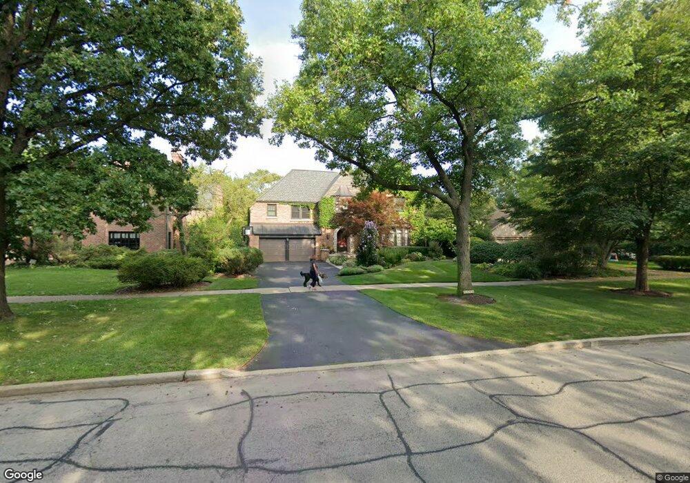
2149 Central Park Ave Evanston, IL 60201
North Evanston NeighborhoodEstimated Value: $1,495,000 - $1,764,000
5
Beds
5
Baths
3,632
Sq Ft
$444/Sq Ft
Est. Value
About This Home
This home is located at 2149 Central Park Ave, Evanston, IL 60201 and is currently estimated at $1,611,480, approximately $443 per square foot. 2149 Central Park Ave is a home located in Cook County with nearby schools including Lincolnwood Elementary School, Haven Middle School, and Evanston Township High School.
Ownership History
Date
Name
Owned For
Owner Type
Purchase Details
Closed on
Mar 21, 2005
Sold by
Levinson Sophie S
Bought by
Harvey Mark and Harvey Linda
Current Estimated Value
Purchase Details
Closed on
Feb 1, 2004
Sold by
Levinson Monte J
Bought by
Declaration Levinson Sophie S and Sophie S Levinson Declaration Of Trust
Purchase Details
Closed on
Dec 6, 1994
Sold by
Levinson Monte J and Levinson Sophie S
Bought by
Levinson Monte J and Levinson Sophie S
Create a Home Valuation Report for This Property
The Home Valuation Report is an in-depth analysis detailing your home's value as well as a comparison with similar homes in the area
Home Values in the Area
Average Home Value in this Area
Purchase History
| Date | Buyer | Sale Price | Title Company |
|---|---|---|---|
| Harvey Mark | -- | -- | |
| Declaration Levinson Sophie S | -- | -- | |
| Levinson Monte J | -- | -- |
Source: Public Records
Tax History Compared to Growth
Tax History
| Year | Tax Paid | Tax Assessment Tax Assessment Total Assessment is a certain percentage of the fair market value that is determined by local assessors to be the total taxable value of land and additions on the property. | Land | Improvement |
|---|---|---|---|---|
| 2024 | $24,413 | $104,160 | $25,200 | $78,960 |
| 2023 | $24,506 | $104,160 | $25,200 | $78,960 |
| 2022 | $24,506 | $108,918 | $25,200 | $83,718 |
| 2021 | $23,426 | $91,606 | $15,225 | $76,381 |
| 2020 | $23,174 | $91,606 | $15,225 | $76,381 |
| 2019 | $23,579 | $104,064 | $15,225 | $88,839 |
| 2018 | $18,004 | $69,150 | $12,600 | $56,550 |
| 2017 | $18,597 | $73,073 | $12,600 | $60,473 |
| 2016 | $18,550 | $75,797 | $12,600 | $63,197 |
| 2015 | $19,865 | $76,711 | $10,500 | $66,211 |
| 2014 | $19,691 | $76,711 | $10,500 | $66,211 |
| 2013 | $19,222 | $76,711 | $10,500 | $66,211 |
Source: Public Records
Map
Nearby Homes
- 2221 Lincolnwood Dr
- 2113 Forestview Rd
- 2951 Colfax St
- 2422 Grant St
- 2022 Mcdaniel Ave
- 2440 Simpson St
- 2518 Ridgeway Ave
- 2633 Crawford Ave
- 2730 Central St Unit 3A
- 2726 Central St Unit 3D
- 2720 Central St Unit 4C
- 3500 Church St Unit 204
- 3131 Central St
- 9833 Keystone Ave
- 9628 Keystone Ave
- 2101 Pioneer Rd
- 2501 Crawford Ave
- 3233 Central St
- 2555 Gross Point Rd Unit 112
- 1808 Laurel Ave
- 2153 Central Park Ave
- 2963 Payne St
- 2949 Payne St
- 2205 Central Park Ave
- 2209 Central Park Ave
- 2129 Central Park Ave
- 2146 Central Park Ave
- 2150 Central Park Ave
- 2140 Central Park Ave
- 2148 Lincolnwood Dr
- 2150 Lincolnwood Dr
- 2202 Central Park Ave
- 2144 Lincolnwood Dr
- 2200 Lincolnwood Dr
- 2215 Central Park Ave
- 2140 Lincolnwood Dr
- 2202 Lincolnwood Dr
- 2123 Central Park Ave
- 2206 Lincolnwood Dr
- 3004 Normandy Place