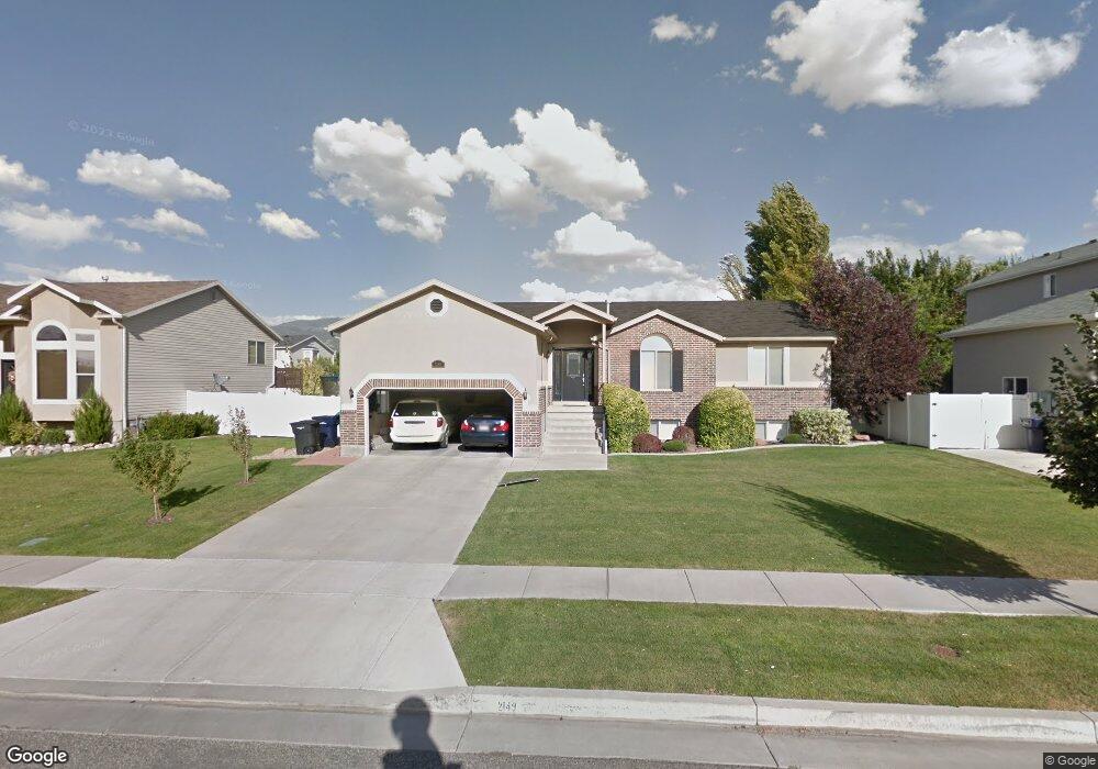
2149 S 1450 W Woods Cross, UT 84087
Estimated Value: $544,348 - $562,000
3
Beds
2
Baths
1,598
Sq Ft
$346/Sq Ft
Est. Value
About This Home
This home is located at 2149 S 1450 W, Woods Cross, UT 84087 and is currently estimated at $553,087, approximately $346 per square foot. 2149 S 1450 W is a home located in Davis County with nearby schools including Odyssey School, South Davis Junior High School, and Woods Cross High School.
Ownership History
Date
Name
Owned For
Owner Type
Purchase Details
Closed on
Apr 26, 2025
Sold by
Preston Jamie Michelle and Preston Michael Willard
Bought by
Preston Family Living Trust and Preston
Current Estimated Value
Purchase Details
Closed on
Nov 29, 2005
Sold by
Preston Michael
Bought by
Preston Michael and Preston Jamie
Home Financials for this Owner
Home Financials are based on the most recent Mortgage that was taken out on this home.
Original Mortgage
$158,692
Interest Rate
6.07%
Mortgage Type
Fannie Mae Freddie Mac
Purchase Details
Closed on
Aug 23, 2004
Sold by
Cloverdale Development Llc
Bought by
Reliance Homes Inc
Home Financials for this Owner
Home Financials are based on the most recent Mortgage that was taken out on this home.
Original Mortgage
$1,762,800
Interest Rate
5.95%
Mortgage Type
Seller Take Back
Create a Home Valuation Report for This Property
The Home Valuation Report is an in-depth analysis detailing your home's value as well as a comparison with similar homes in the area
Home Values in the Area
Average Home Value in this Area
Purchase History
| Date | Buyer | Sale Price | Title Company |
|---|---|---|---|
| Preston Family Living Trust | -- | None Listed On Document | |
| Preston Family Living Trust | -- | None Listed On Document | |
| Preston Michael | -- | Title One Inc | |
| Preston Michael | -- | Title One Inc | |
| Reliance Homes Inc | -- | Us Title Of Utah |
Source: Public Records
Mortgage History
| Date | Status | Borrower | Loan Amount |
|---|---|---|---|
| Previous Owner | Preston Michael | $158,692 | |
| Previous Owner | Reliance Homes Inc | $1,762,800 |
Source: Public Records
Tax History Compared to Growth
Tax History
| Year | Tax Paid | Tax Assessment Tax Assessment Total Assessment is a certain percentage of the fair market value that is determined by local assessors to be the total taxable value of land and additions on the property. | Land | Improvement |
|---|---|---|---|---|
| 2025 | $3,226 | $282,700 | $111,695 | $171,005 |
| 2024 | $3,021 | $270,600 | $119,087 | $151,513 |
| 2023 | $2,864 | $477,000 | $157,761 | $319,239 |
| 2022 | $3,126 | $290,400 | $68,565 | $221,835 |
| 2021 | $2,775 | $410,000 | $100,609 | $309,391 |
| 2020 | $2,471 | $361,000 | $95,759 | $265,241 |
| 2019 | $2,444 | $351,000 | $89,365 | $261,635 |
| 2018 | $2,301 | $328,000 | $87,881 | $240,119 |
| 2016 | $1,867 | $144,870 | $37,474 | $107,396 |
| 2015 | $1,829 | $137,115 | $37,474 | $99,641 |
| 2014 | $1,920 | $148,280 | $37,474 | $110,806 |
| 2013 | -- | $126,789 | $27,193 | $99,596 |
Source: Public Records
Map
Nearby Homes
- 1384 W 2175 S
- 1984 S 1500 W
- 1998 S 1600 W
- 1255 W 2050 S
- 1846 W 2280 S
- 1422 W 1300 S
- 1334 W 1300 S
- 1309 W 1200 S
- 826 W Ivywell Ln Unit 219
- 828 W Ivywell Ln Unit 220
- 1153 N Meridian Ln Unit 120
- 1160 N Clifton Dr Unit 114
- 1156 N Clifton Dr Unit 115
- 1971 W 1870 S
- Kensington Plan at Clifton Place Townhomes
- Charleston Plan at Clifton Place Townhomes
- Camden Plan at Clifton Place Townhomes
- Somerset A Plan at Clifton Place Townhomes
- Somerset B Plan at Clifton Place Townhomes
- 2024 S 925 W