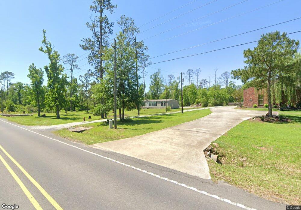
2149 Sutherland Rd Lake Charles, LA 70611
Estimated Value: $103,000 - $307,000
3
Beds
2
Baths
1,445
Sq Ft
$123/Sq Ft
Est. Value
About This Home
This home is located at 2149 Sutherland Rd, Lake Charles, LA 70611 and is currently estimated at $177,333, approximately $122 per square foot. 2149 Sutherland Rd is a home located in Calcasieu Parish with nearby schools including Graham & Parks Alternative Public School, Moss Bluff Elementary School, and Putnam Avenue Upper School.
Ownership History
Date
Name
Owned For
Owner Type
Purchase Details
Closed on
Mar 19, 2008
Sold by
Shreve Stanley Matthew and Shreve Debbie Marie
Bought by
Clanton Michael Wayne
Current Estimated Value
Home Financials for this Owner
Home Financials are based on the most recent Mortgage that was taken out on this home.
Original Mortgage
$141,780
Outstanding Balance
$88,232
Interest Rate
5.72%
Mortgage Type
Purchase Money Mortgage
Estimated Equity
$89,101
Purchase Details
Closed on
May 7, 2007
Sold by
Fontenot Carl James
Bought by
Shreve Stanley Matthew and Shreve Debbie Marie
Create a Home Valuation Report for This Property
The Home Valuation Report is an in-depth analysis detailing your home's value as well as a comparison with similar homes in the area
Home Values in the Area
Average Home Value in this Area
Purchase History
| Date | Buyer | Sale Price | Title Company |
|---|---|---|---|
| Clanton Michael Wayne | $139,000 | Elite Title Insurance Agency | |
| Shreve Stanley Matthew | $76,100 | None Available |
Source: Public Records
Mortgage History
| Date | Status | Borrower | Loan Amount |
|---|---|---|---|
| Open | Clanton Michael Wayne | $141,780 |
Source: Public Records
Tax History Compared to Growth
Tax History
| Year | Tax Paid | Tax Assessment Tax Assessment Total Assessment is a certain percentage of the fair market value that is determined by local assessors to be the total taxable value of land and additions on the property. | Land | Improvement |
|---|---|---|---|---|
| 2024 | $522 | $4,860 | $4,860 | $0 |
| 2023 | $522 | $14,140 | $4,860 | $9,280 |
| 2022 | $702 | $14,140 | $4,860 | $9,280 |
| 2021 | $736 | $14,140 | $4,860 | $9,280 |
| 2020 | $1,418 | $13,020 | $4,670 | $8,350 |
| 2019 | $1,506 | $13,780 | $4,500 | $9,280 |
| 2018 | $687 | $13,780 | $4,500 | $9,280 |
| 2017 | $1,529 | $13,780 | $4,500 | $9,280 |
| 2016 | $564 | $13,780 | $4,500 | $9,280 |
| 2015 | $564 | $7,500 | $1,090 | $6,410 |
Source: Public Records
Map
Nearby Homes
- 1750 Sutherland Rd
- 2192 Sutherland Rd
- 0 Sutherland Rd Unit SWL24003876
- 0 Tbd N Park Ln
- 0 N Park Ln
- 3740 & 3822 Dunn Ferry Rd
- 2263 N Park Ln
- 0 Clifford Rd
- 2092 Westbank Dr
- 2086 Westbank Dr
- 1773 Jessica Ln
- 1086 Bond Rd
- 2419 Tay
- 2319 Gracie Dr
- 2095 Orleans Dr
- 1723 N Woodland Forest Dr
- 1811 Poeyfarre Dr
- 1106 Sutherland Rd
- 1800 Poeyfarre Dr
- 1799 French Quarter Dr
- 2203 Sutherland Rd
- 2195 Sutherland Rd
- 2877 Kari Ln
- 2821 Kari Ln
- 2836 Bordelon Dr Unit Road
- 2836 Bordelon Dr
- 2810 Bordelon Dr
- 2803 Kari Ln
- 2810 Bordelon Rd
- 2893 Kari Ln
- 2836 Bordelon Rd
- 2932 Bordelon Dr
- 0 Kara Bay Unit 64412
- 0 Kara Bay Unit 87023
- 0 Kara Bay Unit 67212
- 0 Kara Bay Unit 66715
- 0 Bordelon Rd
- 3076 Bordelon Dr
- 3026 Bordelon Dr
- 2885 Sam Houston Forest Dr