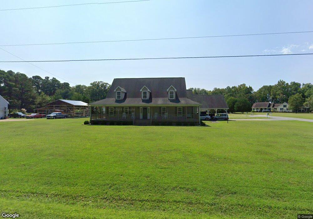
21496 Mallard Cove Ln Carrollton, VA 23314
Estimated Value: $373,000 - $536,000
3
Beds
2
Baths
2,222
Sq Ft
$217/Sq Ft
Est. Value
About This Home
This home is located at 21496 Mallard Cove Ln, Carrollton, VA 23314 and is currently estimated at $481,152, approximately $216 per square foot. 21496 Mallard Cove Ln is a home located in Isle of Wight County with nearby schools including Carrollton Elementary School, Smithfield Middle School, and Smithfield High School.
Ownership History
Date
Name
Owned For
Owner Type
Purchase Details
Closed on
Dec 11, 2024
Sold by
Overstreet Donald R and Overstreet Bonnie H
Bought by
Overstreet Bonnie H
Current Estimated Value
Purchase Details
Closed on
Jun 17, 2016
Purchase Details
Closed on
Jan 27, 2010
Sold by
Overstreet Donald R and Overstreet Sandra S
Purchase Details
Closed on
Apr 17, 2001
Create a Home Valuation Report for This Property
The Home Valuation Report is an in-depth analysis detailing your home's value as well as a comparison with similar homes in the area
Home Values in the Area
Average Home Value in this Area
Purchase History
| Date | Buyer | Sale Price | Title Company |
|---|---|---|---|
| Overstreet Bonnie H | -- | None Listed On Document | |
| -- | -- | -- | |
| -- | -- | -- | |
| -- | -- | -- |
Source: Public Records
Tax History Compared to Growth
Tax History
| Year | Tax Paid | Tax Assessment Tax Assessment Total Assessment is a certain percentage of the fair market value that is determined by local assessors to be the total taxable value of land and additions on the property. | Land | Improvement |
|---|---|---|---|---|
| 2025 | $3,880 | $500,700 | $55,000 | $445,700 |
| 2024 | $3,655 | $500,700 | $55,000 | $445,700 |
| 2023 | $3,609 | $500,700 | $55,000 | $445,700 |
| 2022 | $3,087 | $356,800 | $55,000 | $301,800 |
| 2021 | $3,087 | $356,800 | $55,000 | $301,800 |
| 2020 | $3,087 | $356,800 | $55,000 | $301,800 |
| 2019 | $3,087 | $356,800 | $55,000 | $301,800 |
| 2018 | $2,919 | $337,000 | $55,000 | $282,000 |
| 2016 | $2,937 | $337,000 | $55,000 | $282,000 |
| 2015 | $2,863 | $337,000 | $55,000 | $282,000 |
| 2014 | $2,863 | $328,300 | $55,000 | $273,300 |
| 2013 | -- | $328,300 | $55,000 | $273,300 |
Source: Public Records
Map
Nearby Homes
- 1 Gayle Way
- 15516 Gayle Way
- 22056 Brewers Neck Blvd
- 22500 Britt Way
- 24+AC Brewers Neck Blvd
- 15029 Ashby Way E
- 14176 Carver Dr
- 601 Kathy Ann Way W
- 408 Kathy Ann Way W
- 1010 Kathy Ann Way W
- 1001 Kathy Ann Way W
- 1002 Kathy Ann Way W
- 1512 Kathy Ann Way E
- 1508 Kathy Ann Way E
- 1712 Kathy Ann Way E
- 1502 Kathy Ann Way E
- 1503 Kathy Ann Way E
- 1505 Kathy Ann Way E
- 1706 Kathy Ann Way
- Robert Frost Plan at Bartlett Station Estates
- 0 Mallard Cove Unit 1043055
- 5.43ac Mallard Cove Ln
- 22008 Mallard Cove Ln
- 21482 Mallard Cove Ln
- 21473 Mallard Cove Ln
- 21354 Mallard Cove Ln
- 21460 Mallard Cove Ln
- 15276 Overstreet Ln
- 15203 Wyatt Ct
- 21344 Mallard Cove Ln
- 15193 Wyatt Ct
- 22047 Mallard Cove Ln
- 15300 Overstreet Ln
- 15311 Overstreet Ln
- 15312 Overstreet Ln
- 22073 Mallard Cove Ln
- 15240 New Towne Haven Ln
- 15240 New Town Haven Ln
- 15195 Gayle Way
- 15211 Gayle Way