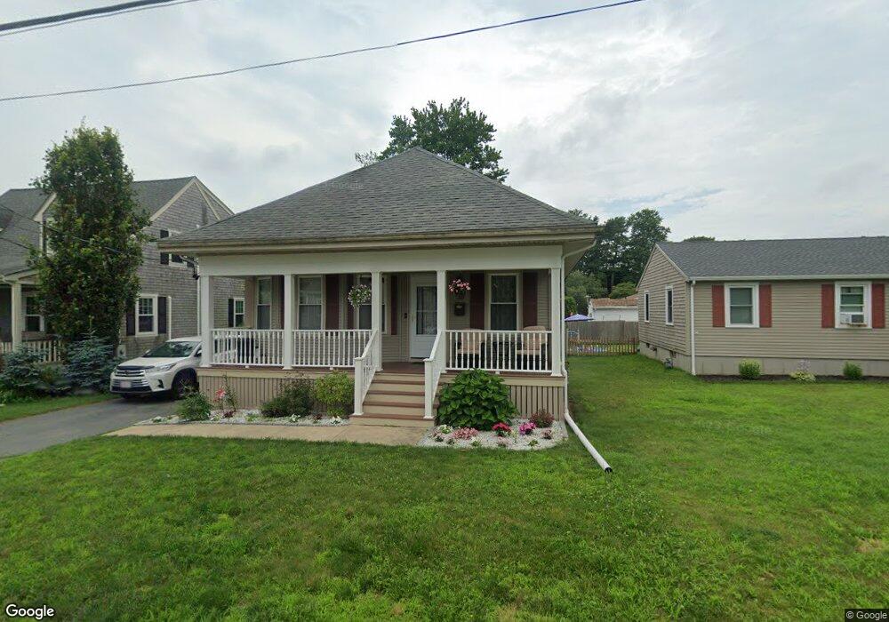
215 Adelaide St New Bedford, MA 02745
Acushnet-Pine Hill NeighborhoodEstimated Value: $432,000 - $468,000
3
Beds
1
Bath
1,409
Sq Ft
$323/Sq Ft
Est. Value
About This Home
This home is located at 215 Adelaide St, New Bedford, MA 02745 and is currently estimated at $455,217, approximately $323 per square foot. 215 Adelaide St is a home located in Bristol County with nearby schools including Jireh Swift School, Normandin Middle School, and New Bedford High School.
Ownership History
Date
Name
Owned For
Owner Type
Purchase Details
Closed on
Feb 17, 2022
Sold by
Amaral Oscar L and Amaral Marcia T
Bought by
Amaral Oscar L and Amaral Marcia T
Current Estimated Value
Purchase Details
Closed on
Jun 22, 1999
Sold by
Dube Mark W and Dube Patricia A
Bought by
Amaral Oscar L and Amaral Marcia T
Home Financials for this Owner
Home Financials are based on the most recent Mortgage that was taken out on this home.
Original Mortgage
$110,941
Interest Rate
6.99%
Mortgage Type
Purchase Money Mortgage
Purchase Details
Closed on
Apr 27, 1990
Sold by
Sturtevant Elwood Est
Bought by
Dube Ft
Purchase Details
Closed on
Nov 14, 1989
Sold by
Richmond Ann
Bought by
Dube Mark W
Create a Home Valuation Report for This Property
The Home Valuation Report is an in-depth analysis detailing your home's value as well as a comparison with similar homes in the area
Home Values in the Area
Average Home Value in this Area
Purchase History
| Date | Buyer | Sale Price | Title Company |
|---|---|---|---|
| Amaral Oscar L | -- | None Available | |
| Amaral Oscar L | -- | None Available | |
| Amaral Oscar L | $111,000 | -- | |
| Amaral Oscar L | $111,000 | -- | |
| Dube Ft | $5,000 | -- | |
| Dube Mark W | $110,000 | -- |
Source: Public Records
Mortgage History
| Date | Status | Borrower | Loan Amount |
|---|---|---|---|
| Previous Owner | Dube Mark W | $113,500 | |
| Previous Owner | Dube Mark W | $110,941 | |
| Previous Owner | Dube Mark W | $93,600 |
Source: Public Records
Tax History Compared to Growth
Tax History
| Year | Tax Paid | Tax Assessment Tax Assessment Total Assessment is a certain percentage of the fair market value that is determined by local assessors to be the total taxable value of land and additions on the property. | Land | Improvement |
|---|---|---|---|---|
| 2025 | $4,592 | $406,000 | $119,200 | $286,800 |
| 2024 | $4,466 | $372,200 | $119,200 | $253,000 |
| 2023 | $4,483 | $313,700 | $98,100 | $215,600 |
| 2022 | $4,118 | $265,000 | $91,100 | $173,900 |
| 2021 | $3,971 | $254,700 | $89,400 | $165,300 |
| 2020 | $3,874 | $239,700 | $89,400 | $150,300 |
| 2019 | $3,660 | $222,200 | $89,400 | $132,800 |
| 2018 | $3,449 | $207,400 | $89,400 | $118,000 |
| 2017 | $3,158 | $189,200 | $84,100 | $105,100 |
| 2016 | $2,981 | $180,800 | $80,600 | $100,200 |
| 2015 | $2,761 | $175,500 | $80,600 | $94,900 |
| 2014 | $2,500 | $164,900 | $80,600 | $84,300 |
Source: Public Records
Map
Nearby Homes
- 1024 Marion St
- 65 Armsby St
- 209 Jarry St
- 506 Hawes St
- 6 Illinois St
- 9 Middlefield Place
- 6 Middlefield Place
- 362 Tarkiln Hill Rd
- 187 Tarkiln Hill Rd
- 362 Prescott St
- 0 Church Dutton & Chaffee Unit 73371719
- 683 Church St
- 398 Brockton St
- 850 Terry Ln
- 263 Hersom St
- 957 Glen St
- 1044 Victoria St Unit B-29
- 447 Wood St
- 847 Terry Ln
- 1164 Victoria St
- 209 Adelaide St
- 219 Adelaide St
- 205 Adelaide St
- 1076 Shelburne St
- 212 Pine Grove St
- 206 Pine Grove St
- 0 Shelburne St
- 49 Ethel St
- 197 Adelaide St
- 220 Adelaide St
- 198 Pine Grove St
- 231 Adelaide St
- 45 Ethel St
- 1069 Shelburne St
- 1077 Shelburne St
- 189 Adelaide St
- 77 Pontiac St
- 48 Ethel St
- 1040 Shelburne St
- 232 Adelaide St