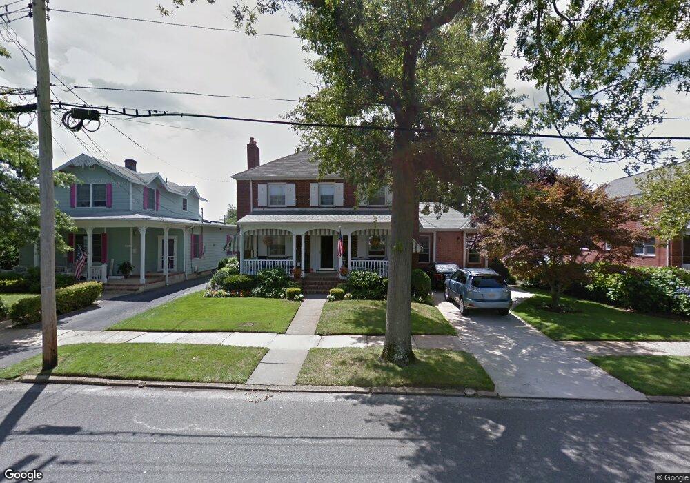
215 Atlantic Ave Spring Lake, NJ 07762
Estimated Value: $2,812,000 - $3,565,000
4
Beds
1
Bath
2,867
Sq Ft
$1,164/Sq Ft
Est. Value
About This Home
This home is located at 215 Atlantic Ave, Spring Lake, NJ 07762 and is currently estimated at $3,338,459, approximately $1,164 per square foot. 215 Atlantic Ave is a home located in Monmouth County with nearby schools including St. Catharine School.
Ownership History
Date
Name
Owned For
Owner Type
Purchase Details
Closed on
Jun 11, 2019
Sold by
Foley Thomas F and Foley Paula
Bought by
Foley Thomas F and Thomas F Foley Revocable Trust
Current Estimated Value
Purchase Details
Closed on
May 30, 1988
Bought by
Foley Thomas F and Foley Paula
Create a Home Valuation Report for This Property
The Home Valuation Report is an in-depth analysis detailing your home's value as well as a comparison with similar homes in the area
Home Values in the Area
Average Home Value in this Area
Purchase History
| Date | Buyer | Sale Price | Title Company |
|---|---|---|---|
| Foley Thomas F | -- | None Available | |
| Foley Thomas F | $475,000 | -- |
Source: Public Records
Tax History Compared to Growth
Tax History
| Year | Tax Paid | Tax Assessment Tax Assessment Total Assessment is a certain percentage of the fair market value that is determined by local assessors to be the total taxable value of land and additions on the property. | Land | Improvement |
|---|---|---|---|---|
| 2025 | $14,465 | $3,362,900 | $2,815,000 | $547,900 |
| 2024 | $13,759 | $2,958,100 | $2,490,000 | $468,100 |
| 2023 | $13,759 | $2,735,400 | $2,278,200 | $457,200 |
| 2022 | $12,535 | $2,505,700 | $2,070,400 | $435,300 |
| 2021 | $12,535 | $2,089,100 | $1,695,300 | $393,800 |
| 2020 | $12,516 | $2,025,200 | $1,646,800 | $378,400 |
| 2019 | $12,433 | $1,973,500 | $1,606,000 | $367,500 |
| 2018 | $12,339 | $1,964,800 | $1,606,000 | $358,800 |
| 2017 | $11,826 | $1,889,100 | $1,550,000 | $339,100 |
| 2016 | $12,920 | $1,891,600 | $1,358,000 | $533,600 |
| 2015 | $13,203 | $1,891,600 | $1,358,000 | $533,600 |
| 2014 | $12,976 | $1,891,600 | $1,358,000 | $533,600 |
Source: Public Records
Map
Nearby Homes
- 200 Monmouth Ave Unit 21
- 200 Monmouth Ave Unit 19
- 200 Monmouth Ave Unit 27
- 200 Monmouth Ave Unit 23
- 200 Monmouth Ave Unit 5
- 306 Ocean Rd
- 305 4th Ave
- 418 Salem Ave
- 418 Monmouth Ave
- 11 Union Ave
- 16 Sussex Ave
- 20 Sussex Ave
- 118 Warren Ave
- 513 Mercer Ave
- 2 The Terrace
- 601 Central Ave
- 530 Highway 71 Unit 4
- 103 Ocean Ave
- 613 Warren Ave
- 510 Beacon Blvd
- 211 Atlantic Ave
- 217 Atlantic Ave
- 209 Atlantic Ave
- 214 Salem Ave
- 212 Salem Ave
- 207 Atlantic Ave
- 218 Salem Ave
- 218 Atlantic Ave
- 210 Salem Ave
- 301 Atlantic Ave
- 208 Salem Ave
- 214 Atlantic Ave
- 216 Atlantic Ave
- 500 3rd Ave
- 210 Atlantic Ave
- 300 Salem Ave
- 205 Atlantic Ave
- 206 Salem Ave
- 302 Salem Ave
- 203 Atlantic Ave