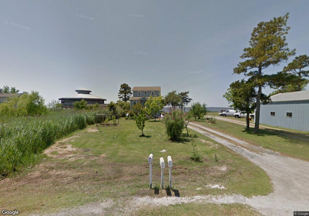
215 Bayview Dr Unit 1/lot0 Stumpy Point, NC 27978
Estimated Value: $449,194 - $513,000
3
Beds
2
Baths
1,568
Sq Ft
$307/Sq Ft
Est. Value
About This Home
This home is located at 215 Bayview Dr Unit 1/lot0, Stumpy Point, NC 27978 and is currently estimated at $481,049, approximately $306 per square foot. 215 Bayview Dr Unit 1/lot0 is a home located in Dare County with nearby schools including Manteo Elementary School, Manteo Middle School, and Manteo High School.
Ownership History
Date
Name
Owned For
Owner Type
Purchase Details
Closed on
Jun 11, 2021
Sold by
Meekins James G and Meekins Pamela K
Bought by
Sheehan Robert Manning and Sheehan Jolynn M
Current Estimated Value
Home Financials for this Owner
Home Financials are based on the most recent Mortgage that was taken out on this home.
Original Mortgage
$346,499
Outstanding Balance
$313,028
Interest Rate
2.9%
Mortgage Type
New Conventional
Estimated Equity
$168,021
Create a Home Valuation Report for This Property
The Home Valuation Report is an in-depth analysis detailing your home's value as well as a comparison with similar homes in the area
Home Values in the Area
Average Home Value in this Area
Purchase History
| Date | Buyer | Sale Price | Title Company |
|---|---|---|---|
| Sheehan Robert Manning | $399,000 | None Available |
Source: Public Records
Mortgage History
| Date | Status | Borrower | Loan Amount |
|---|---|---|---|
| Open | Sheehan Robert Manning | $346,499 |
Source: Public Records
Tax History Compared to Growth
Tax History
| Year | Tax Paid | Tax Assessment Tax Assessment Total Assessment is a certain percentage of the fair market value that is determined by local assessors to be the total taxable value of land and additions on the property. | Land | Improvement |
|---|---|---|---|---|
| 2025 | $1,867 | $440,700 | $120,400 | $320,300 |
| 2024 | $1,893 | $304,400 | $84,300 | $220,100 |
| 2023 | $1,893 | $307,508 | $84,300 | $223,208 |
| 2022 | $1,860 | $307,514 | $84,300 | $223,214 |
| 2021 | $1,797 | $302,020 | $78,800 | $223,220 |
| 2020 | $1,793 | $302,116 | $78,800 | $223,316 |
| 2019 | $1,265 | $177,400 | $60,300 | $117,100 |
| 2018 | $1,264 | $177,400 | $60,300 | $117,100 |
| 2017 | $1,251 | $177,400 | $60,300 | $117,100 |
| 2016 | $1,180 | $177,400 | $60,300 | $117,100 |
| 2014 | -- | $177,400 | $60,300 | $117,100 |
Source: Public Records
Map
Nearby Homes
- 232A Bayview Dr
- 172 Bayview Dr
- 170 Bayview Dr
- 288 Bayview Dr Unit N/A
- 149 Bayview Dr
- 142 Bayview Dr Unit Lot
- 113 Bayview Dr
- 92 Mosley Ln
- 168 Burrus Rd
- 4013 Mill Landing Rd
- 4683 Mill Landing Rd
- 7636 Shipyard Rd
- 807 Back Bay Rd Unit Lot30
- 5689 Old Ferry Dock Rd
- 0 N Highway 64 264 Unit Lot 1R 129719
- 0 N Highway 64 264 Unit Lot 3R 129718
- 0 Docks Unit slip R14 130572
- 0 Docks Unit Lot 15 125645
- 104 Coleman Rd
- 1285 Burnside Rd Unit Lot 3
- 215 Bayview Dr
- 217 Bayview Dr
- 214 Bayview Dr
- 214 Bayview Dr Unit 1/lot0
- 219 Bayview Dr
- 207 Bayview Dr
- 216 Bayview Dr
- 212 Bayview Dr
- 210 Bayview Dr
- 218 Bayview Dr
- 228 Bayview Dr
- 224 Bayview Dr
- 208 Bayview Dr
- 201 Bayview Dr
- 227 Bayview Dr
- 199 Bayview Dr
- 197 Bayview Dr
- 231 Bayview Dr
- 195 Bayview Dr
- 232 Bayview Dr