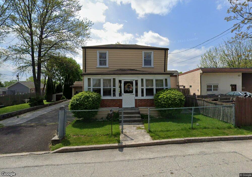
215 Bristol Ave Norristown, PA 19401
East Norriton Township NeighborhoodEstimated Value: $321,173 - $352,000
2
Beds
1
Bath
1,560
Sq Ft
$218/Sq Ft
Est. Value
About This Home
This home is located at 215 Bristol Ave, Norristown, PA 19401 and is currently estimated at $340,043, approximately $217 per square foot. 215 Bristol Ave is a home located in Montgomery County with nearby schools including Cole Manor Elementary School, Charles Blockson Middle School, and East Norriton Middle School.
Ownership History
Date
Name
Owned For
Owner Type
Purchase Details
Closed on
Feb 9, 2022
Sold by
Lee Jones Robert
Bought by
Jones Robert Lee and Jones Keisha
Current Estimated Value
Purchase Details
Closed on
Sep 30, 1997
Sold by
Jones Herbert
Bought by
Jones Robert Lee
Create a Home Valuation Report for This Property
The Home Valuation Report is an in-depth analysis detailing your home's value as well as a comparison with similar homes in the area
Home Values in the Area
Average Home Value in this Area
Purchase History
| Date | Buyer | Sale Price | Title Company |
|---|---|---|---|
| Jones Robert Lee | $6,269 | Oliver & Caiola Llc | |
| Jones Robert Lee | -- | -- |
Source: Public Records
Tax History Compared to Growth
Tax History
| Year | Tax Paid | Tax Assessment Tax Assessment Total Assessment is a certain percentage of the fair market value that is determined by local assessors to be the total taxable value of land and additions on the property. | Land | Improvement |
|---|---|---|---|---|
| 2025 | $4,344 | $92,220 | $38,100 | $54,120 |
| 2024 | $4,344 | $92,220 | $38,100 | $54,120 |
| 2023 | $4,293 | $92,220 | $38,100 | $54,120 |
| 2022 | $4,265 | $92,220 | $38,100 | $54,120 |
| 2021 | $4,238 | $92,220 | $38,100 | $54,120 |
| 2020 | $4,106 | $92,220 | $38,100 | $54,120 |
| 2019 | $4,011 | $92,220 | $38,100 | $54,120 |
| 2018 | $4,011 | $92,220 | $38,100 | $54,120 |
| 2017 | $3,778 | $92,220 | $38,100 | $54,120 |
| 2016 | $3,741 | $92,220 | $38,100 | $54,120 |
| 2015 | $3,546 | $92,220 | $38,100 | $54,120 |
| 2014 | $3,546 | $92,220 | $38,100 | $54,120 |
Source: Public Records
Map
Nearby Homes
- 51 Zummo Way Unit CONDO
- 41 Zummo Way
- 8 Zummo Way
- 37 Zummo Way
- 4 Zummo Way
- 1847 Arch St
- 1879 Harmony Ct Unit 72A
- 1883 Arbor Place Dr Unit 81C
- 1883 Arbor Place Dr Unit 82C
- 1883 Arbor Place Dr Unit 84A
- 1831 Arch St Unit 9W
- 1829 Arch St Unit 10S
- 1827 Arch St Unit 11E
- 272 Harmony Ct Unit 78A
- 1825 Arch St Unit 12E
- 1850 Arbor Place Dr Unit 48E
- 1819 Arch St Unit 15E
- 1842 Arbor Place Dr Unit 44E
- 1840 Arbor Place Dr Unit 43E
- 1817 Arch St Unit 16E
- 210 Connor St
- 2011 Rahway Ave
- 2009 Rahway Ave
- 222 Connor St
- 232 Connor St
- 227 Bristol Ave
- 2001 Rahway Ave
- 0 Shamokin Ave
- 2107 Rahway Ave
- 1 Shamokin Ave
- 1909 Rahway Ave
- 219 Connor St
- 211 Shamokin Ave
- 211 Connor St
- 215 Connor St
- 245 Connor St
- 2012 Rahway Ave
- 2206 Rahway Ave
- 2006 Rahway Ave
- 2111 Rahway Ave