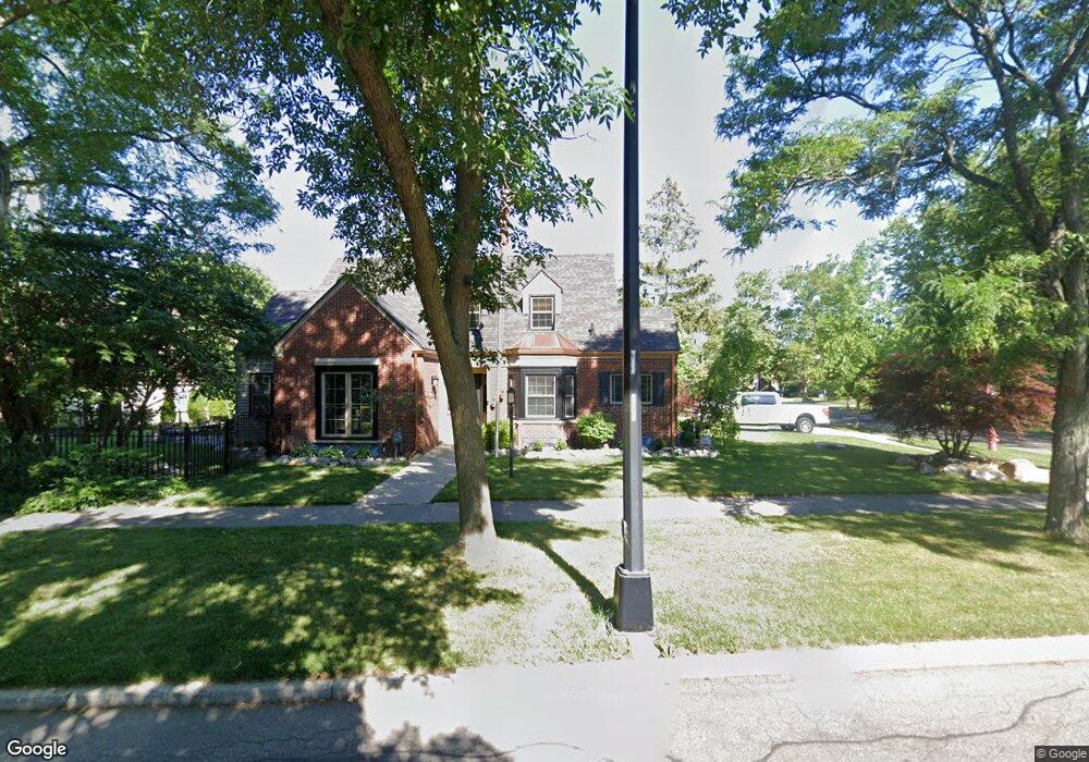
215 Chalfonte Ave Unit Bldg-Unit Grosse Pointe Farms, MI 48236
Estimated Value: $501,000 - $545,000
--
Bed
4
Baths
1,768
Sq Ft
$297/Sq Ft
Est. Value
About This Home
This home is located at 215 Chalfonte Ave Unit Bldg-Unit, Grosse Pointe Farms, MI 48236 and is currently estimated at $524,254, approximately $296 per square foot. 215 Chalfonte Ave Unit Bldg-Unit is a home located in Wayne County with nearby schools including Kerby Elementary School, Brownell Middle School, and Grosse Pointe South High School.
Ownership History
Date
Name
Owned For
Owner Type
Purchase Details
Closed on
Jun 16, 2021
Sold by
Towar Brandi
Bought by
Hastings Andrew and Wojno Shelby
Current Estimated Value
Purchase Details
Closed on
Mar 10, 2015
Sold by
Brabb R Seldon
Bought by
Towar Brandi
Purchase Details
Closed on
May 24, 2012
Sold by
Krato Matthew and Krato Jeselynn
Bought by
Federal Home Loan Mortgage Corporation
Purchase Details
Closed on
Aug 26, 2010
Sold by
Krato Jeselynn C
Bought by
Krato Matthew A
Create a Home Valuation Report for This Property
The Home Valuation Report is an in-depth analysis detailing your home's value as well as a comparison with similar homes in the area
Home Values in the Area
Average Home Value in this Area
Purchase History
| Date | Buyer | Sale Price | Title Company |
|---|---|---|---|
| Hastings Andrew | $421,000 | None Available | |
| Towar Brandi | $259,700 | Greco Title Agency Llc | |
| Federal Home Loan Mortgage Corporation | $253,716 | None Available | |
| Krato Matthew A | -- | None Available |
Source: Public Records
Tax History Compared to Growth
Tax History
| Year | Tax Paid | Tax Assessment Tax Assessment Total Assessment is a certain percentage of the fair market value that is determined by local assessors to be the total taxable value of land and additions on the property. | Land | Improvement |
|---|---|---|---|---|
| 2025 | $5,660 | $249,500 | $0 | $0 |
| 2024 | $5,660 | $230,700 | $0 | $0 |
| 2023 | $5,393 | $212,900 | $0 | $0 |
| 2022 | $10,072 | $194,800 | $0 | $0 |
| 2021 | $7,877 | $185,200 | $0 | $0 |
| 2019 | $9,046 | $176,900 | $0 | $0 |
| 2018 | $3,714 | $146,300 | $0 | $0 |
| 2017 | $6,444 | $143,100 | $0 | $0 |
| 2016 | $6,755 | $137,400 | $0 | $0 |
| 2015 | $11,552 | $124,500 | $0 | $0 |
| 2013 | $10,830 | $108,300 | $0 | $0 |
| 2012 | $2,711 | $106,200 | $36,300 | $69,900 |
Source: Public Records
Map
Nearby Homes
- 415 Lothrop Rd
- 380 Merriweather Rd
- 343 Mount Vernon Ave
- 975 Fisher Rd
- 317 Mount Vernon Ave
- 314 Mount Vernon Ave
- 441 Manor St
- 352 Mckinley Ave
- 302 Mount Vernon Ave
- 341 Mcmillan Rd
- 827 Fisher Rd
- 876 Washington Rd
- 351 Moselle Place
- 265 Williams Ave
- 471 Touraine Rd
- 259 Mount Vernon Ave
- 18119 Cornwall St
- 432 Calvin Ave
- 276 Lewiston Rd
- 4598 Lodewyck St
- 215 Chalfonte Ave
- 405 Mount Vernon Ave
- 416 Moran Rd
- 395 Mount Vernon Ave
- 412 Moran Rd
- 418 Moran Rd
- 407 Mount Vernon Ave
- 410 Moran Rd
- 225 Chalfonte Ave
- 404 Mount Vernon Ave
- 406 Mount Vernon Ave
- 393 Mount Vernon Ave
- 393 Mt Vernon
- 422 Moran Rd
- 207 Chalfonte Ave
- 390 Mount Vernon Ave Unit Bldg-Unit
- 390 Mount Vernon Ave
- 390 Mt Vernon
- 389 Mount Vernon Ave
- 386 Mount Vernon Ave