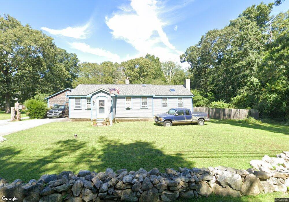
215 Charlotte White Rd Westport, MA 02790
Brownell/Giffords Corner NeighborhoodEstimated Value: $493,845 - $683,000
3
Beds
--
Bath
1,390
Sq Ft
$424/Sq Ft
Est. Value
About This Home
This home is located at 215 Charlotte White Rd, Westport, MA 02790 and is currently estimated at $589,711, approximately $424 per square foot. 215 Charlotte White Rd is a home located in Bristol County with nearby schools including Alice A. Macomber Primary School, Westport Elementary School, and Westport Middle-High School.
Ownership History
Date
Name
Owned For
Owner Type
Purchase Details
Closed on
Sep 4, 2014
Sold by
Jane M Defaria Lt
Bought by
Defaria Henrique M and Defaria Jane M
Current Estimated Value
Purchase Details
Closed on
Jul 29, 2009
Sold by
Defaria Henrique M and Defaria Jane M
Bought by
Defaria Tr Henrique M and Defaria Jane M
Purchase Details
Closed on
Jan 4, 1978
Bought by
Defaria Henrique M and Defaria Jane M
Create a Home Valuation Report for This Property
The Home Valuation Report is an in-depth analysis detailing your home's value as well as a comparison with similar homes in the area
Home Values in the Area
Average Home Value in this Area
Purchase History
| Date | Buyer | Sale Price | Title Company |
|---|---|---|---|
| Defaria Henrique M | -- | -- | |
| Defaria Tr Henrique M | -- | -- | |
| Defaria Henrique M | -- | -- |
Source: Public Records
Mortgage History
| Date | Status | Borrower | Loan Amount |
|---|---|---|---|
| Previous Owner | Defaria Henrique M | $25,000 |
Source: Public Records
Tax History Compared to Growth
Tax History
| Year | Tax Paid | Tax Assessment Tax Assessment Total Assessment is a certain percentage of the fair market value that is determined by local assessors to be the total taxable value of land and additions on the property. | Land | Improvement |
|---|---|---|---|---|
| 2025 | $3,180 | $426,800 | $165,300 | $261,500 |
| 2024 | $3,133 | $405,300 | $146,500 | $258,800 |
| 2023 | $2,965 | $363,400 | $126,800 | $236,600 |
| 2022 | $2,710 | $319,600 | $126,800 | $192,800 |
| 2021 | $2,383 | $276,400 | $109,500 | $166,900 |
| 2020 | $2,245 | $266,300 | $99,600 | $166,700 |
| 2019 | $2,149 | $259,800 | $99,600 | $160,200 |
| 2018 | $1,944 | $238,000 | $111,700 | $126,300 |
| 2017 | $1,853 | $232,500 | $108,200 | $124,300 |
| 2016 | $1,769 | $223,700 | $104,600 | $119,100 |
| 2015 | $1,713 | $216,000 | $107,000 | $109,000 |
Source: Public Records
Map
Nearby Homes
- 118 Charlotte White Rd
- 8 Strawberry Ln
- 978 Sodom Rd
- 118 Charlotte White Rd Extension
- 0 Hidden Glen Ln
- Lot 0 Marcotte
- 4 Main Rd
- 218 American Legion Hwy
- 308 Robert St
- 15 Village Way
- 7 Village Way
- 47 Robert St
- 8 Village Way
- 47 Fallon Dr
- 771 Sanford Rd
- 33 Moniz Dr
- 47 Devol Ave
- 837 Main Rd
- 837 Main Road & Lot 2
- 374 Crandall Rd
- 159 Charlotte White Rd
- 223 Charlotte White Rd
- 221 Charlotte White Rd
- 229 Charlotte White Rd
- 227 Charlotte White Rd
- 7 Shannon Dr
- 235 Charlotte White Rd Unit 237
- 238 -4 Charlotte White
- 238 - 3 Charlotte White
- 238 -2 Charlotte White
- 238 -1 Charlotte White
- 238 -6 Charlotte White
- 238 -5 Charlotte White
- 238 - 7 Charlotte White
- 2 Shannon Dr
- 210 Charlotte White Rd
- 239-241 Charlotte White Rd Unit 241
- 239-241 Charlotte White Rd Unit 239
- 202 Charlotte White Rd
- 239 Charlotte White Rd Unit 241