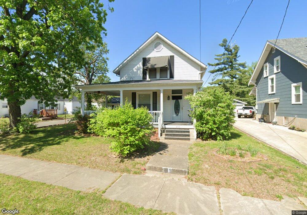
215 College Ave Moberly, MO 65270
Estimated Value: $152,000 - $207,000
2
Beds
2
Baths
1,542
Sq Ft
$110/Sq Ft
Est. Value
About This Home
This home is located at 215 College Ave, Moberly, MO 65270 and is currently estimated at $169,419, approximately $109 per square foot. 215 College Ave is a home located in Randolph County with nearby schools including Moberly Senior High School, St. Pius X. Catholic School, and Maranatha Seventh-day Adventist School.
Ownership History
Date
Name
Owned For
Owner Type
Purchase Details
Closed on
Apr 29, 2016
Sold by
Auxier Bruce W and Auxier Tracy J
Bought by
Cole Brandon K
Current Estimated Value
Home Financials for this Owner
Home Financials are based on the most recent Mortgage that was taken out on this home.
Original Mortgage
$102,600
Outstanding Balance
$81,810
Interest Rate
3.71%
Mortgage Type
Stand Alone First
Estimated Equity
$87,610
Purchase Details
Closed on
Jan 20, 2009
Sold by
Dunlop Daniel T and Dunlop Toni L
Bought by
Auxier Bruce W
Home Financials for this Owner
Home Financials are based on the most recent Mortgage that was taken out on this home.
Original Mortgage
$88,369
Interest Rate
5.17%
Create a Home Valuation Report for This Property
The Home Valuation Report is an in-depth analysis detailing your home's value as well as a comparison with similar homes in the area
Home Values in the Area
Average Home Value in this Area
Purchase History
| Date | Buyer | Sale Price | Title Company |
|---|---|---|---|
| Cole Brandon K | -- | None Available | |
| Auxier Bruce W | -- | -- |
Source: Public Records
Mortgage History
| Date | Status | Borrower | Loan Amount |
|---|---|---|---|
| Open | Cole Brandon K | $102,600 | |
| Previous Owner | Auxier Bruce W | $88,369 |
Source: Public Records
Tax History
| Year | Tax Paid | Tax Assessment Tax Assessment Total Assessment is a certain percentage of the fair market value that is determined by local assessors to be the total taxable value of land and additions on the property. | Land | Improvement |
|---|---|---|---|---|
| 2025 | $1,234 | $18,420 | $1,311 | $17,109 |
| 2024 | $12 | $16,950 | $1,140 | $15,810 |
| 2023 | $1,253 | $16,950 | $1,140 | $15,810 |
| 2022 | $1,196 | $16,610 | $1,140 | $15,470 |
| 2020 | $1,195 | $16,610 | $1,140 | $15,470 |
| 2019 | $1,193 | $16,610 | $1,140 | $15,470 |
| 2018 | $1,181 | $16,500 | $1,140 | $15,360 |
| 2017 | $1,179 | $16,500 | $0 | $0 |
| 2016 | $1,039 | $14,620 | $0 | $0 |
| 2014 | -- | $13,730 | $0 | $0 |
| 2013 | -- | $13,730 | $0 | $0 |
| 2012 | -- | $13,540 | $0 | $0 |
Source: Public Records
Map
Nearby Homes
- 953 W Rollins St
- 1004 W Reed St
- 816 W Reed St
- 724 W Rollins St
- 4 Fair Oaks
- 710 W Rollins St
- 1126 Franklin St
- 632 W Logan St
- 709 Gilman St
- 311 Epperson St
- 1316 Concannon St
- 621 Gilman St
- LOT 2 County Rd
- 1123 Concannon St
- 1029 Concannon St
- 535 W Reed St
- 216 S 5th St
- 309 S 4th St
- 419 S 4th St
- 604 S 5th St
- 213 College Ave
- 301 College Ave
- 1117 High St
- 1119 High St
- 302 College Ave
- 1115 Fisk Ave
- 214 College Ave
- 300 College Ave
- 1121 High St
- 1121 Fisk Ave
- 306 College Ave
- 1020 W Burkhart St
- 1123 High St
- 215 Locust St
- 217 Locust St
- 1023 W Burkhart St
- 1001 Fisk Ave
- 1019 W Burkhart St
- 1000 W Burkhart St
- 1017 W Burkhart St
Your Personal Tour Guide
Ask me questions while you tour the home.