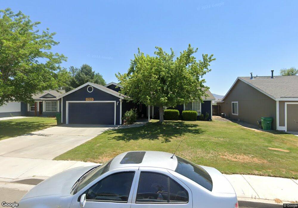
215 Corral Dr Dayton, NV 89403
Estimated Value: $377,000 - $385,000
3
Beds
2
Baths
1,300
Sq Ft
$292/Sq Ft
Est. Value
About This Home
This home is located at 215 Corral Dr, Dayton, NV 89403 and is currently estimated at $379,319, approximately $291 per square foot. 215 Corral Dr is a home located in Lyon County with nearby schools including Sutro Elementary School, Dayton Intermediate School, and Dayton High School.
Ownership History
Date
Name
Owned For
Owner Type
Purchase Details
Closed on
Mar 16, 2007
Sold by
Canas Rosa Marie
Bought by
Martinez Pedro Humberto
Current Estimated Value
Home Financials for this Owner
Home Financials are based on the most recent Mortgage that was taken out on this home.
Original Mortgage
$179,600
Outstanding Balance
$117,281
Interest Rate
7.75%
Estimated Equity
$262,038
Purchase Details
Closed on
Feb 28, 2007
Sold by
Siri Joan E
Bought by
Canas Pedro H Martines
Home Financials for this Owner
Home Financials are based on the most recent Mortgage that was taken out on this home.
Original Mortgage
$179,600
Outstanding Balance
$117,281
Interest Rate
7.75%
Estimated Equity
$262,038
Create a Home Valuation Report for This Property
The Home Valuation Report is an in-depth analysis detailing your home's value as well as a comparison with similar homes in the area
Home Values in the Area
Average Home Value in this Area
Purchase History
| Date | Buyer | Sale Price | Title Company |
|---|---|---|---|
| Martinez Pedro Humberto | -- | First Centennial Title Co | |
| Canas Pedro H Martines | $224,500 | First Centennial Title Co |
Source: Public Records
Mortgage History
| Date | Status | Borrower | Loan Amount |
|---|---|---|---|
| Open | Martinez Pedro Humberto | $179,600 | |
| Closed | Canas Pedro H Martines | $44,900 |
Source: Public Records
Tax History Compared to Growth
Tax History
| Year | Tax Paid | Tax Assessment Tax Assessment Total Assessment is a certain percentage of the fair market value that is determined by local assessors to be the total taxable value of land and additions on the property. | Land | Improvement |
|---|---|---|---|---|
| 2025 | $1,482 | $97,004 | $52,500 | $44,504 |
| 2024 | $1,438 | $97,487 | $52,500 | $44,986 |
| 2023 | $1,438 | $94,890 | $52,500 | $42,390 |
| 2022 | $1,144 | $83,104 | $43,785 | $39,319 |
| 2021 | $1,111 | $82,297 | $43,785 | $38,512 |
| 2020 | $1,057 | $80,179 | $43,790 | $36,389 |
| 2019 | $1,026 | $56,219 | $21,000 | $35,219 |
| 2018 | $996 | $55,466 | $21,000 | $34,466 |
| 2017 | $967 | $48,582 | $14,000 | $34,582 |
| 2016 | $943 | $39,860 | $7,880 | $31,980 |
| 2015 | $941 | $31,512 | $7,880 | $23,632 |
| 2014 | $913 | $28,602 | $7,880 | $20,722 |
Source: Public Records
Map
Nearby Homes
- 298 Monte Cristo Dr
- 7017 Highway 50 Unit 61
- 539 Rawe Peak Dr
- 608 Westwinds Dr
- 628 Rock Island Dr
- 720 Butte Creek Rd
- 7013 Highway 50
- 300 Golden Pick Dr
- 856 Schell Creek Dr
- 707 Butte Creek Rd
- 201 Crown Point Dr
- 214 Green Ln
- The Gem Plan at Gold Sky
- The Haven Plan at Gold Sky
- The Cottonwood Plan at Oro Hills at Traditions
- The Highland Plan at Oro Hills at Traditions
- The La Mesa Plan at Oro Hills at Traditions
- The Eden Plan at Gold Sky
- 832 Camp Station Dr Unit Homesite 312
- 818 Camp Station Dr Unit Homesite 357