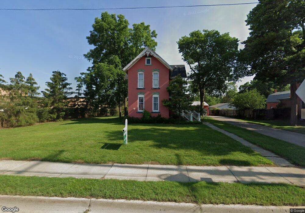
215 E Flint St Davison, MI 48423
Estimated Value: $207,000 - $235,000
3
Beds
3
Baths
2,100
Sq Ft
$106/Sq Ft
Est. Value
About This Home
This home is located at 215 E Flint St, Davison, MI 48423 and is currently estimated at $223,627, approximately $106 per square foot. 215 E Flint St is a home located in Genesee County with nearby schools including Thomson Elementary School, Hill Elementary School, and Siple Elementary School.
Ownership History
Date
Name
Owned For
Owner Type
Purchase Details
Closed on
Jul 20, 2018
Sold by
Varner Mark R and Varner Janet L
Bought by
Jan Mar Llc
Current Estimated Value
Purchase Details
Closed on
Nov 17, 2010
Sold by
Cowan William and Cowan Kristine
Bought by
Davison State Bank
Purchase Details
Closed on
Nov 17, 2006
Sold by
Thomas Rachel E
Bought by
Cowan William and Cowan Kristine
Purchase Details
Closed on
Dec 23, 1998
Sold by
Phillips Gwendolyn A
Bought by
Flint Jack R and Mallais Marcelle
Create a Home Valuation Report for This Property
The Home Valuation Report is an in-depth analysis detailing your home's value as well as a comparison with similar homes in the area
Home Values in the Area
Average Home Value in this Area
Purchase History
| Date | Buyer | Sale Price | Title Company |
|---|---|---|---|
| Jan Mar Llc | -- | None Available | |
| Davison State Bank | $48,000 | None Available | |
| Cowan William | $157,000 | Metropolitan Title Company | |
| Flint Jack R | $88,350 | First American Title |
Source: Public Records
Tax History Compared to Growth
Tax History
| Year | Tax Paid | Tax Assessment Tax Assessment Total Assessment is a certain percentage of the fair market value that is determined by local assessors to be the total taxable value of land and additions on the property. | Land | Improvement |
|---|---|---|---|---|
| 2025 | $4,314 | $81,400 | $0 | $0 |
| 2024 | $2,009 | $75,300 | $0 | $0 |
| 2023 | $1,926 | $71,800 | $0 | $0 |
| 2022 | $3,891 | $69,200 | $0 | $0 |
| 2021 | $3,731 | $66,900 | $0 | $0 |
| 2020 | $1,671 | $64,700 | $0 | $0 |
| 2019 | $1,649 | $61,900 | $0 | $0 |
| 2018 | $3,359 | $56,600 | $0 | $0 |
| 2017 | $3,231 | $55,400 | $0 | $0 |
| 2016 | $3,204 | $52,600 | $0 | $0 |
| 2015 | $3,206 | $49,000 | $0 | $0 |
| 2012 | -- | $47,700 | $47,700 | $0 |
Source: Public Records
Map
Nearby Homes
- 505 N Main St
- 230 W Flint St
- 625 Charles St
- 0 Davison Rd Unit 218068693
- 000 Davison Rd
- 436 Gary Ray Dr
- 502 Gary Ray Dr
- 10294 Carriage Way
- 612 Carriage Way
- 322 North Dr
- 730 Natalia Dr
- 611 W Flint St
- 923 Village
- 927 Village Dr
- 842 Star Dr Unit 19
- 7040 N Oak Rd
- 2323 Baltimore
- 2239 Baltimore Ln
- 7120 N Oak Rd
- 7250 N Oak Rd
- 219 E Flint St
- 0 Crossing Cir Unit 30052711
- 0 Crossing Cir Unit 30068136
- 0 Lapeer - Parcel L Rd Unit 217094993
- 0 Cal - Parcel J Dr Unit 217094961
- 0 Cal - Parcel G Dr Unit 217094548
- 0 E Lippincott-Parcel B Blvd Unit 217094359
- 0 Crossing Cir Unit 217076953
- 0 E Lippincott-Parcel B Blvd Unit 20230004299
- 0 Cal - Parcel G Dr Unit 20230004256
- 0 Crossing Cir Unit G21313991
- 0 Lapeer - Parcel L Rd Unit 2220003858
- 0 Lapeer - Parcel L Rd Unit 2200005789
- 0 Cal - Parcel J Dr Unit 2200005645
- 0 Cal - Parcel G Dr Unit 2200005530
- 0 E Lippincott-Parcel B Blvd Unit 2200005443
- 301 E Flint St
- 307 E Flint St
- 520 N Davison St
- 311 E Flint St Unit Bldg-Unit