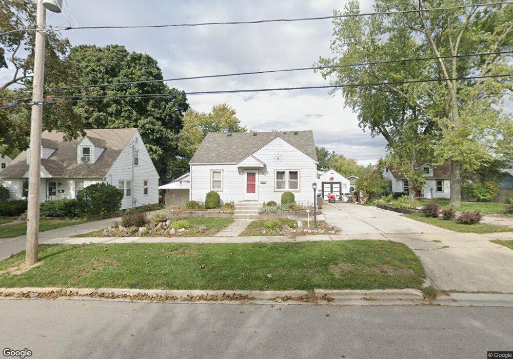
215 E Todd Ave Woodstock, IL 60098
Estimated Value: $222,000 - $259,000
3
Beds
2
Baths
1,218
Sq Ft
$201/Sq Ft
Est. Value
About This Home
This home is located at 215 E Todd Ave, Woodstock, IL 60098 and is currently estimated at $244,221, approximately $200 per square foot. 215 E Todd Ave is a home located in McHenry County with nearby schools including Westwood Elementary School, Creekside Middle School, and Woodstock High School.
Ownership History
Date
Name
Owned For
Owner Type
Purchase Details
Closed on
May 19, 1999
Sold by
Riggs Corbin T
Bought by
Limbaugh Brad E and Limbaugh Beverly J
Current Estimated Value
Home Financials for this Owner
Home Financials are based on the most recent Mortgage that was taken out on this home.
Original Mortgage
$119,000
Outstanding Balance
$30,620
Interest Rate
6.99%
Mortgage Type
FHA
Estimated Equity
$213,601
Purchase Details
Closed on
Sep 26, 1997
Sold by
Riggs Corbin T
Bought by
Riggs Corbin T and Ely Marlo A
Home Financials for this Owner
Home Financials are based on the most recent Mortgage that was taken out on this home.
Original Mortgage
$93,100
Interest Rate
6.12%
Create a Home Valuation Report for This Property
The Home Valuation Report is an in-depth analysis detailing your home's value as well as a comparison with similar homes in the area
Home Values in the Area
Average Home Value in this Area
Purchase History
| Date | Buyer | Sale Price | Title Company |
|---|---|---|---|
| Limbaugh Brad E | $120,000 | Intercounty Title | |
| Riggs Corbin T | -- | Intercounty Title | |
| Riggs Corbin T | -- | -- | |
| Riggs Corbin Thomas | $98,000 | Chicago Title Insurance Co |
Source: Public Records
Mortgage History
| Date | Status | Borrower | Loan Amount |
|---|---|---|---|
| Open | Limbaugh Brad E | $119,000 | |
| Previous Owner | Riggs Corbin Thomas | $93,100 |
Source: Public Records
Tax History Compared to Growth
Tax History
| Year | Tax Paid | Tax Assessment Tax Assessment Total Assessment is a certain percentage of the fair market value that is determined by local assessors to be the total taxable value of land and additions on the property. | Land | Improvement |
|---|---|---|---|---|
| 2024 | $5,525 | $67,969 | $5,804 | $62,165 |
| 2023 | $5,230 | $61,466 | $5,249 | $56,217 |
| 2022 | $5,006 | $54,549 | $4,658 | $49,891 |
| 2021 | $4,745 | $50,966 | $4,352 | $46,614 |
| 2020 | $4,559 | $48,428 | $4,135 | $44,293 |
| 2019 | $4,413 | $46,227 | $3,947 | $42,280 |
| 2018 | $3,865 | $40,674 | $4,502 | $36,172 |
| 2017 | $3,634 | $38,281 | $4,237 | $34,044 |
| 2016 | $3,575 | $35,445 | $3,923 | $31,522 |
| 2013 | -- | $36,629 | $8,864 | $27,765 |
Source: Public Records
Map
Nearby Homes
- Lots 8 & 9 Greenwood Cir
- 724 Wheeler St
- 0 N Seminary Ave Unit MRD11676693
- 338 Mchenry Ave
- 320 W Donovan Ave
- 208 W Greenwood Ave
- 1409 N Seminary Ave
- 709 Mchenry Ave
- 324 N Madison St
- 266 Hutchins Ct
- 130 Washington St
- 514 Washington St
- 00 Illinois 120
- 431 Washington St
- Lt 7 Flagg Ln
- Lt 8 Flagg Ln
- Lt 13 Flagg Ln
- 200 E Judd St
- 871 Hickman Ln
- 1546 Wheeler St
- 223 E Todd Ave
- 211 E Todd Ave
- 207 E Todd Ave
- 912 N Madison St
- 907 N Seminary Ave
- 901 N Seminary Ave
- 904 N Madison St
- 915 N Seminary Ave
- 920 N Madison St
- 927 N Seminary Ave
- 858 N Madison St
- 220 E Todd Ave
- 220 E Todd Ave
- 926 N Madison St
- 929 N Seminary Ave
- 854 N Madison St
- 845 N Seminary Ave
- 145 E Todd Ave
- 932 N Madison St
- 931 N Seminary Ave