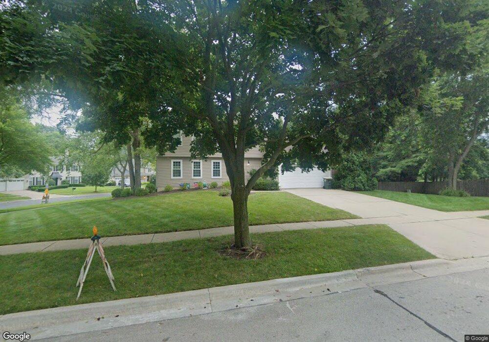
215 E Winchester Rd Libertyville, IL 60048
Estimated Value: $608,000 - $743,000
4
Beds
3
Baths
1,818
Sq Ft
$362/Sq Ft
Est. Value
About This Home
This home is located at 215 E Winchester Rd, Libertyville, IL 60048 and is currently estimated at $658,869, approximately $362 per square foot. 215 E Winchester Rd is a home located in Lake County with nearby schools including Adler Park School, Highland Middle School, and Libertyville High School.
Ownership History
Date
Name
Owned For
Owner Type
Purchase Details
Closed on
May 19, 2004
Sold by
Norsworthy Jase and Norsworthy Karen
Bought by
Rittner Ralph and Rittner Tara
Current Estimated Value
Home Financials for this Owner
Home Financials are based on the most recent Mortgage that was taken out on this home.
Original Mortgage
$309,000
Outstanding Balance
$154,582
Interest Rate
6.46%
Mortgage Type
Credit Line Revolving
Estimated Equity
$504,287
Purchase Details
Closed on
Jun 20, 1997
Sold by
Opeka Robert W and Opeka Karna K
Bought by
Norsworthy Jase and Norsworthy Karen L
Home Financials for this Owner
Home Financials are based on the most recent Mortgage that was taken out on this home.
Original Mortgage
$170,000
Interest Rate
8%
Create a Home Valuation Report for This Property
The Home Valuation Report is an in-depth analysis detailing your home's value as well as a comparison with similar homes in the area
Home Values in the Area
Average Home Value in this Area
Purchase History
| Date | Buyer | Sale Price | Title Company |
|---|---|---|---|
| Rittner Ralph | $405,000 | Burnet Title Llc | |
| Norsworthy Jase | $230,000 | Chicago Title Insurance Co |
Source: Public Records
Mortgage History
| Date | Status | Borrower | Loan Amount |
|---|---|---|---|
| Open | Rittner Ralph | $309,000 | |
| Previous Owner | Norsworthy Jase | $170,000 |
Source: Public Records
Tax History Compared to Growth
Tax History
| Year | Tax Paid | Tax Assessment Tax Assessment Total Assessment is a certain percentage of the fair market value that is determined by local assessors to be the total taxable value of land and additions on the property. | Land | Improvement |
|---|---|---|---|---|
| 2024 | $11,869 | $168,461 | $62,088 | $106,373 |
| 2023 | $10,934 | $155,378 | $57,266 | $98,112 |
| 2022 | $10,934 | $142,718 | $55,042 | $87,676 |
| 2021 | $10,526 | $139,646 | $53,857 | $85,789 |
| 2020 | $11,305 | $152,554 | $58,835 | $93,719 |
| 2019 | $11,024 | $151,104 | $58,276 | $92,828 |
| 2018 | $10,891 | $154,275 | $68,464 | $85,811 |
| 2017 | $10,739 | $149,405 | $66,303 | $83,102 |
| 2016 | $10,382 | $141,656 | $62,864 | $78,792 |
| 2015 | $10,286 | $132,401 | $58,757 | $73,644 |
| 2014 | $9,174 | $121,314 | $55,208 | $66,106 |
| 2012 | $8,576 | $117,429 | $55,688 | $61,741 |
Source: Public Records
Map
Nearby Homes
- 1211 Parliament Ct
- 922 N Milwaukee Ave Unit A
- 204 W Ellis Ave
- 208 W Ellis Ave
- 212 W Ellis Ave
- 31132-31140 N Milwaukee Ave
- 224 Newberry Ave
- 616 Parkside Ct
- 619 Parkside Ct
- 662 Parkside Ct
- 694 Parkside Ct
- 217 E Church St
- 505 Lange Ct
- 420 W Cook Ave
- 16108 W Des Plaines Dr
- 212 Elm Ct
- 16051 W Des Plaines Dr
- 601 Broadway St
- 121 4th St
- 112 3rd St
- 1215 Parliament Ct
- 218 E Winchester Rd
- 248 E Ellis Ave
- Lot #30 E Ellis Ave
- Lot 28 E Ellis Ave
- 1218 Parliament Ct
- 1213 Parliament Ct
- 1216 Parliament Ct
- 220 E Winchester Rd
- 1214 Parliament Ct
- 235 E Winchester Rd
- 1221 Parliament Ct
- 1212 Parliament Ct
- 152 E Winchester Rd Unit B
- 150 E Winchester Rd Unit 7813
- 152 E Winchester Rd Unit 8414
- 152 E Winchester Rd Unit 8314
- 152 E Winchester Rd Unit 8214
- 152 E Winchester Rd Unit 8114
- 152 E Winchester Rd Unit 8014