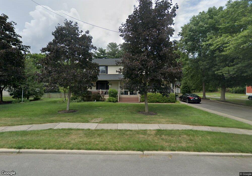
215 Georgetown Rd Glassboro, NJ 08028
Estimated Value: $476,000 - $558,000
--
Bed
--
Bath
3,142
Sq Ft
$162/Sq Ft
Est. Value
About This Home
This home is located at 215 Georgetown Rd, Glassboro, NJ 08028 and is currently estimated at $509,162, approximately $162 per square foot. 215 Georgetown Rd is a home located in Gloucester County with nearby schools including J Harvey Rodgers School, Dorothy L Bullock Elementary, and Glassboro Intermediate School.
Ownership History
Date
Name
Owned For
Owner Type
Purchase Details
Closed on
Jul 27, 2005
Sold by
Wilmot Kenneth A and Wilmot Gail D
Bought by
Walsh Michael J and Walsh Jennifer D
Current Estimated Value
Home Financials for this Owner
Home Financials are based on the most recent Mortgage that was taken out on this home.
Original Mortgage
$244,000
Outstanding Balance
$128,341
Interest Rate
5.68%
Mortgage Type
Fannie Mae Freddie Mac
Estimated Equity
$380,821
Create a Home Valuation Report for This Property
The Home Valuation Report is an in-depth analysis detailing your home's value as well as a comparison with similar homes in the area
Home Values in the Area
Average Home Value in this Area
Purchase History
| Date | Buyer | Sale Price | Title Company |
|---|---|---|---|
| Walsh Michael J | $305,000 | Congress Title |
Source: Public Records
Mortgage History
| Date | Status | Borrower | Loan Amount |
|---|---|---|---|
| Open | Walsh Michael J | $244,000 |
Source: Public Records
Tax History Compared to Growth
Tax History
| Year | Tax Paid | Tax Assessment Tax Assessment Total Assessment is a certain percentage of the fair market value that is determined by local assessors to be the total taxable value of land and additions on the property. | Land | Improvement |
|---|---|---|---|---|
| 2025 | $10,743 | $305,200 | $68,300 | $236,900 |
| 2024 | $10,679 | $305,200 | $68,300 | $236,900 |
| 2023 | $10,679 | $305,200 | $68,300 | $236,900 |
| 2022 | $10,572 | $305,200 | $68,300 | $236,900 |
| 2021 | $10,752 | $305,200 | $68,300 | $236,900 |
| 2020 | $10,813 | $305,200 | $68,300 | $236,900 |
| 2019 | $10,832 | $305,200 | $68,300 | $236,900 |
| 2018 | $10,838 | $305,200 | $68,300 | $236,900 |
| 2017 | $10,890 | $305,200 | $68,300 | $236,900 |
| 2016 | $10,575 | $305,200 | $68,300 | $236,900 |
| 2015 | $10,346 | $305,200 | $68,300 | $236,900 |
| 2014 | $10,111 | $305,200 | $68,300 | $236,900 |
Source: Public Records
Map
Nearby Homes
- 0 Franklin Rd
- 220 Franklin Rd
- 112 Dickinson Rd
- 20 Princeton Dr
- 20 Deptford Rd
- 306 Mullica Hill Rd
- 109 Laurel Ave
- 116 Ellis St
- 114 Ellis St
- 825 Fordham Place
- 131 Evergreen Pkwy
- 102 Stoneham Dr
- 70 Arlotta St
- 61 Arlotta St
- 340 Honeymoon Rd
- 350 Honeymoon Rd
- 120 Peace Ln
- 29 S Main St
- 52-54 N Main St
- 12 Normal Blvd
- 219 Georgetown Rd
- 211 Georgetown Rd
- 203 Georgetown Rd Unit 7
- 220 Dickinson Rd
- 214 Georgetown Rd
- 221 Yale Rd N
- 221 Yale Rd S
- 222 Dickinson Rd
- 212 Georgetown Rd
- 216 Georgetown Rd
- 224 Dickinson Rd
- 220 Georgetown Rd
- 208 Dickinson Rd
- 208 Georgetown Rd
- 206 Georgetown Rd
- 222 Georgetown Rd
- 217 Dickinson Rd
- 206 Dickinson Rd
- 205 Columbia Rd S
- 215 Dickinson Rd Unit 17