Estimated Value: $394,000 - $454,000
--
Bed
--
Bath
1,145
Sq Ft
$379/Sq Ft
Est. Value
About This Home
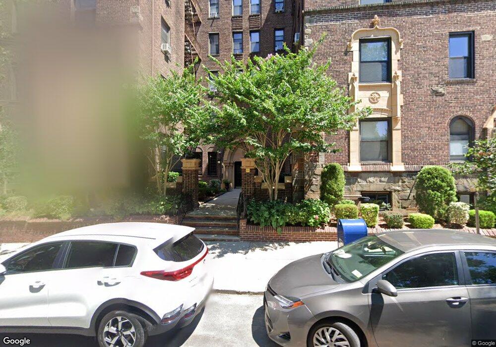
This home is located at 215 Hart Blvd Unit 6L, Staten Island, NY 10301 and is currently estimated at $433,701, approximately $378 per square foot. 215 Hart Blvd Unit 6L is a home located in Richmond County with nearby schools including P.S. 45 John Tyler, Is 61 William A Morris, and Curtis High School.
Ownership History
Date
Name
Owned For
Owner Type
Purchase Details
Closed on
Jul 17, 2023
Sold by
Surpin Jo A
Bought by
Salvatore Matthew
Current Estimated Value
Home Financials for this Owner
Home Financials are based on the most recent Mortgage that was taken out on this home.
Original Mortgage
$351,000
Outstanding Balance
$342,470
Interest Rate
6.69%
Mortgage Type
New Conventional
Estimated Equity
$91,231
Create a Home Valuation Report for This Property
The Home Valuation Report is an in-depth analysis detailing your home's value as well as a comparison with similar homes in the area
Home Values in the Area
Average Home Value in this Area
Purchase History
| Date | Buyer | Sale Price | Title Company |
|---|---|---|---|
| Salvatore Matthew | $390,000 | Homestead Title |
Source: Public Records
Mortgage History
| Date | Status | Borrower | Loan Amount |
|---|---|---|---|
| Open | Salvatore Matthew | $351,000 |
Source: Public Records
Tax History Compared to Growth
Tax History
| Year | Tax Paid | Tax Assessment Tax Assessment Total Assessment is a certain percentage of the fair market value that is determined by local assessors to be the total taxable value of land and additions on the property. | Land | Improvement |
|---|---|---|---|---|
| 2025 | $5,617 | $54,509 | $1,593 | $52,916 |
| 2024 | $4,039 | $53,924 | $1,593 | $52,331 |
| 2023 | $5,252 | $42,815 | $1,593 | $41,222 |
| 2022 | $4,995 | $40,828 | $1,593 | $39,235 |
| 2021 | $4,657 | $37,960 | $1,593 | $36,367 |
| 2020 | $3,762 | $44,716 | $1,593 | $43,123 |
| 2019 | $4,674 | $43,356 | $1,593 | $41,763 |
| 2018 | $4,188 | $43,016 | $1,593 | $41,423 |
| 2017 | $3,837 | $33,181 | $1,593 | $31,588 |
| 2016 | $3,758 | $30,674 | $1,593 | $29,081 |
| 2015 | $3,560 | $28,539 | $1,593 | $26,946 |
| 2014 | $3,560 | $29,219 | $1,593 | $27,626 |
Source: Public Records
About This Building
Map
Nearby Homes
- 215 Hart Blvd Unit 3L
- 58-62 University Place
- 72 Gregg Place
- 372 Sharon Ave
- 112 Delafield Ave
- 776 Brighton Ave
- 54 City Blvd
- 171 Silver Lake Rd
- 605 Bard Ave
- 414 Castleton Ave
- 525 Castleton Ave Unit 1C
- 435 Castleton Ave
- 26 Valencia Ave
- 328 Stanley Ave
- 20 Baker Place
- 585 Castleton Ave Unit 1c
- 244 Delafield Ave
- 34 Harvest Ave
- 1 Sunset Hill Dr
- 100 Lawrence Ave
- 215 Hart Blvd Unit 5H
- 215 Hart Blvd Unit 5E
- 215 Hart Blvd Unit 5A
- 215 Hart Blvd Unit 6K
- 215 Hart Blvd Unit 6J
- 215 Hart Blvd Unit 6I
- 215 Hart Blvd Unit 6H
- 215 Hart Blvd Unit 6G
- 215 Hart Blvd Unit 6F
- 215 Hart Blvd Unit 6E
- 215 Hart Blvd Unit 6C
- 215 Hart Blvd Unit 6B
- 215 Hart Blvd Unit 6A
- 215 Hart Blvd Unit 5L
- 215 Hart Blvd Unit 5K
- 215 Hart Blvd Unit 5J
- 215 Hart Blvd Unit 5I
- 215 Hart Blvd Unit 5G
- 215 Hart Blvd Unit 5F
- 215 Hart Blvd Unit 5C