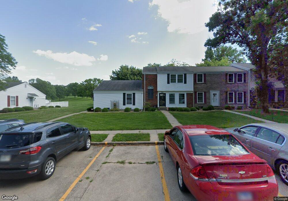
215 Jamestown Rd Macomb, IL 61455
Estimated Value: $70,000
2
Beds
1
Bath
816
Sq Ft
$86/Sq Ft
Est. Value
About This Home
This home is located at 215 Jamestown Rd, Macomb, IL 61455 and is currently priced at $70,000, approximately $85 per square foot. 215 Jamestown Rd is a home located in McDonough County with nearby schools including Lincoln Elementary School, Edison Elementary School, and Macomb Junior High School.
Ownership History
Date
Name
Owned For
Owner Type
Purchase Details
Closed on
Jun 29, 2012
Sold by
Johnson Dixie L
Bought by
Gordon Robert and Morath Bethany
Current Estimated Value
Home Financials for this Owner
Home Financials are based on the most recent Mortgage that was taken out on this home.
Original Mortgage
$68,850
Outstanding Balance
$47,885
Interest Rate
3.83%
Mortgage Type
New Conventional
Create a Home Valuation Report for This Property
The Home Valuation Report is an in-depth analysis detailing your home's value as well as a comparison with similar homes in the area
Home Values in the Area
Average Home Value in this Area
Purchase History
| Date | Buyer | Sale Price | Title Company |
|---|---|---|---|
| Gordon Robert | $67,500 | Terrill Title Co Inc |
Source: Public Records
Mortgage History
| Date | Status | Borrower | Loan Amount |
|---|---|---|---|
| Open | Gordon Robert | $68,850 |
Source: Public Records
Tax History Compared to Growth
Tax History
| Year | Tax Paid | Tax Assessment Tax Assessment Total Assessment is a certain percentage of the fair market value that is determined by local assessors to be the total taxable value of land and additions on the property. | Land | Improvement |
|---|---|---|---|---|
| 2023 | -- | $21,451 | $1,361 | $20,090 |
| 2022 | $0 | $20,300 | $1,288 | $19,012 |
| 2021 | $1,104 | $19,900 | $1,263 | $18,637 |
| 2020 | $1,104 | $20,848 | $1,244 | $19,604 |
| 2019 | $1,104 | $21,203 | $1,244 | $19,959 |
| 2018 | $0 | $21,495 | $1,261 | $20,234 |
| 2017 | $0 | $21,495 | $1,261 | $20,234 |
| 2016 | $1,104 | $21,244 | $1,246 | $19,998 |
| 2015 | $1,095 | $21,012 | $1,232 | $19,780 |
| 2014 | $1,161 | $20,382 | $1,361 | $19,021 |
| 2013 | $170 | $19,228 | $1,284 | $17,944 |
Source: Public Records
Map
Nearby Homes
- 260 Jamestown Rd
- 40 N Yorktown Rd
- 45 N Yorktown Rd
- 130 S Yorktown Rd
- 105 Arlington Dr
- 130 Arlington Dr
- 90 Carriage Hill
- 100 S Quail Walk Rd
- 206 Meadow Dr
- 3010 W Jackson St
- 524 Meadow Dr
- 2001 W Jackson St Unit C
- 1713 W Adams Rd
- 1925 Riverview Dr
- 1500 W Adams Rd
- 11250 E 900th St
- 1613 W Adams Rd
- 3 Rye Ct
- 1707 Riverview Dr
- 15 Cedar Dr
- 205 Jamestown Rd
- 195 Jamestown Rd
- 225 Jamestown Rd
- 185 Jamestown Rd
- 235 Jamestown Rd
- 175 Jamestown Rd
- 245 Jamestown Rd
- 165 Jamestown Rd
- 255 Jamestown Rd
- 155 Jamestown Rd
- 265 Jamestown Rd
- 145 Jamestown Rd
- 5 Arlington Dr
- 285 Jamestown Rd
- 15 Arlington Dr
- 230 Jamestown Rd
- 240 Jamestown Rd
- 250 Jamestown Rd
- 55 Arlington Dr
- 65 Arlington Dr